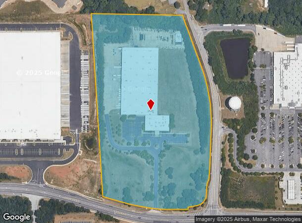
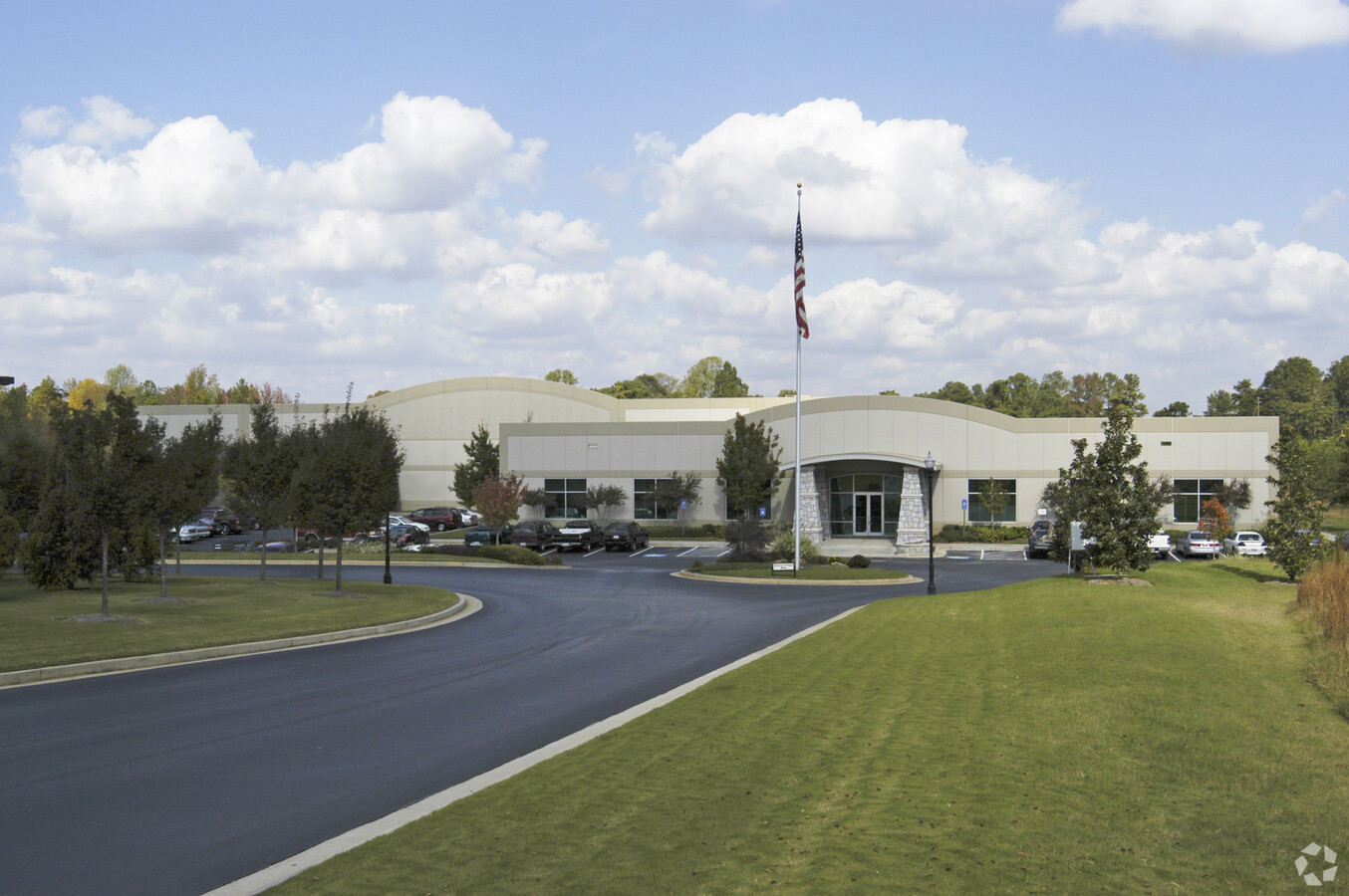
Property Record
2832 Anvil Block Rd, Ellenwood, GA 30294

NEARBY LISTINGS FOR SALE OR LEASE
Property Detail
2832 Anvil Block Rd
12-0235A-00A-002
Clayton
Distributionwarehouseregional
Georgia
X
235
13063C0043F
20.28 AC
2024
S Clayton/Henry Cnty
2024
Atlanta
040410
Atlanta-Sandy Springs-Roswell, GA
96,000 SF
DEMOGRAPHICS near 2832 Anvil Block Rd
1 Mile
3 Mile
5 Mile
2024 Total Population
3,284
39,193
147,989
2029 Population
3,301
39,284
149,071
Pop Growth 2024-2029
+ 0.52%
+ 0.23%
+ 0.73%
Average Age
36
38
37
2024 Total Households
1,107
13,128
51,513
HH Growth 2024-2029
+ 0.45%
+ 0.25%
+ 0.86%
Median Household Inc
$78,454
$67,323
$56,358
Avg Household Size
2.90
2.90
2.80
2024 Avg HH Vehicles
2.00
2.00
2.00
Median Home Value
$183,265
$194,147
$186,043
Median Year Built
2002
1997
1985
Nearby Places
- Restaurants
- Banks
- Shops
- Fitness
- Groceries
PUBLIC TRANSPORTATION
AIRPORT
Hartsfield - Jackson Atlanta International
DRIVE
WALK
Distance
Hartsfield - Jackson Atlanta International
19 min
8.8 mi
Freight Ports
Georgia Ports - Savannah
DRIVE
WALK
Distance
Georgia Ports - Savannah
264 min
236.7 mi
Nearby Properties
Address
Land Use
TOTAL SIZE
Lot Size
Zoning
Address
Land Use
TOTAL SIZE
Lot Size
Zoning
42,671 SF
56.11 AC
I
Address
Land Use
TOTAL SIZE
Lot Size
Zoning
20,964 SF
70.93 AC
I
Address
Land Use
TOTAL SIZE
Lot Size
Zoning
797,738 SF
54.98 AC
WH
Address
Land Use
TOTAL SIZE
Lot Size
Zoning
848,420 SF
48.96 AC
I
Address
Land Use
TOTAL SIZE
Lot Size
Zoning
659,547 SF
31.20 AC
HI
Address
Land Use
TOTAL SIZE
Lot Size
Zoning
321,464 SF
23.11 AC
HI
Address
Land Use
TOTAL SIZE
Lot Size
Zoning
44,365 SF
18 AC
M
Address
Land Use
TOTAL SIZE
Lot Size
Zoning
272,376 SF
17.73 AC
MXI
Address
Land Use
TOTAL SIZE
Lot Size
Zoning
229,829 SF
24.15 AC
HI
Address
Land Use
TOTAL SIZE
Lot Size
Zoning
210,538 SF
101.30 AC
X
Address
Land Use
TOTAL SIZE
Lot Size
Zoning
365,298 SF
22.51 AC
I
Address
Land Use
TOTAL SIZE
Lot Size
Zoning
332,442 SF
28.80 AC
HI
Address
Land Use
TOTAL SIZE
Lot Size
Zoning
399,000 SF
30.50 AC
WH
Address
Land Use
TOTAL SIZE
Lot Size
Zoning
343,585 SF
24.04 AC
LI
Address
Land Use
TOTAL SIZE
Lot Size
Zoning
400,000 SF
42.87 AC
HI
Address
Land Use
TOTAL SIZE
Lot Size
Zoning
169,832 SF
13.35 AC
I
Address
Land Use
TOTAL SIZE
Lot Size
Zoning
312,798 SF
21.38 AC
HI
Address
Land Use
TOTAL SIZE
Lot Size
Zoning
214,055 SF
55.08 AC
HI
Address
Land Use
TOTAL SIZE
Lot Size
Zoning
7,967 SF
7.84 AC
HI
Address
Land Use
TOTAL SIZE
Lot Size
Zoning
188,589 SF
27.76 AC
PUD
Address
Land Use
TOTAL SIZE
Lot Size
Zoning
23,169 SF
21.09 AC
PUD
Address
Land Use
TOTAL SIZE
Lot Size
Zoning
271,919 SF
17.89 AC
HI
Address
Land Use
TOTAL SIZE
Lot Size
Zoning
13,108 SF
27.48 AC
M
Address
Land Use
TOTAL SIZE
Lot Size
Zoning
188,766 SF
10.48 AC
I
Address
Land Use
TOTAL SIZE
Lot Size
Zoning
14,240 SF
48.12 AC
HI
Address
Land Use
TOTAL SIZE
Lot Size
Zoning
6,425 SF
64.33 AC
HI
Address
Land Use
TOTAL SIZE
Lot Size
Zoning
49,528 SF
32.24 AC
I
Address
Land Use
TOTAL SIZE
Lot Size
Zoning
234,192 SF
23 AC
HI
Address
Land Use
TOTAL SIZE
Lot Size
Zoning
68.50 AC
I
Address
Land Use
TOTAL SIZE
Lot Size
Zoning
210,670 SF
14.80 AC
HI
The World's #1 Commercial Real Estate Marketplace
Connect with us
© 2025 CoStar Group
The information above has been obtained from sources believed reliable. While we do not doubt its accuracy we have not verified it and make no guarantee, warranty or representation about it. It is your responsibility to independently confirm its accuracy and completeness. Any projections, opinions, assumptions, or estimates used are for example only and do not represent the current or future performance of the property. The value of this transaction to you depends on tax and other factors which should be evaluated by your tax, financial, and legal advisors. You and your advisors should conduct a careful, independent investigation of the property to determine to your satisfaction the suitability of the property for your needs.