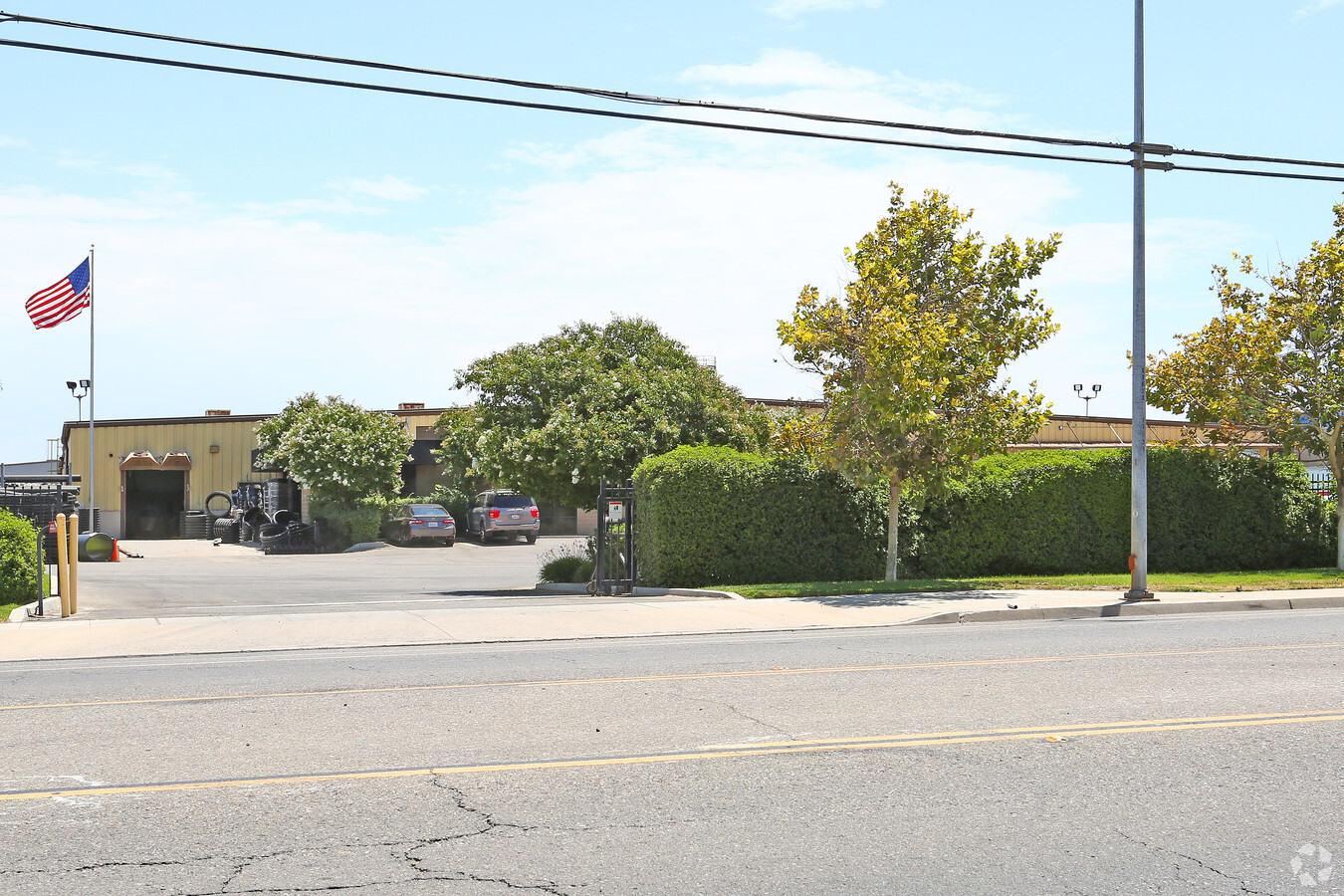
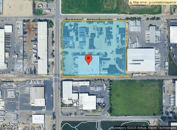
Property Record
2839 S Cherry Ave, Fresno, CA 93706

NEARBY LISTINGS FOR SALE OR LEASE
Property Detail
2839 S Cherry Ave
Fresno, CA
Fresno Colony
328-032-17S
SUR RT 9.71 AC IN N1/2 LOT 107 & 108 FRESNO COL
Lightindustrial
Fresno
X
California
06019C2110H
108
2023
9.71 AC
2023
Southeast Fresno
001800
Fresno
47,704 SF
DEMOGRAPHICS near 2839 S Cherry Ave
1 Mile
3 Mile
5 Mile
2024 Total Population
2,979
61,438
178,370
2029 Population
3,047
62,349
181,412
Pop Growth 2024-2029
+ 2.28%
+ 1.48%
+ 1.71%
Average Age
32
33
34
2024 Total Households
716
15,895
50,713
HH Growth 2024-2029
+ 2.37%
+ 1.54%
+ 1.75%
Median Household Inc
$30,961
$37,939
$40,428
Avg Household Size
3.80
3.50
3.30
2024 Avg HH Vehicles
2.00
2.00
2.00
Median Home Value
$156,961
$218,440
$236,224
Median Year Built
1967
1969
1967
Nearby Places
- Restaurants
- Banks
- Shops
- Fitness
- Groceries
PUBLIC TRANSPORTATION
COMMUTER RAIL
Fresno (San Joaquins - Amtrak)
DRIVE
WALK
Distance
Fresno (San Joaquins - Amtrak)
7 min
3.3 mi
AIRPORT
Fresno Yosemite International
DRIVE
WALK
Distance
Fresno Yosemite International
15 min
8.5 mi
Freight Ports
Port of Stockton
DRIVE
WALK
Distance
Port of Stockton
155 min
129.8 mi
Nearby Properties
Address
Land Use
TOTAL SIZE
Lot Size
Zoning
Address
Land Use
TOTAL SIZE
Lot Size
Zoning
855,000 SF
63.99 AC
IH
Address
Land Use
TOTAL SIZE
Lot Size
Zoning
459,723 SF
39.04 AC
M3
Address
Land Use
TOTAL SIZE
Lot Size
Zoning
211,597 SF
12.82 AC
M3
Address
Land Use
TOTAL SIZE
Lot Size
Zoning
288,597 SF
1.18 AC
C4
Address
Land Use
TOTAL SIZE
Lot Size
Zoning
141,959 SF
35.39 AC
SPLIT
Address
Land Use
TOTAL SIZE
Lot Size
Zoning
147,101 SF
6.31 AC
SPLIT
Address
Land Use
TOTAL SIZE
Lot Size
Zoning
176,926 SF
9.79 AC
IH
Address
Land Use
TOTAL SIZE
Lot Size
Zoning
670,680 SF
30.16 AC
IH
Address
Land Use
TOTAL SIZE
Lot Size
Zoning
245,112 SF
28.85 AC
M3
Address
Land Use
TOTAL SIZE
Lot Size
Zoning
101,510 SF
3.37 AC
CM
Address
Land Use
TOTAL SIZE
Lot Size
Zoning
343,038 SF
19.54 AC
AE20
Address
Land Use
TOTAL SIZE
Lot Size
Zoning
238,160 SF
18.77 AC
M3
Address
Land Use
TOTAL SIZE
Lot Size
Zoning
50,450 SF
16.84 AC
M3
Address
Land Use
TOTAL SIZE
Lot Size
Zoning
396,353 SF
34.78 AC
M3
Address
Land Use
TOTAL SIZE
Lot Size
Zoning
213,874 SF
4.17 AC
SPLIT
Address
Land Use
TOTAL SIZE
Lot Size
Zoning
275,000 SF
22.55 AC
M3
Address
Land Use
TOTAL SIZE
Lot Size
Zoning
61,575 SF
3.50 AC
SPLIT
Address
Land Use
TOTAL SIZE
Lot Size
Zoning
206,766 SF
17.11 AC
R2
Address
Land Use
TOTAL SIZE
Lot Size
Zoning
198,436 SF
20.85 AC
M3
Address
Land Use
TOTAL SIZE
Lot Size
Zoning
409,374 SF
24.73 AC
SPLIT
Address
Land Use
TOTAL SIZE
Lot Size
Zoning
90,500 SF
1.29 AC
CM
Address
Land Use
TOTAL SIZE
Lot Size
Zoning
55,200 SF
14.94 AC
M3
Address
Land Use
TOTAL SIZE
Lot Size
Zoning
259,852 SF
56.49 AC
AE20
Address
Land Use
TOTAL SIZE
Lot Size
Zoning
569,220 SF
23.46 AC
SPLIT
Address
Land Use
TOTAL SIZE
Lot Size
Zoning
96,012 SF
1.33 AC
C4
Address
Land Use
TOTAL SIZE
Lot Size
Zoning
314,915 SF
14.12 AC
M2
Address
Land Use
TOTAL SIZE
Lot Size
Zoning
54,526 SF
5.88 AC
M3
Address
Land Use
TOTAL SIZE
Lot Size
Zoning
82,096 SF
0.26 AC
C4
Address
Land Use
TOTAL SIZE
Lot Size
Zoning
104,036 SF
6.73 AC
M3
Address
Land Use
TOTAL SIZE
Lot Size
Zoning
202,038 SF
10.83 AC
IH
The World's #1 Commercial Real Estate Marketplace
Connect with us
© 2025 CoStar Group
The information above has been obtained from sources believed reliable. While we do not doubt its accuracy we have not verified it and make no guarantee, warranty or representation about it. It is your responsibility to independently confirm its accuracy and completeness. Any projections, opinions, assumptions, or estimates used are for example only and do not represent the current or future performance of the property. The value of this transaction to you depends on tax and other factors which should be evaluated by your tax, financial, and legal advisors. You and your advisors should conduct a careful, independent investigation of the property to determine to your satisfaction the suitability of the property for your needs.