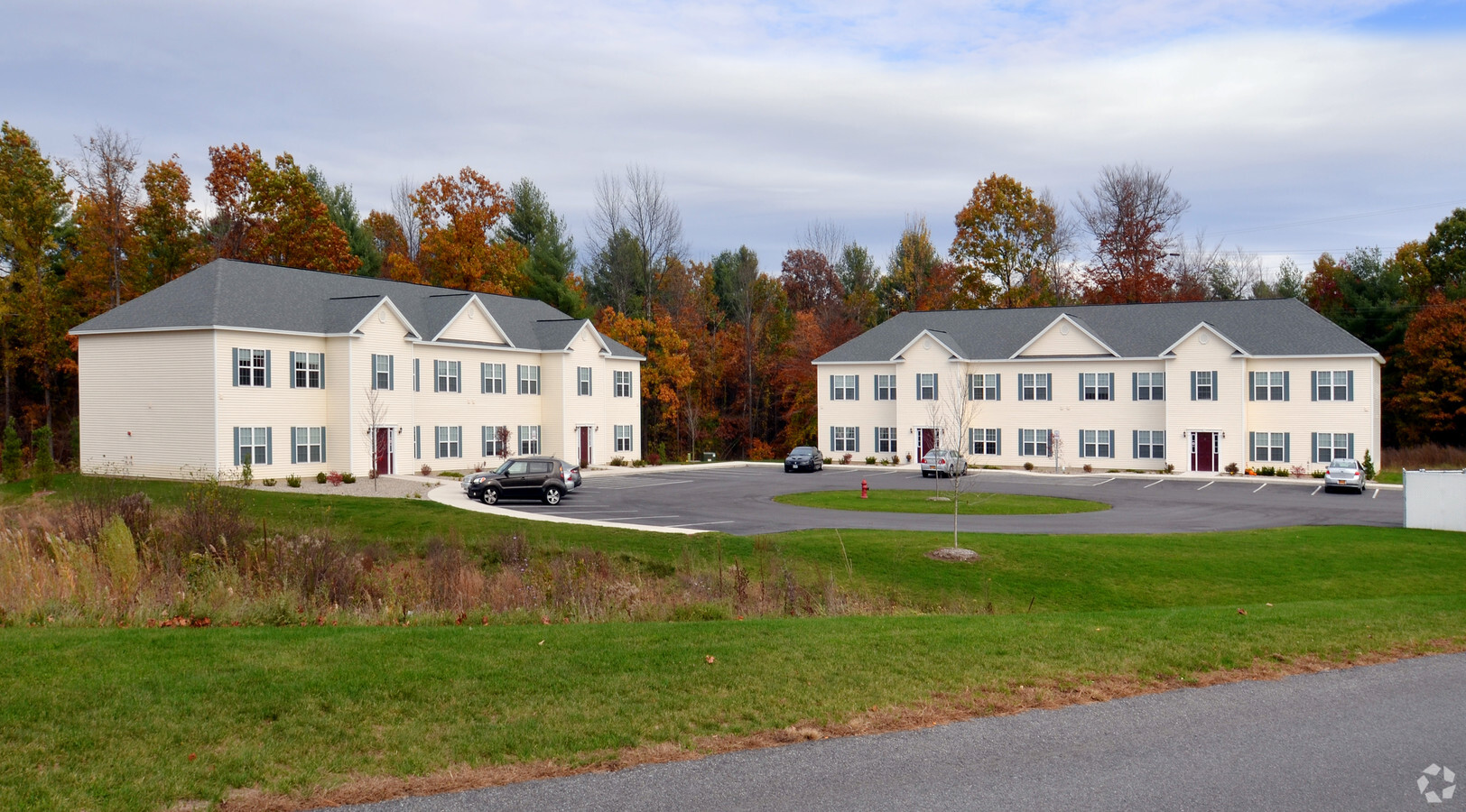
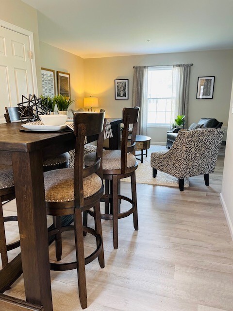
Property Record
284 Fort Edward Rd, South Glens Falls, NY 12803
NEARBY LISTINGS FOR SALE OR LEASE
Property Detail
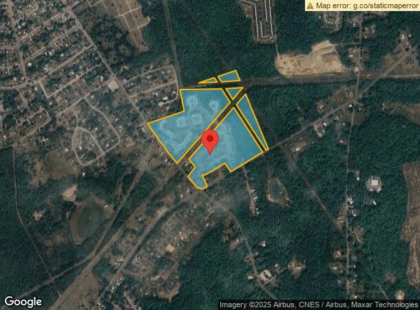
284 Fort Edward Rd
Albany-Schenectady-Troy, NY
Saratoga
414489-050-000-0002-001-011-0000
New York
Apartment
1.011
2023
39.79 AC
2023
Outer Saratoga County
060102
Albany/Schenectady/Troy
5,680 SF
DEMOGRAPHICS near 284 Fort Edward Rd
1 Mile
3 Mile
5 Mile
2024 Total Population
3,760
39,373
60,707
2029 Population
3,816
39,192
60,480
Pop Growth 2024-2029
+ 1.49%
(0.46%)
(0.37%)
Average Age
41
42
42
2024 Total Households
1,592
17,200
26,350
HH Growth 2024-2029
+ 1.44%
(0.55%)
(0.45%)
Median Household Inc
$64,649
$62,179
$69,022
Avg Household Size
2.30
2.20
2.20
2024 Avg HH Vehicles
2.00
2.00
2.00
Median Home Value
$168,640
$170,207
$189,140
Median Year Built
1961
1954
1968
Nearby Places
- Restaurants
- Banks
- Shops
- Fitness
- Groceries
PUBLIC TRANSPORTATION
COMMUTER RAIL
Fort Edward Amtrak (Adirondack - Amtrak, Ethan Allen Express - Amtrak)
DRIVE
WALK
Distance
Fort Edward Amtrak (Adirondack - Amtrak, Ethan Allen Express - Amtrak)
10 min
4.1 mi
Freight Ports
Albany, NY Port
DRIVE
WALK
Distance
Albany, NY Port
73 min
54.1 mi
Nearby Properties
Address
Land Use
TOTAL SIZE
Lot Size
Zoning
Address
Land Use
TOTAL SIZE
Lot Size
Zoning
273,242 SF
11.07 AC
GC2
Address
Land Use
TOTAL SIZE
Lot Size
Zoning
16.34 AC
M1
Address
Land Use
TOTAL SIZE
Lot Size
Zoning
116,696 SF
23.70 AC
04 - FARM
Address
Land Use
TOTAL SIZE
Lot Size
Zoning
35.53 AC
HI
Address
Land Use
TOTAL SIZE
Lot Size
Zoning
161,338 SF
1.74 AC
GC2
Address
Land Use
TOTAL SIZE
Lot Size
Zoning
19.74 AC
HI
Address
Land Use
TOTAL SIZE
Lot Size
Zoning
393,880 SF
23.90 AC
M1
Address
Land Use
TOTAL SIZE
Lot Size
Zoning
191,130 SF
20.09 AC
R-1A
Address
Land Use
TOTAL SIZE
Lot Size
Zoning
82,922 SF
8.03 AC
I
Address
Land Use
TOTAL SIZE
Lot Size
Zoning
938 SF
80.03 AC
C1
Address
Land Use
TOTAL SIZE
Lot Size
Zoning
1.91 AC
HI
Address
Land Use
TOTAL SIZE
Lot Size
Zoning
183,950 SF
11.41 AC
C1
Address
Land Use
TOTAL SIZE
Lot Size
Zoning
91,000 SF
0.52 AC
GC2
Address
Land Use
TOTAL SIZE
Lot Size
Zoning
89,902 SF
9.61 AC
05 - COMME
Address
Land Use
TOTAL SIZE
Lot Size
Zoning
Address
Land Use
TOTAL SIZE
Lot Size
Zoning
12,337 SF
26.95 AC
HI
Address
Land Use
TOTAL SIZE
Lot Size
Zoning
144,029 SF
28.34 AC
R1
Address
Land Use
TOTAL SIZE
Lot Size
Zoning
70,176 SF
3.50 AC
GC1
Address
Land Use
TOTAL SIZE
Lot Size
Zoning
302,484 SF
4.49 AC
GC1
Address
Land Use
TOTAL SIZE
Lot Size
Zoning
9,216 SF
32.20 AC
UR
Address
Land Use
TOTAL SIZE
Lot Size
Zoning
6,549 SF
17.26 AC
M1
Address
Land Use
TOTAL SIZE
Lot Size
Zoning
16.20 AC
R1
Address
Land Use
TOTAL SIZE
Lot Size
Zoning
8,683 SF
8.27 AC
HI
Address
Land Use
TOTAL SIZE
Lot Size
Zoning
176,655 SF
1.91 AC
GC2
Address
Land Use
TOTAL SIZE
Lot Size
Zoning
156,550 SF
33.27 AC
CI
Address
Land Use
TOTAL SIZE
Lot Size
Zoning
20,250 SF
46.97 AC
HI
Address
Land Use
TOTAL SIZE
Lot Size
Zoning
125,082 SF
17.54 AC
R2
Address
Land Use
TOTAL SIZE
Lot Size
Zoning
18,133 SF
29.71 AC
LDR25
Address
Land Use
TOTAL SIZE
Lot Size
Zoning
38,796 SF
25.34 AC
LDR25
The World's #1 Commercial Real Estate Marketplace
Connect with us
© 2025 CoStar Group
The information above has been obtained from sources believed reliable. While we do not doubt its accuracy we have not verified it and make no guarantee, warranty or representation about it. It is your responsibility to independently confirm its accuracy and completeness. Any projections, opinions, assumptions, or estimates used are for example only and do not represent the current or future performance of the property. The value of this transaction to you depends on tax and other factors which should be evaluated by your tax, financial, and legal advisors. You and your advisors should conduct a careful, independent investigation of the property to determine to your satisfaction the suitability of the property for your needs.