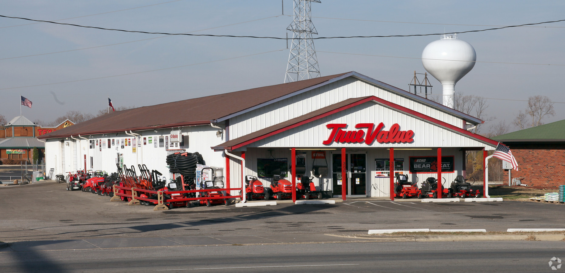
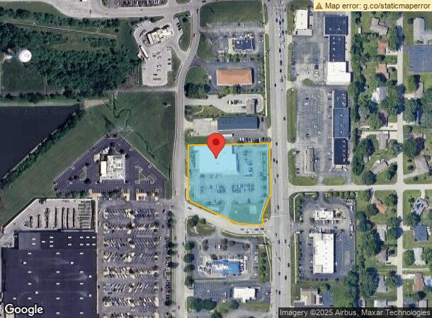
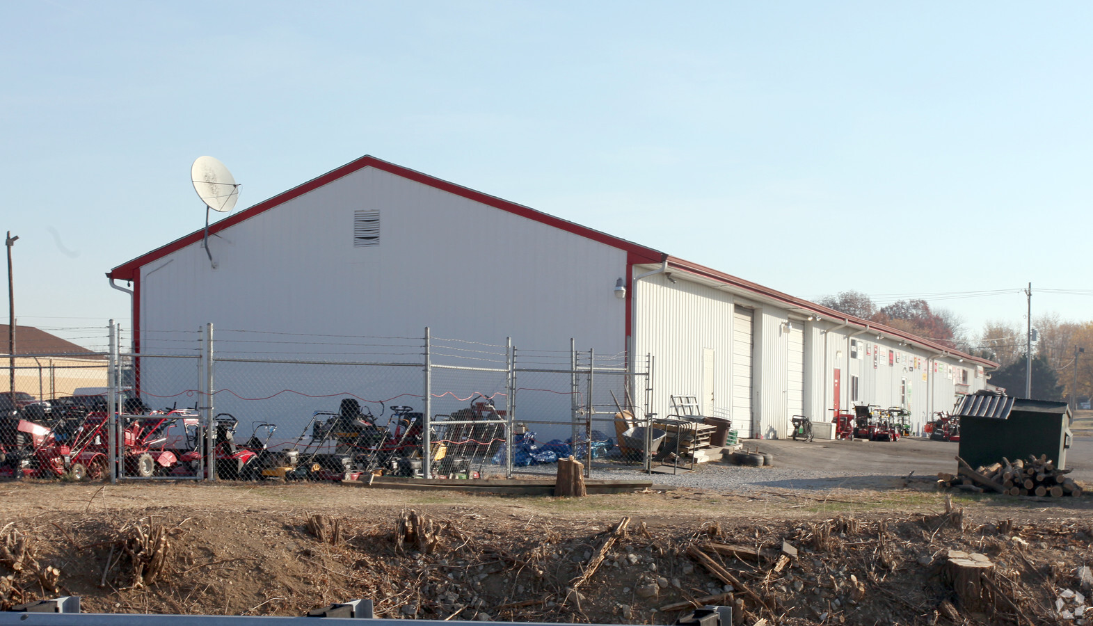
Property Record
284 S State Road 135, Greenwood, IN 46142
NEARBY LISTINGS FOR SALE OR LEASE
Property Detail
284 S State Road 135
Indianapolis-Carmel-Anderson, IN
Brown Subdivision
41-03-35-041-006.000-041
ALDI STORE # 20 COMMERCIAL PLAT LOT 1
Wholesaleoutletdiscountstore
Johnson
X
Indiana
18081C0106E
1
2023
2.40 AC
2024
Greenwood
610605
Indianapolis
17,421 SF
DEMOGRAPHICS near 284 S State Road 135
1 Mile
3 Mile
5 Mile
2024 Total Population
8,252
74,690
166,266
2029 Population
8,727
78,138
171,331
Pop Growth 2024-2029
+ 5.76%
+ 4.62%
+ 3.05%
Average Age
41
40
38
2024 Total Households
3,162
28,747
63,160
HH Growth 2024-2029
+ 5.91%
+ 4.67%
+ 3.11%
Median Household Inc
$84,091
$79,333
$76,431
Avg Household Size
2.50
2.50
2.60
2024 Avg HH Vehicles
2.00
2.00
2.00
Median Home Value
$233,712
$242,178
$224,593
Median Year Built
1990
1988
1989
Nearby Places
- Restaurants
- Banks
- Shops
- Fitness
- Groceries
PUBLIC TRANSPORTATION
AIRPORT
Indianapolis International
DRIVE
WALK
Distance
Indianapolis International
35 min
20.2 mi
Freight Ports
Port of Toledo
DRIVE
WALK
Distance
Port of Toledo
287 min
238.6 mi
Nearby Properties
Address
Land Use
TOTAL SIZE
Lot Size
Zoning
Address
Land Use
TOTAL SIZE
Lot Size
Zoning
295,161 SF
70.54 AC
Address
Land Use
TOTAL SIZE
Lot Size
Zoning
4,582 SF
30.22 AC
R4
Address
Land Use
TOTAL SIZE
Lot Size
Zoning
56,520 SF
35.65 AC
Address
Land Use
TOTAL SIZE
Lot Size
Zoning
3,346 SF
21.35 AC
Address
Land Use
TOTAL SIZE
Lot Size
Zoning
3,286 SF
26.39 AC
Address
Land Use
TOTAL SIZE
Lot Size
Zoning
23,040 SF
9.28 AC
ZO01
Address
Land Use
TOTAL SIZE
Lot Size
Zoning
39,866 SF
19.99 AC
Address
Land Use
TOTAL SIZE
Lot Size
Zoning
1,102 SF
9.98 AC
Address
Land Use
TOTAL SIZE
Lot Size
Zoning
226,129 SF
18.69 AC
ZO01
Address
Land Use
TOTAL SIZE
Lot Size
Zoning
33,790 SF
13.01 AC
Address
Land Use
TOTAL SIZE
Lot Size
Zoning
11,546 SF
14.18 AC
Address
Land Use
TOTAL SIZE
Lot Size
Zoning
108,092 SF
23.62 AC
ZO01
Address
Land Use
TOTAL SIZE
Lot Size
Zoning
3,701 SF
26 AC
ZO01
Address
Land Use
TOTAL SIZE
Lot Size
Zoning
3,793 SF
23.47 AC
ZO01
Address
Land Use
TOTAL SIZE
Lot Size
Zoning
6,272 SF
21.90 AC
Address
Land Use
TOTAL SIZE
Lot Size
Zoning
3,257 SF
19.49 AC
Address
Land Use
TOTAL SIZE
Lot Size
Zoning
141,533 SF
16.65 AC
Address
Land Use
TOTAL SIZE
Lot Size
Zoning
176,228 SF
1.57 AC
Address
Land Use
TOTAL SIZE
Lot Size
Zoning
82,619 SF
13.50 AC
Address
Land Use
TOTAL SIZE
Lot Size
Zoning
1,426 SF
11.73 AC
Address
Land Use
TOTAL SIZE
Lot Size
Zoning
3,168 SF
8.62 AC
Address
Land Use
TOTAL SIZE
Lot Size
Zoning
69,444 SF
2.99 AC
Address
Land Use
TOTAL SIZE
Lot Size
Zoning
3,406 SF
20.34 AC
Address
Land Use
TOTAL SIZE
Lot Size
Zoning
748 SF
6.83 AC
Address
Land Use
TOTAL SIZE
Lot Size
Zoning
193,178 SF
14.48 AC
Address
Land Use
TOTAL SIZE
Lot Size
Zoning
28,590 SF
7.16 AC
Address
Land Use
TOTAL SIZE
Lot Size
Zoning
69,215 SF
4.90 AC
B1
Address
Land Use
TOTAL SIZE
Lot Size
Zoning
3,877 SF
12.91 AC
Address
Land Use
TOTAL SIZE
Lot Size
Zoning
3,360 SF
14.68 AC
Address
Land Use
TOTAL SIZE
Lot Size
Zoning
1,448 SF
5 AC
ZO01
The World's #1 Commercial Real Estate Marketplace
Connect with us
© 2025 CoStar Group
The information above has been obtained from sources believed reliable. While we do not doubt its accuracy we have not verified it and make no guarantee, warranty or representation about it. It is your responsibility to independently confirm its accuracy and completeness. Any projections, opinions, assumptions, or estimates used are for example only and do not represent the current or future performance of the property. The value of this transaction to you depends on tax and other factors which should be evaluated by your tax, financial, and legal advisors. You and your advisors should conduct a careful, independent investigation of the property to determine to your satisfaction the suitability of the property for your needs.