Property Record
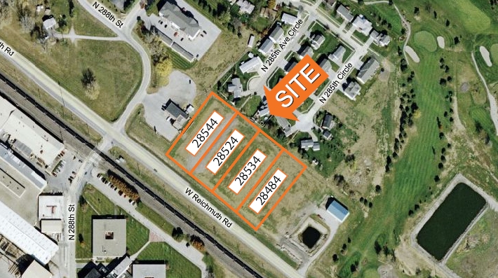
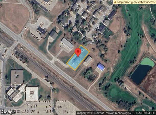
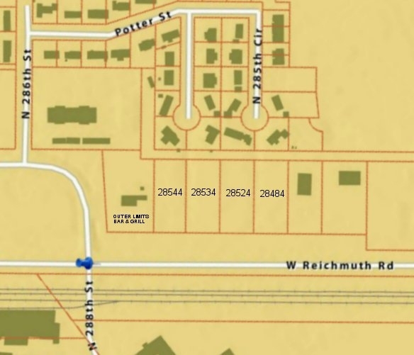
28484 W Reichmuth Rd, Valley, NE 68064
NEARBY LISTINGS FOR SALE OR LEASE
Property Detail
28484 W Reichmuth Rd
Omaha-Council Bluffs, NE-IA
Valley Farms 1St Add
4528-5222-23
VALLEY FARMS 1ST ADD REP 1 LOT 2 BLOCK 0 IRREG .77 AC
Daycare
Douglas
AO
Nebraska
31155C0275D
2
2023
0.77 AC
2023
Northwest Omaha
007504
Omaha/Council Bluffs
2,926 SF
DEMOGRAPHICS near 28484 W Reichmuth Rd
1 Mile
3 Mile
5 Mile
2024 Total Population
937
4,395
6,103
2029 Population
1,002
4,680
6,481
Pop Growth 2024-2029
+ 6.94%
+ 6.48%
+ 6.19%
Average Age
44
44
44
2024 Total Households
381
1,902
2,568
HH Growth 2024-2029
+ 7.09%
+ 6.73%
+ 6.39%
Median Household Inc
$66,283
$67,679
$71,187
Avg Household Size
2.50
2.30
2.40
2024 Avg HH Vehicles
2.00
2.00
2.00
Median Home Value
$511,450
$497,700
$467,041
Median Year Built
1982
1979
1978
Nearby Places
- Restaurants
- Banks
- Shops
- Fitness
- Groceries
PUBLIC TRANSPORTATION
AIRPORT
Eppley Airfield
Drive
Walk
Distance
Eppley Airfield
47 min
29.0 mi
Freight Ports
Tulsa Port Of Catoosa
Drive
Walk
Distance
Tulsa Port Of Catoosa
494 min
443.4 mi
Nearby Properties
Address
Land Use
TOTAL SIZE
Lot Size
Zoning
Address
Land Use
TOTAL SIZE
Lot Size
Zoning
731561
256.02 AC
Address
Land Use
TOTAL SIZE
Lot Size
Zoning
410207
114.30 AC
Address
Land Use
TOTAL SIZE
Lot Size
Zoning
154061
4.85 AC
Address
Land Use
TOTAL SIZE
Lot Size
Zoning
242139
64.40 AC
Address
Land Use
TOTAL SIZE
Lot Size
Zoning
164360
24.93 AC
Address
Land Use
TOTAL SIZE
Lot Size
Zoning
55185
3.81 AC
Address
Land Use
TOTAL SIZE
Lot Size
Zoning
77570
42.05 AC
Address
Land Use
TOTAL SIZE
Lot Size
Zoning
35163
35.15 AC
AF1
Address
Land Use
TOTAL SIZE
Lot Size
Zoning
46664
12.56 AC
Address
Land Use
TOTAL SIZE
Lot Size
Zoning
601060
108.73 AC
Address
Land Use
TOTAL SIZE
Lot Size
Zoning
9838
10.20 AC
Address
Land Use
TOTAL SIZE
Lot Size
Zoning
60916
9.07 AC
Address
Land Use
TOTAL SIZE
Lot Size
Zoning
26999
7.73 AC
Address
Land Use
TOTAL SIZE
Lot Size
Zoning
62970
4.89 AC
Address
Land Use
TOTAL SIZE
Lot Size
Zoning
3080
221.57 AC
Address
Land Use
TOTAL SIZE
Lot Size
Zoning
18351
1.40 AC
Address
Land Use
TOTAL SIZE
Lot Size
Zoning
28000
17.92 AC
Address
Land Use
TOTAL SIZE
Lot Size
Zoning
311.90 AC
Address
Land Use
TOTAL SIZE
Lot Size
Zoning
22500
4 AC
Address
Land Use
TOTAL SIZE
Lot Size
Zoning
310.98 AC
AG
Address
Land Use
TOTAL SIZE
Lot Size
Zoning
24186
132.99 AC
Address
Land Use
TOTAL SIZE
Lot Size
Zoning
1040
73.70 AC
Address
Land Use
TOTAL SIZE
Lot Size
Zoning
30276
2.77 AC
Address
Land Use
TOTAL SIZE
Lot Size
Zoning
9205
1.38 AC
Address
Land Use
TOTAL SIZE
Lot Size
Zoning
214.66 AC
AG
Address
Land Use
TOTAL SIZE
Lot Size
Zoning
19200
10.24 AC
Address
Land Use
TOTAL SIZE
Lot Size
Zoning
63.48 AC
Address
Land Use
TOTAL SIZE
Lot Size
Zoning
6320
0.80 AC
Start a new search to find other properties for sale or lease
Connect with us
© 2024 CoStar Group
The information above has been obtained from sources believed reliable. While we do not doubt its accuracy we have not verified it and make no guarantee, warranty or representation about it. It is your responsibility to independently confirm its accuracy and completeness. Any projections, opinions, assumptions, or estimates used are for example only and do not represent the current or future performance of the property. The value of this transaction to you depends on tax and other factors which should be evaluated by your tax, financial, and legal advisors. You and your advisors should conduct a careful, independent investigation of the property to determine to your satisfaction the suitability of the property for your needs.