Property Record
28603 E State Highway 55, Paynesville, MN 56362
NEARBY LISTINGS FOR SALE OR LEASE
-
-
View all Paynesville listings for sale on LoopNet.com
Property Detail
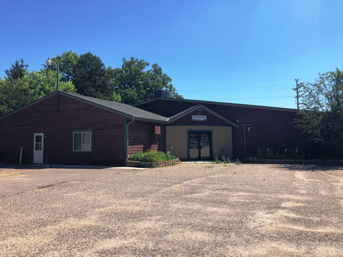
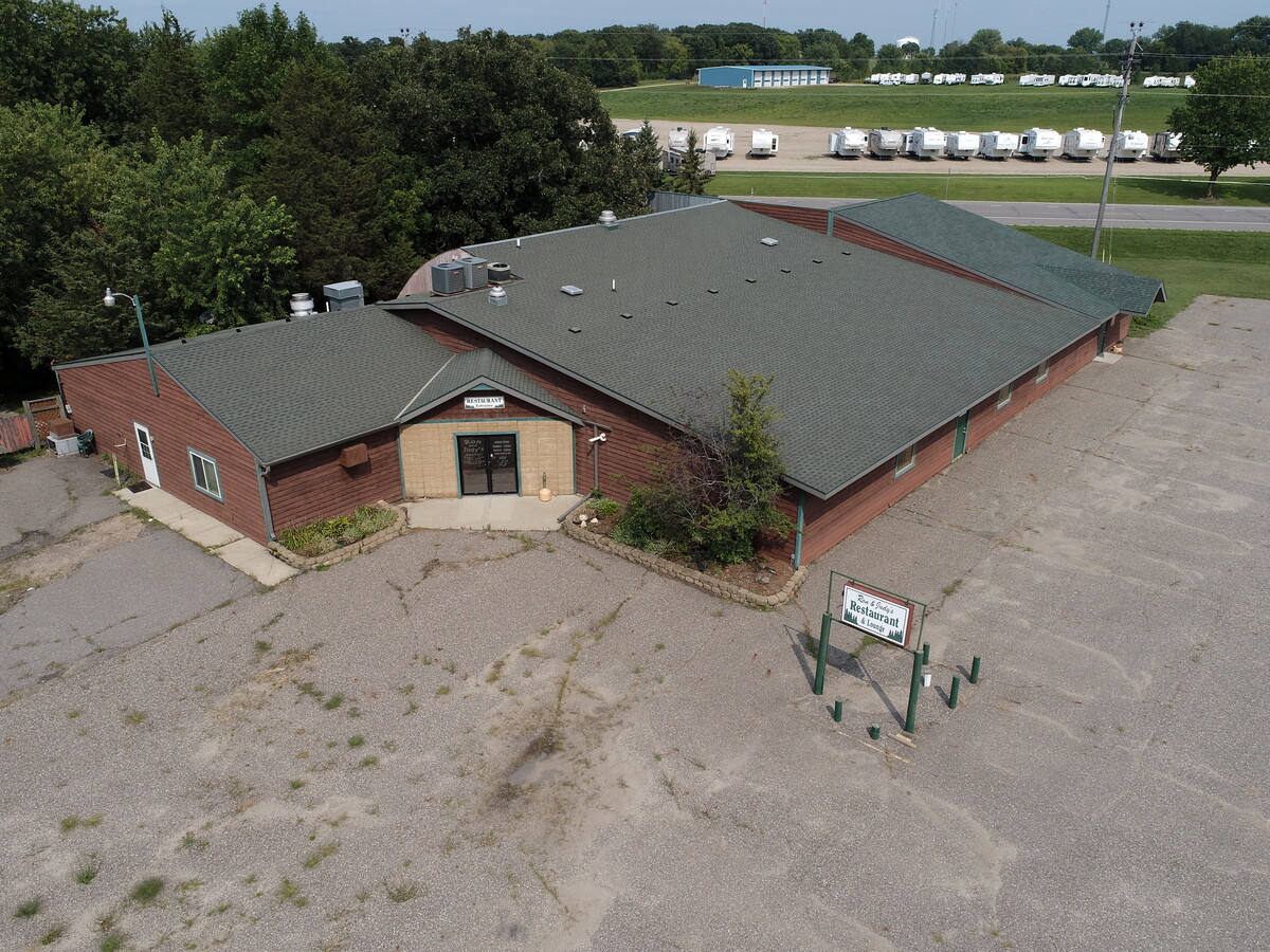
28603 E State Highway 55
St. Cloud, MN
Koronis Oaks
26.16243.0000
LOT 002 BLK 001 KORONIS OAKS SECTION 21 TOWNSHIP 122 RANGE 032 SECTION 21 TOWNSHIP 122 RANGE 032
Restaurantbuilding
Stearns
X
Minnesota
27093C0050C
2
2024
1.56 AC
2024
Stearns County
011000
Minneapolis/St Paul
9,693 SF
DEMOGRAPHICS near 28603 E State Highway 55
1 Mile
3 Mile
5 Mile
2024 Total Population
2,149
4,347
5,662
2029 Population
2,291
4,606
5,985
Pop Growth 2024-2029
+ 6.61%
+ 5.96%
+ 5.70%
Average Age
43
43
43
2024 Total Households
945
1,867
2,377
HH Growth 2024-2029
+ 6.88%
+ 6.21%
+ 5.97%
Median Household Inc
$65,437
$65,535
$69,228
Avg Household Size
2.20
2.30
2.30
2024 Avg HH Vehicles
2.00
2.00
2.00
Median Home Value
$239,558
$239,755
$250,000
Median Year Built
1976
1974
1975
Nearby Places
- Restaurants
- Banks
- Shops
- Fitness
- Groceries
SALE & LEASE HISTORY
LISTING DATE
SALE/LEASE

Sep 22, 2020
For Sale
Jul 15, 2019
For Sale
Apr 10, 2018
For Sale
Nearby Properties
Address
Land Use
TOTAL SIZE
Lot Size
Zoning
Address
Land Use
TOTAL SIZE
Lot Size
Zoning
221,297 SF
45.96 AC
Address
Land Use
TOTAL SIZE
Lot Size
Zoning
199,025 SF
5 AC
Address
Land Use
TOTAL SIZE
Lot Size
Zoning
86,320 SF
10.61 AC
Address
Land Use
TOTAL SIZE
Lot Size
Zoning
10.46 AC
Address
Land Use
TOTAL SIZE
Lot Size
Zoning
35,512 SF
5.63 AC
Address
Land Use
TOTAL SIZE
Lot Size
Zoning
10,766 SF
16.61 AC
Address
Land Use
TOTAL SIZE
Lot Size
Zoning
153,370 SF
4.31 AC
Address
Land Use
TOTAL SIZE
Lot Size
Zoning
59,829 SF
1.65 AC
Address
Land Use
TOTAL SIZE
Lot Size
Zoning
33,442 SF
199.20 AC
Address
Land Use
TOTAL SIZE
Lot Size
Zoning
40,735 SF
4 AC
Address
Land Use
TOTAL SIZE
Lot Size
Zoning
Address
Land Use
TOTAL SIZE
Lot Size
Zoning
68,446 SF
18.42 AC
Address
Land Use
TOTAL SIZE
Lot Size
Zoning
96,083 SF
6.96 AC
Address
Land Use
TOTAL SIZE
Lot Size
Zoning
51.28 AC
T20
Address
Land Use
TOTAL SIZE
Lot Size
Zoning
10,245 SF
3.60 AC
Address
Land Use
TOTAL SIZE
Lot Size
Zoning
17,357 SF
1.10 AC
Address
Land Use
TOTAL SIZE
Lot Size
Zoning
26,300 SF
5.50 AC
Address
Land Use
TOTAL SIZE
Lot Size
Zoning
51,147 SF
21.71 AC
Address
Land Use
TOTAL SIZE
Lot Size
Zoning
170 AC
Address
Land Use
TOTAL SIZE
Lot Size
Zoning
21,337 SF
8.76 AC
Address
Land Use
TOTAL SIZE
Lot Size
Zoning
48,673 SF
3.70 AC
Address
Land Use
TOTAL SIZE
Lot Size
Zoning
157 AC
Address
Land Use
TOTAL SIZE
Lot Size
Zoning
160 AC
2AIMP
Address
Land Use
TOTAL SIZE
Lot Size
Zoning
23,214 SF
2.46 AC
Address
Land Use
TOTAL SIZE
Lot Size
Zoning
40,351 SF
4.55 AC
Address
Land Use
TOTAL SIZE
Lot Size
Zoning
1.72 AC
Address
Land Use
TOTAL SIZE
Lot Size
Zoning
149.88 AC
PL78B2
Address
Land Use
TOTAL SIZE
Lot Size
Zoning
7,860 SF
1.26 AC
Address
Land Use
TOTAL SIZE
Lot Size
Zoning
4,398 SF
160 AC
2AIMP
Address
Land Use
TOTAL SIZE
Lot Size
Zoning
47,728 SF
4.27 AC
The World's #1 Commercial Real Estate Marketplace
Connect with us
© 2025 CoStar Group
The information above has been obtained from sources believed reliable. While we do not doubt its accuracy we have not verified it and make no guarantee, warranty or representation about it. It is your responsibility to independently confirm its accuracy and completeness. Any projections, opinions, assumptions, or estimates used are for example only and do not represent the current or future performance of the property. The value of this transaction to you depends on tax and other factors which should be evaluated by your tax, financial, and legal advisors. You and your advisors should conduct a careful, independent investigation of the property to determine to your satisfaction the suitability of the property for your needs.