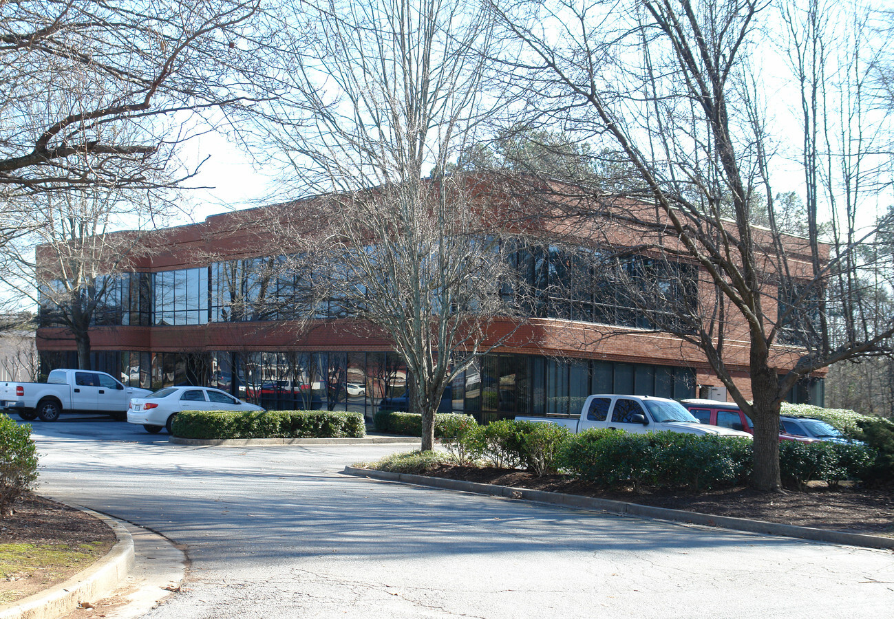
Property Record
2862 Buford Hwy, Duluth, GA 30096
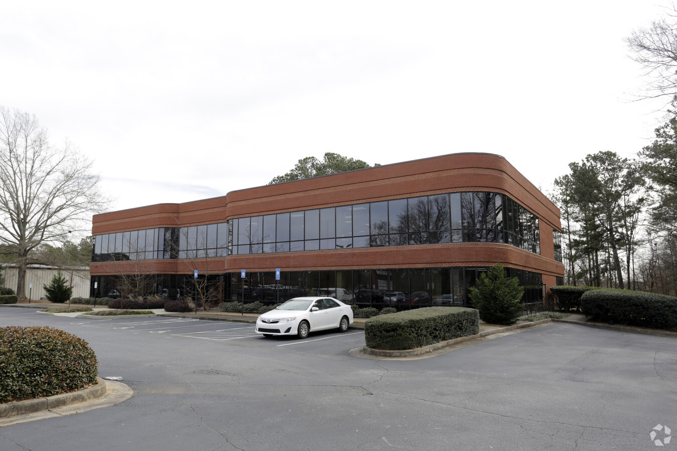

This Property Is For Sale
NEARBY LISTINGS FOR SALE OR LEASE
Property Detail
2862 Buford Hwy
7-202-189
HWY 23
Officebuilding
Gwinnett
X
Georgia
13121C0094G
0202
2024
2.51 AC
2023
Duluth/Suwanee/Buford
050237
Atlanta
16,988 SF
Atlanta-Sandy Springs-Roswell, GA
DEMOGRAPHICS near 2862 Buford Hwy
1 Mile
3 Mile
5 Mile
2024 Total Population
8,647
67,746
207,397
2029 Population
9,043
70,745
216,965
Pop Growth 2024-2029
+ 4.58%
+ 4.43%
+ 4.61%
Average Age
40
39
38
2024 Total Households
3,099
25,541
75,614
HH Growth 2024-2029
+ 4.74%
+ 4.52%
+ 4.64%
Median Household Inc
$96,969
$79,608
$78,229
Avg Household Size
2.80
2.60
2.70
2024 Avg HH Vehicles
2.00
2.00
2.00
Median Home Value
$351,044
$368,442
$388,243
Median Year Built
1993
1995
1995
Nearby Places
- Restaurants
- Banks
- Shops
- Fitness
- Groceries
Nearby Properties
Address
Land Use
TOTAL SIZE
Lot Size
Zoning
Address
Land Use
TOTAL SIZE
Lot Size
Zoning
652,108 SF
78.64 AC
PUD
Address
Land Use
TOTAL SIZE
Lot Size
Zoning
344,203 SF
17.05 AC
MUR
Address
Land Use
TOTAL SIZE
Lot Size
Zoning
491,482 SF
41.72 AC
C1
Address
Land Use
TOTAL SIZE
Lot Size
Zoning
20,896 SF
38.74 AC
RM13-MULTI
Address
Land Use
TOTAL SIZE
Lot Size
Zoning
272,196 SF
44.76 AC
RM13
Address
Land Use
TOTAL SIZE
Lot Size
Zoning
327,680 SF
29.70 AC
RM13
Address
Land Use
TOTAL SIZE
Lot Size
Zoning
421,088 SF
40.47 AC
RM
Address
Land Use
TOTAL SIZE
Lot Size
Zoning
450,095 SF
45.79 AC
RM10
Address
Land Use
TOTAL SIZE
Lot Size
Zoning
300,735 SF
21.95 AC
PUD
Address
Land Use
TOTAL SIZE
Lot Size
Zoning
315,806 SF
13.03 AC
MUR
Address
Land Use
TOTAL SIZE
Lot Size
Zoning
324,001 SF
11.64 AC
PUD
Address
Land Use
TOTAL SIZE
Lot Size
Zoning
90,748 SF
21 AC
R100
Address
Land Use
TOTAL SIZE
Lot Size
Zoning
389,385 SF
25.93 AC
RM13
Address
Land Use
TOTAL SIZE
Lot Size
Zoning
365,351 SF
30.70 AC
RM13
Address
Land Use
TOTAL SIZE
Lot Size
Zoning
357,430 SF
47.93 AC
RM
Address
Land Use
TOTAL SIZE
Lot Size
Zoning
323,846 SF
24.89 AC
PUD
Address
Land Use
TOTAL SIZE
Lot Size
Zoning
304,001 SF
32 AC
PUD
Address
Land Use
TOTAL SIZE
Lot Size
Zoning
237,864 SF
5.09 AC
PUD
Address
Land Use
TOTAL SIZE
Lot Size
Zoning
341,506 SF
36.69 AC
C1
Address
Land Use
TOTAL SIZE
Lot Size
Zoning
232,176 SF
8.74 AC
RM24
Address
Land Use
TOTAL SIZE
Lot Size
Zoning
217,080 SF
49.32 AC
M1
Address
Land Use
TOTAL SIZE
Lot Size
Zoning
268,409 SF
25.95 AC
RM13
Address
Land Use
TOTAL SIZE
Lot Size
Zoning
1,405,900 SF
101.50 AC
MUR
Address
Land Use
TOTAL SIZE
Lot Size
Zoning
254,048 SF
28.59 AC
RM
Address
Land Use
TOTAL SIZE
Lot Size
Zoning
285,038 SF
1.93 AC
MUR
Address
Land Use
TOTAL SIZE
Lot Size
Zoning
347,940 SF
46.73 AC
OI
Address
Land Use
TOTAL SIZE
Lot Size
Zoning
287,824 SF
31.59 AC
RM
Address
Land Use
TOTAL SIZE
Lot Size
Zoning
201,795 SF
22.03 AC
RM
Address
Land Use
TOTAL SIZE
Lot Size
Zoning
202,674 SF
8.42 AC
PUD-PLANNE
Address
Land Use
TOTAL SIZE
Lot Size
Zoning
251,611 SF
22.50 AC
RM
The World's #1 Commercial Real Estate Marketplace
Connect with us
© 2025 CoStar Group
The information above has been obtained from sources believed reliable. While we do not doubt its accuracy we have not verified it and make no guarantee, warranty or representation about it. It is your responsibility to independently confirm its accuracy and completeness. Any projections, opinions, assumptions, or estimates used are for example only and do not represent the current or future performance of the property. The value of this transaction to you depends on tax and other factors which should be evaluated by your tax, financial, and legal advisors. You and your advisors should conduct a careful, independent investigation of the property to determine to your satisfaction the suitability of the property for your needs.