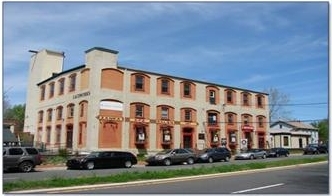
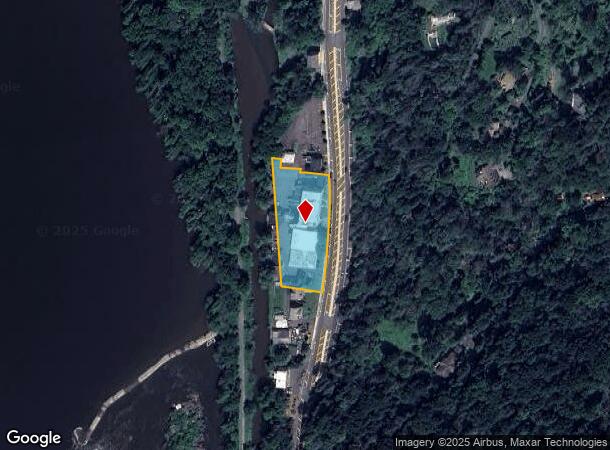
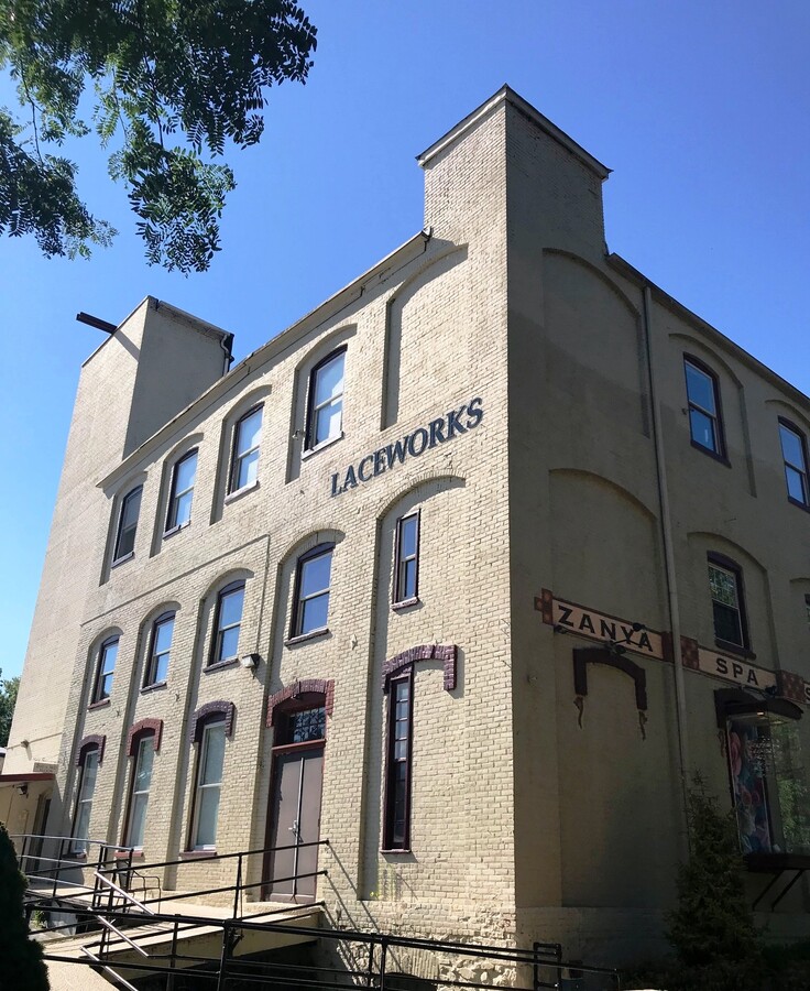
Property Record
287 S Main St, Lambertville, NJ 08530

NEARBY LISTINGS FOR SALE OR LEASE
Property Detail
287 S Main St
17-01055-01-00008
ADDITIONAL LOTS: 9,9.01
Retailwithmorethanonenonretailuse
Hunterdon
AE
New Jersey
42017C0327J
8
2023
1.47 AC
2024
Hunterdon
011900
Northern New Jersey
4,434 SF
Newark, NJ-PA
DEMOGRAPHICS near 287 S Main St
1 Mile
3 Mile
5 Mile
2024 Total Population
5,332
13,441
22,844
2029 Population
5,398
13,473
22,761
Pop Growth 2024-2029
+ 1.24%
+ 0.24%
(0.36%)
Average Age
49
48
47
2024 Total Households
2,701
6,075
9,659
HH Growth 2024-2029
+ 1.30%
+ 0.38%
(0.24%)
Median Household Inc
$114,440
$129,530
$141,816
Avg Household Size
2.00
2.20
2.30
2024 Avg HH Vehicles
2.00
2.00
2.00
Median Home Value
$497,782
$636,633
$681,699
Median Year Built
1969
1972
1973
Nearby Places
- Restaurants
- Banks
- Shops
- Fitness
- Groceries
PUBLIC TRANSPORTATION
AIRPORT
Trenton Mercer
DRIVE
WALK
Distance
Trenton Mercer
21 min
11.5 mi
Freight Ports
Port of Philadelphia
DRIVE
WALK
Distance
Port of Philadelphia
54 min
36.5 mi
SALE & LEASE HISTORY
LISTING DATE
SALE/LEASE

Sep 25, 2016
For Lease
Nov 07, 2019
For Lease
Aug 21, 2017
For Lease
Aug 18, 2020
For Lease
Nearby Properties
Address
Land Use
TOTAL SIZE
Lot Size
Zoning
Address
Land Use
TOTAL SIZE
Lot Size
Zoning
4 AC
PRD
Address
Land Use
TOTAL SIZE
Lot Size
Zoning
24,768 SF
1.47 AC
FP
Address
Land Use
TOTAL SIZE
Lot Size
Zoning
0.36 AC
CBD
Address
Land Use
TOTAL SIZE
Lot Size
Zoning
1,620 SF
0.23 AC
Address
Land Use
TOTAL SIZE
Lot Size
Zoning
4,924 SF
0.57 AC
CBD
Address
Land Use
TOTAL SIZE
Lot Size
Zoning
14,429 SF
2.20 AC
COM
Address
Land Use
TOTAL SIZE
Lot Size
Zoning
127.42 AC
MRC
Address
Land Use
TOTAL SIZE
Lot Size
Zoning
147.58 AC
Q
Address
Land Use
TOTAL SIZE
Lot Size
Zoning
39,390 SF
1.80 AC
R-2
Address
Land Use
TOTAL SIZE
Lot Size
Zoning
100 AC
I-2
Address
Land Use
TOTAL SIZE
Lot Size
Zoning
8,456 SF
2.36 AC
R-2
Address
Land Use
TOTAL SIZE
Lot Size
Zoning
4,200 SF
14.98 AC
HC
Address
Land Use
TOTAL SIZE
Lot Size
Zoning
2,618 SF
83.19 AC
MRC
Address
Land Use
TOTAL SIZE
Lot Size
Zoning
30,048 SF
22.12 AC
SRPD
Address
Land Use
TOTAL SIZE
Lot Size
Zoning
14,331 SF
3.88 AC
HC
Address
Land Use
TOTAL SIZE
Lot Size
Zoning
24,742 SF
0.11 AC
CBD
Address
Land Use
TOTAL SIZE
Lot Size
Zoning
3,474 SF
4.09 AC
HC
Address
Land Use
TOTAL SIZE
Lot Size
Zoning
11,452 SF
3.95 AC
PRD
Address
Land Use
TOTAL SIZE
Lot Size
Zoning
9,100 SF
5.40 AC
HC
Address
Land Use
TOTAL SIZE
Lot Size
Zoning
4,423 SF
0.40 AC
R-2
Address
Land Use
TOTAL SIZE
Lot Size
Zoning
20,505 SF
0.14 AC
CBD
Address
Land Use
TOTAL SIZE
Lot Size
Zoning
8,396 SF
2 AC
RR-5
Address
Land Use
TOTAL SIZE
Lot Size
Zoning
5,600 SF
10.99 AC
HC
Address
Land Use
TOTAL SIZE
Lot Size
Zoning
0.42 AC
CBD
Address
Land Use
TOTAL SIZE
Lot Size
Zoning
10,032 SF
0.10 AC
CBD
Address
Land Use
TOTAL SIZE
Lot Size
Zoning
6,851 SF
8.55 AC
RL
Address
Land Use
TOTAL SIZE
Lot Size
Zoning
6.30 AC
HC
Address
Land Use
TOTAL SIZE
Lot Size
Zoning
20,316 SF
8.81 AC
HC
Address
Land Use
TOTAL SIZE
Lot Size
Zoning
9,975 SF
0.11 AC
CBD
The World's #1 Commercial Real Estate Marketplace
Connect with us
© 2025 CoStar Group
The information above has been obtained from sources believed reliable. While we do not doubt its accuracy we have not verified it and make no guarantee, warranty or representation about it. It is your responsibility to independently confirm its accuracy and completeness. Any projections, opinions, assumptions, or estimates used are for example only and do not represent the current or future performance of the property. The value of this transaction to you depends on tax and other factors which should be evaluated by your tax, financial, and legal advisors. You and your advisors should conduct a careful, independent investigation of the property to determine to your satisfaction the suitability of the property for your needs.