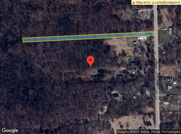
Property Record
28710 Sumpter Rd, New Boston, MI 48164

This Property Is For Sale
NEARBY LISTINGS FOR SALE OR LEASE
-
-
No Photo
-
-
View all New Boston listings for sale on LoopNet.com
Property Detail
28710 Sumpter Rd
81-132-99-0004-000
33U3A N 1/2 OF THAT PART OF THE SE 1/4 OF SEC 33 T4S R8E DESCRIBED AS BEGINNING AT A POINT ON THE E LINE OF SAID SECTION DIS N 3D 00M E 2383.76 FT FROM THE SE CORNER OF SECTION 33 AND PROCEEDING TH N 3D 00M E ALONG SAID E LINE 81.32 FT TH N 88D 45M 4
Residentialacreage
Wayne
X
Michigan
26115C0080E
0004
2024
1.21 AC
2024
Airport District
589402
Detroit
720 SF
Detroit-Warren-Dearborn, MI
DEMOGRAPHICS near 28710 Sumpter Rd
1 Mile
3 Mile
5 Mile
2024 Total Population
462
3,566
15,481
2029 Population
453
3,498
15,243
Pop Growth 2024-2029
(1.95%)
(1.91%)
(1.54%)
Average Age
41
41
41
2024 Total Households
163
1,249
5,685
HH Growth 2024-2029
(1.84%)
(2.00%)
(1.48%)
Median Household Inc
$82,639
$88,064
$73,635
Avg Household Size
2.80
2.80
2.70
2024 Avg HH Vehicles
3.00
3.00
2.00
Median Home Value
$264,197
$257,491
$252,945
Median Year Built
1987
1987
1984
Nearby Places
- Restaurants
- Banks
- Shops
- Fitness
- Groceries
PUBLIC TRANSPORTATION
AIRPORT
Detroit Metro Wayne County
DRIVE
WALK
Distance
Detroit Metro Wayne County
22 min
16.0 mi
Windsor International
DRIVE
WALK
Distance
Windsor International
67 min
41.5 mi
Freight Ports
Port of Toledo
DRIVE
WALK
Distance
Port of Toledo
57 min
43.7 mi
Nearby Properties
Address
Land Use
TOTAL SIZE
Lot Size
Zoning
Address
Land Use
TOTAL SIZE
Lot Size
Zoning
Address
Land Use
TOTAL SIZE
Lot Size
Zoning
1,422 SF
84.24 AC
Address
Land Use
TOTAL SIZE
Lot Size
Zoning
1,422 SF
74.65 AC
Address
Land Use
TOTAL SIZE
Lot Size
Zoning
7,183 SF
75.43 AC
Address
Land Use
TOTAL SIZE
Lot Size
Zoning
19,133 SF
19.61 AC
Address
Land Use
TOTAL SIZE
Lot Size
Zoning
59.39 AC
Address
Land Use
TOTAL SIZE
Lot Size
Zoning
7,822 SF
114.51 AC
Address
Land Use
TOTAL SIZE
Lot Size
Zoning
Address
Land Use
TOTAL SIZE
Lot Size
Zoning
4,190 SF
59.09 AC
Address
Land Use
TOTAL SIZE
Lot Size
Zoning
46.10 AC
Address
Land Use
TOTAL SIZE
Lot Size
Zoning
11,220 SF
17 AC
Address
Land Use
TOTAL SIZE
Lot Size
Zoning
1,463 SF
42.79 AC
Address
Land Use
TOTAL SIZE
Lot Size
Zoning
39.61 AC
Address
Land Use
TOTAL SIZE
Lot Size
Zoning
12,392 SF
79.07 AC
Address
Land Use
TOTAL SIZE
Lot Size
Zoning
4,637 SF
39.50 AC
Address
Land Use
TOTAL SIZE
Lot Size
Zoning
4,150 SF
31 AC
Address
Land Use
TOTAL SIZE
Lot Size
Zoning
3,895 SF
40 AC
MHP
Address
Land Use
TOTAL SIZE
Lot Size
Zoning
2,120 SF
80 AC
Address
Land Use
TOTAL SIZE
Lot Size
Zoning
4,852 SF
12.11 AC
Address
Land Use
TOTAL SIZE
Lot Size
Zoning
3,442 SF
17.89 AC
Address
Land Use
TOTAL SIZE
Lot Size
Zoning
3,848 SF
2.50 AC
Address
Land Use
TOTAL SIZE
Lot Size
Zoning
3,990 SF
2.27 AC
Address
Land Use
TOTAL SIZE
Lot Size
Zoning
75.29 AC
Address
Land Use
TOTAL SIZE
Lot Size
Zoning
27.26 AC
Address
Land Use
TOTAL SIZE
Lot Size
Zoning
2,514 SF
18.57 AC
Address
Land Use
TOTAL SIZE
Lot Size
Zoning
3,799 SF
4.88 AC
Address
Land Use
TOTAL SIZE
Lot Size
Zoning
3,254 SF
17.16 AC
Address
Land Use
TOTAL SIZE
Lot Size
Zoning
Address
Land Use
TOTAL SIZE
Lot Size
Zoning
2,552 SF
28.15 AC
Address
Land Use
TOTAL SIZE
Lot Size
Zoning
107.11 AC
The World's #1 Commercial Real Estate Marketplace
Connect with us
© 2025 CoStar Group
The information above has been obtained from sources believed reliable. While we do not doubt its accuracy we have not verified it and make no guarantee, warranty or representation about it. It is your responsibility to independently confirm its accuracy and completeness. Any projections, opinions, assumptions, or estimates used are for example only and do not represent the current or future performance of the property. The value of this transaction to you depends on tax and other factors which should be evaluated by your tax, financial, and legal advisors. You and your advisors should conduct a careful, independent investigation of the property to determine to your satisfaction the suitability of the property for your needs.