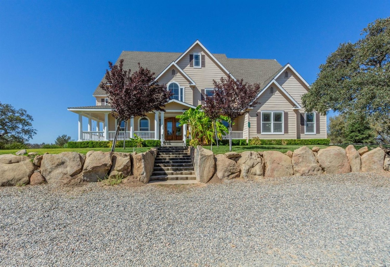
Property Record
28722 Spring Valley Ranch Rd, Coarsegold, CA 93614
NEARBY LISTINGS FOR SALE OR LEASE
Property Detail
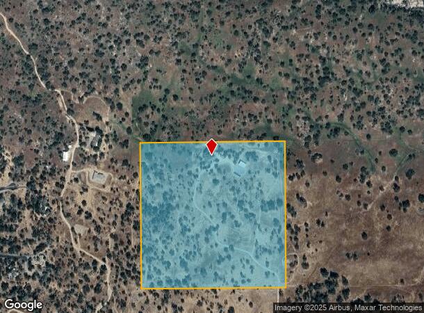
28722 Spring Valley Ranch Rd
050-041-076
Parcel Map No 3155
Pasture
POR SEC 12 T9S R20E PM 3155 41/121-2
X
Madera
06039C0725E
California
2023
40.29 AC
2023
Outlying Madera County
000106
Fresno
4,568 SF
Madera, CA
DEMOGRAPHICS near 28722 Spring Valley Ranch Rd
1 Mile
3 Mile
5 Mile
2024 Total Population
337
3,824
8,405
2029 Population
360
4,086
8,926
Pop Growth 2024-2029
+ 6.82%
+ 6.85%
+ 6.20%
Average Age
44
45
45
2024 Total Households
125
1,453
3,194
HH Growth 2024-2029
+ 6.40%
+ 6.40%
+ 5.79%
Median Household Inc
$98,332
$93,659
$80,603
Avg Household Size
2.60
2.50
2.50
2024 Avg HH Vehicles
2.00
2.00
2.00
Median Home Value
$363,333
$364,636
$362,979
Median Year Built
1993
1992
1992
Nearby Places
- Restaurants
- Banks
- Shops
- Fitness
- Groceries
PUBLIC TRANSPORTATION
AIRPORT
Fresno Yosemite International
DRIVE
WALK
Distance
Fresno Yosemite International
50 min
32.4 mi
Freight Ports
Port of Stockton
DRIVE
WALK
Distance
Port of Stockton
171 min
133.4 mi
SALE & LEASE HISTORY
LISTING DATE
SALE/LEASE

Oct 08, 2018
For Sale
Nearby Properties
Address
Land Use
TOTAL SIZE
Lot Size
Zoning
Address
Land Use
TOTAL SIZE
Lot Size
Zoning
205.31 AC
ARF
Address
Land Use
TOTAL SIZE
Lot Size
Zoning
3,506 SF
80 AC
ARE-40
Address
Land Use
TOTAL SIZE
Lot Size
Zoning
27,901 SF
4.07 AC
CRM
Address
Land Use
TOTAL SIZE
Lot Size
Zoning
7,138 SF
30.53 AC
OS
Address
Land Use
TOTAL SIZE
Lot Size
Zoning
4,219 SF
111.41 AC
ARE-40
Address
Land Use
TOTAL SIZE
Lot Size
Zoning
Address
Land Use
TOTAL SIZE
Lot Size
Zoning
1,810 SF
4.43 AC
CRM
Address
Land Use
TOTAL SIZE
Lot Size
Zoning
9.11 AC
IA
Address
Land Use
TOTAL SIZE
Lot Size
Zoning
960 SF
20.48 AC
ARE-40
Address
Land Use
TOTAL SIZE
Lot Size
Zoning
9,521 SF
5.55 AC
ARF
Address
Land Use
TOTAL SIZE
Lot Size
Zoning
1,946 SF
60 AC
ARE-160
Address
Land Use
TOTAL SIZE
Lot Size
Zoning
1,102 SF
6.52 AC
ARF
Address
Land Use
TOTAL SIZE
Lot Size
Zoning
1,543 SF
159.05 AC
ARF
Address
Land Use
TOTAL SIZE
Lot Size
Zoning
Address
Land Use
TOTAL SIZE
Lot Size
Zoning
2,920 SF
29.54 AC
ARF
Address
Land Use
TOTAL SIZE
Lot Size
Zoning
2,285 SF
3.91 AC
MHA
Address
Land Use
TOTAL SIZE
Lot Size
Zoning
2,426 SF
51.94 AC
ARE-40
Address
Land Use
TOTAL SIZE
Lot Size
Zoning
320 SF
5.58 AC
RRS-5
Address
Land Use
TOTAL SIZE
Lot Size
Zoning
1,438 SF
40.60 AC
ARE-40
Address
Land Use
TOTAL SIZE
Lot Size
Zoning
2,194 SF
2.54 AC
ARF
Address
Land Use
TOTAL SIZE
Lot Size
Zoning
1.04 AC
RMS
Address
Land Use
TOTAL SIZE
Lot Size
Zoning
2,662 SF
15.67 AC
MHA
Address
Land Use
TOTAL SIZE
Lot Size
Zoning
2,592 SF
25 AC
ARF
Address
Land Use
TOTAL SIZE
Lot Size
Zoning
5,788 SF
80 AC
ARE-40
Address
Land Use
TOTAL SIZE
Lot Size
Zoning
2,557 SF
3.09 AC
ARF
Address
Land Use
TOTAL SIZE
Lot Size
Zoning
2,180 SF
1.35 AC
RMS
Address
Land Use
TOTAL SIZE
Lot Size
Zoning
3,148 SF
39.92 AC
ARE-40
Address
Land Use
TOTAL SIZE
Lot Size
Zoning
2,179 SF
18.42 AC
RRS-10
The World's #1 Commercial Real Estate Marketplace
Connect with us
© 2025 CoStar Group
The information above has been obtained from sources believed reliable. While we do not doubt its accuracy we have not verified it and make no guarantee, warranty or representation about it. It is your responsibility to independently confirm its accuracy and completeness. Any projections, opinions, assumptions, or estimates used are for example only and do not represent the current or future performance of the property. The value of this transaction to you depends on tax and other factors which should be evaluated by your tax, financial, and legal advisors. You and your advisors should conduct a careful, independent investigation of the property to determine to your satisfaction the suitability of the property for your needs.