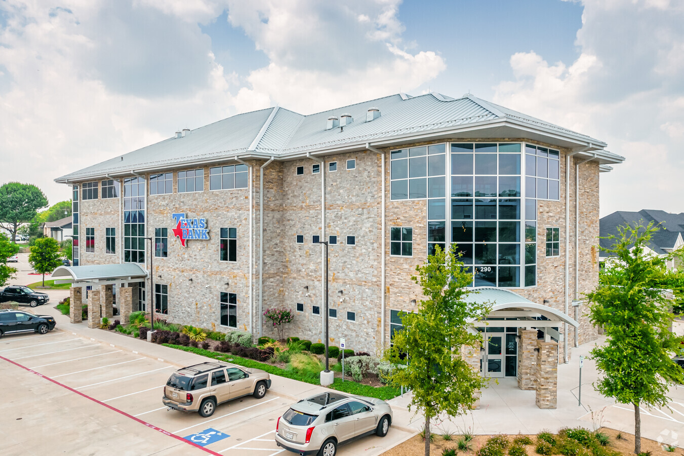
Property Record
290 S Preston Rd, Prosper, TX 75078


Current Lease Availabilities
NEARBY LISTINGS FOR SALE OR LEASE
Property Detail
290 S Preston Rd
Dallas-Fort Worth-Arlington, TX
Prosper Bank Addition No. 1 (Cpr)
R-11457-00A-0010-1
PROSPER BANK ADDITION NO. 1 (CPR), BLK A, LOT 1
Commercialnec
Collin
X
Texas
48121C0450G
1
2023
2.32 AC
2023
Outlying Collin County
030304
Dallas/Ft Worth
32,155 SF
DEMOGRAPHICS near 290 S Preston Rd
1 Mile
3 Mile
5 Mile
2024 Total Population
7,320
55,287
156,830
2029 Population
8,883
68,655
193,426
Pop Growth 2024-2029
+ 21.35%
+ 24.18%
+ 23.33%
Average Age
36
34
35
2024 Total Households
2,068
16,860
48,252
HH Growth 2024-2029
+ 21.62%
+ 24.42%
+ 23.64%
Median Household Inc
$159,600
$162,603
$149,540
Avg Household Size
3.50
3.30
3.20
2024 Avg HH Vehicles
3.00
2.00
2.00
Median Home Value
$570,356
$509,240
$477,047
Median Year Built
2006
2011
2010
Nearby Places
- Restaurants
- Banks
- Shops
- Fitness
- Groceries
PUBLIC TRANSPORTATION
AIRPORT
Dallas Love Field
DRIVE
WALK
Distance
Dallas Love Field
42 min
32.7 mi
Dallas-Fort Worth International
DRIVE
WALK
Distance
Dallas-Fort Worth International
41 min
33.5 mi
Freight Ports
Port of Shreveport
DRIVE
WALK
Distance
Port of Shreveport
245 min
226.0 mi
Nearby Properties
Address
Land Use
TOTAL SIZE
Lot Size
Zoning
Address
Land Use
TOTAL SIZE
Lot Size
Zoning
882,734 SF
98.26 AC
Address
Land Use
TOTAL SIZE
Lot Size
Zoning
980,997 SF
93.94 AC
Address
Land Use
TOTAL SIZE
Lot Size
Zoning
153.96 AC
Address
Land Use
TOTAL SIZE
Lot Size
Zoning
490,246 SF
24.39 AC
MF-M
Address
Land Use
TOTAL SIZE
Lot Size
Zoning
491,094 SF
14.06 AC
Address
Land Use
TOTAL SIZE
Lot Size
Zoning
621,249 SF
80.62 AC
Address
Land Use
TOTAL SIZE
Lot Size
Zoning
530,080 SF
Address
Land Use
TOTAL SIZE
Lot Size
Zoning
348,136 SF
23.07 AC
MF-L
Address
Land Use
TOTAL SIZE
Lot Size
Zoning
200,259 SF
44.76 AC
Address
Land Use
TOTAL SIZE
Lot Size
Zoning
536,616 SF
23.21 AC
MF-M
Address
Land Use
TOTAL SIZE
Lot Size
Zoning
275,288 SF
19.40 AC
MF-M
Address
Land Use
TOTAL SIZE
Lot Size
Zoning
357,333 SF
15.01 AC
Address
Land Use
TOTAL SIZE
Lot Size
Zoning
309,073 SF
33.58 AC
Address
Land Use
TOTAL SIZE
Lot Size
Zoning
436,200 SF
24.95 AC
Address
Land Use
TOTAL SIZE
Lot Size
Zoning
211,535 SF
35.62 AC
Address
Land Use
TOTAL SIZE
Lot Size
Zoning
140,868 SF
12.64 AC
Address
Land Use
TOTAL SIZE
Lot Size
Zoning
208,462 SF
24.46 AC
Address
Land Use
TOTAL SIZE
Lot Size
Zoning
210,643 SF
35.28 AC
Address
Land Use
TOTAL SIZE
Lot Size
Zoning
136,969 SF
19.87 AC
Address
Land Use
TOTAL SIZE
Lot Size
Zoning
201,473 SF
48.22 AC
Address
Land Use
TOTAL SIZE
Lot Size
Zoning
369,933 SF
73.82 AC
Address
Land Use
TOTAL SIZE
Lot Size
Zoning
96,025 SF
12.30 AC
Address
Land Use
TOTAL SIZE
Lot Size
Zoning
96,484 SF
10.08 AC
Address
Land Use
TOTAL SIZE
Lot Size
Zoning
96,113 SF
10.94 AC
Address
Land Use
TOTAL SIZE
Lot Size
Zoning
96,484 SF
10.23 AC
Address
Land Use
TOTAL SIZE
Lot Size
Zoning
91,545 SF
9.08 AC
Address
Land Use
TOTAL SIZE
Lot Size
Zoning
212,155 SF
12.16 AC
Address
Land Use
TOTAL SIZE
Lot Size
Zoning
94,436 SF
11 AC
Address
Land Use
TOTAL SIZE
Lot Size
Zoning
77,768 SF
17.07 AC
Address
Land Use
TOTAL SIZE
Lot Size
Zoning
48,323 SF
6.95 AC
The World's #1 Commercial Real Estate Marketplace
Connect with us
© 2025 CoStar Group
The information above has been obtained from sources believed reliable. While we do not doubt its accuracy we have not verified it and make no guarantee, warranty or representation about it. It is your responsibility to independently confirm its accuracy and completeness. Any projections, opinions, assumptions, or estimates used are for example only and do not represent the current or future performance of the property. The value of this transaction to you depends on tax and other factors which should be evaluated by your tax, financial, and legal advisors. You and your advisors should conduct a careful, independent investigation of the property to determine to your satisfaction the suitability of the property for your needs.