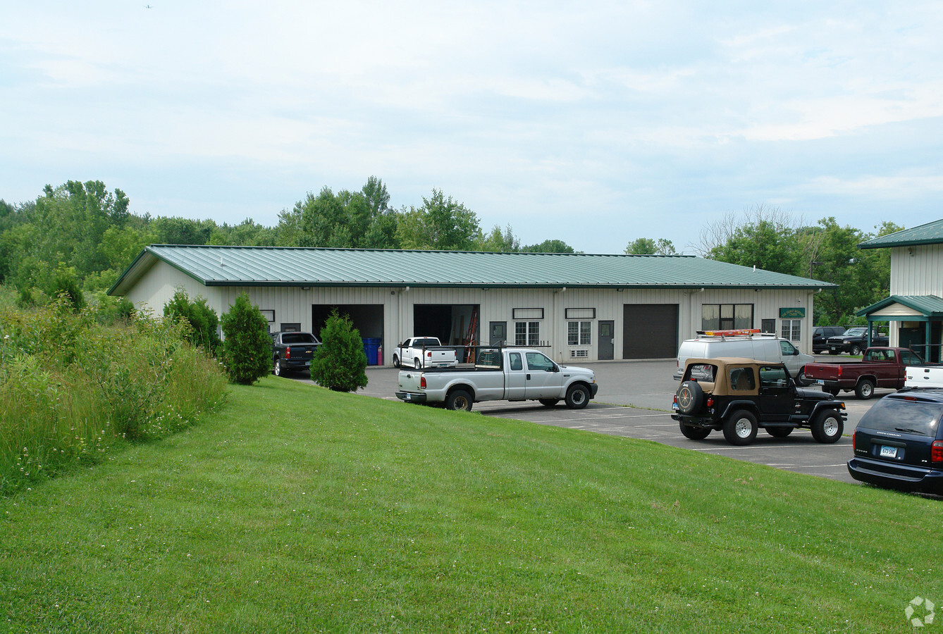
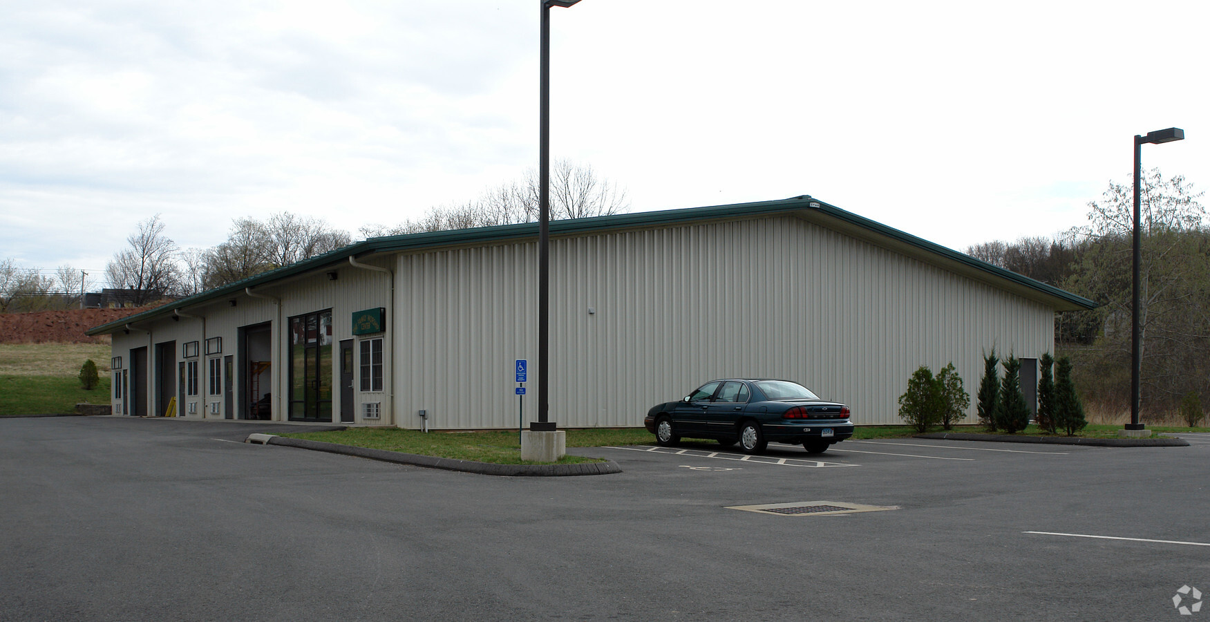
Property Record
290 Somers Rd, Ellington, CT 06029

NEARBY LISTINGS FOR SALE OR LEASE
Property Detail
290 Somers Rd
Hartford-West Hartford-East Hartford, CT
Tolland
ELLI-000083-000001
Connecticut
Industrialgeneral
8.14 AC
2024
Tolland County
2024
Hartford
535102
DEMOGRAPHICS near 290 Somers Rd
1 Mile
3 Mile
5 Mile
2024 Total Population
1,901
14,088
49,490
2029 Population
1,906
13,992
49,207
Pop Growth 2024-2029
+ 0.26%
(0.68%)
(0.57%)
Average Age
41
41
41
2024 Total Households
848
5,685
21,159
HH Growth 2024-2029
+ 0.35%
(0.67%)
(0.58%)
Median Household Inc
$86,458
$92,137
$74,870
Avg Household Size
2.20
2.40
2.30
2024 Avg HH Vehicles
2.00
2.00
2.00
Median Home Value
$315,137
$314,231
$277,268
Median Year Built
1979
1976
1973
Nearby Places
- Restaurants
- Banks
- Shops
- Fitness
- Groceries
PUBLIC TRANSPORTATION
AIRPORT
Bradley International
DRIVE
WALK
Distance
Bradley International
39 min
17.8 mi
Freight Ports
Port of New Haven
DRIVE
WALK
Distance
Port of New Haven
73 min
54.9 mi
Nearby Properties
Address
Land Use
TOTAL SIZE
Lot Size
Zoning
Address
Land Use
TOTAL SIZE
Lot Size
Zoning
71.60 AC
MF
Address
Land Use
TOTAL SIZE
Lot Size
Zoning
40 AC
MF
Address
Land Use
TOTAL SIZE
Lot Size
Zoning
59.25 AC
C
Address
Land Use
TOTAL SIZE
Lot Size
Zoning
29.99 AC
PC
Address
Land Use
TOTAL SIZE
Lot Size
Zoning
47.78 AC
RAR
Address
Land Use
TOTAL SIZE
Lot Size
Zoning
24.66 AC
C
Address
Land Use
TOTAL SIZE
Lot Size
Zoning
80,487 SF
11.41 AC
DMF
Address
Land Use
TOTAL SIZE
Lot Size
Zoning
15.84 AC
R
Address
Land Use
TOTAL SIZE
Lot Size
Zoning
19.38 AC
C
Address
Land Use
TOTAL SIZE
Lot Size
Zoning
20.27 AC
MF
Address
Land Use
TOTAL SIZE
Lot Size
Zoning
77,212 SF
19.60 AC
R
Address
Land Use
TOTAL SIZE
Lot Size
Zoning
12.23 AC
C
Address
Land Use
TOTAL SIZE
Lot Size
Zoning
18.84 AC
MF
Address
Land Use
TOTAL SIZE
Lot Size
Zoning
13.05 AC
PC
Address
Land Use
TOTAL SIZE
Lot Size
Zoning
24,465 SF
1.89 AC
R
Address
Land Use
TOTAL SIZE
Lot Size
Zoning
98,980 SF
0.88 AC
RC
Address
Land Use
TOTAL SIZE
Lot Size
Zoning
13,508 SF
5.15 AC
C
Address
Land Use
TOTAL SIZE
Lot Size
Zoning
45,680 SF
8.11 AC
PC
Address
Land Use
TOTAL SIZE
Lot Size
Zoning
13,496 SF
1.49 AC
RC
Address
Land Use
TOTAL SIZE
Lot Size
Zoning
9.76 AC
MF
Address
Land Use
TOTAL SIZE
Lot Size
Zoning
10,847 SF
5 AC
PC
Address
Land Use
TOTAL SIZE
Lot Size
Zoning
4.25 AC
R
Address
Land Use
TOTAL SIZE
Lot Size
Zoning
5 AC
C
Address
Land Use
TOTAL SIZE
Lot Size
Zoning
6.54 AC
C
Address
Land Use
TOTAL SIZE
Lot Size
Zoning
78,998 SF
8.60 AC
IP
Address
Land Use
TOTAL SIZE
Lot Size
Zoning
9.18 AC
C
Address
Land Use
TOTAL SIZE
Lot Size
Zoning
5.74 AC
PC
Address
Land Use
TOTAL SIZE
Lot Size
Zoning
27,660 SF
6.53 AC
PC
Address
Land Use
TOTAL SIZE
Lot Size
Zoning
60,540 SF
4.20 AC
I
Address
Land Use
TOTAL SIZE
Lot Size
Zoning
11,692 SF
6.65 AC
PC
The World's #1 Commercial Real Estate Marketplace
Connect with us
© 2025 CoStar Group
The information above has been obtained from sources believed reliable. While we do not doubt its accuracy we have not verified it and make no guarantee, warranty or representation about it. It is your responsibility to independently confirm its accuracy and completeness. Any projections, opinions, assumptions, or estimates used are for example only and do not represent the current or future performance of the property. The value of this transaction to you depends on tax and other factors which should be evaluated by your tax, financial, and legal advisors. You and your advisors should conduct a careful, independent investigation of the property to determine to your satisfaction the suitability of the property for your needs.