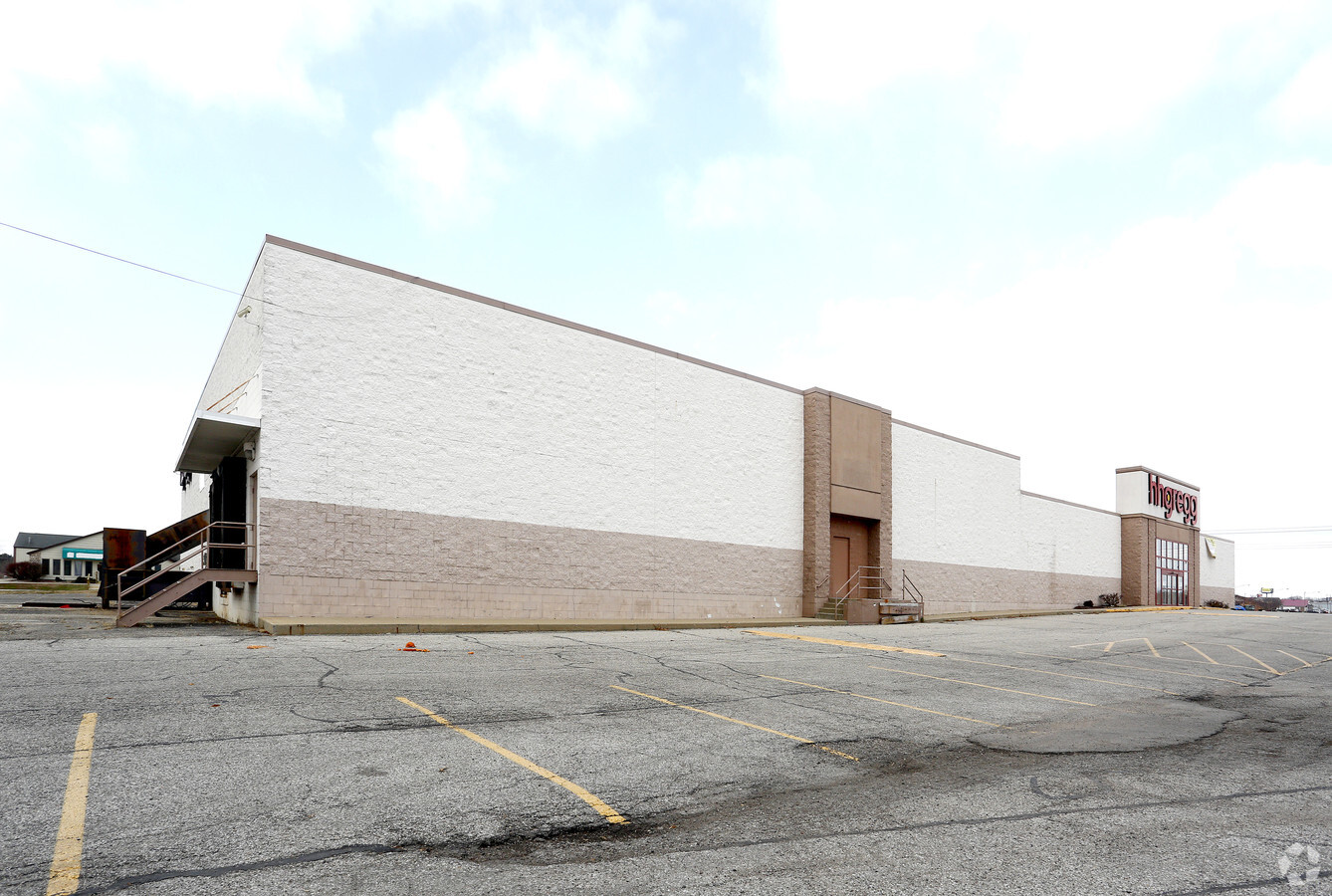
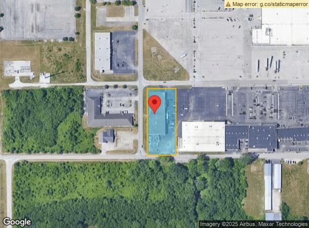
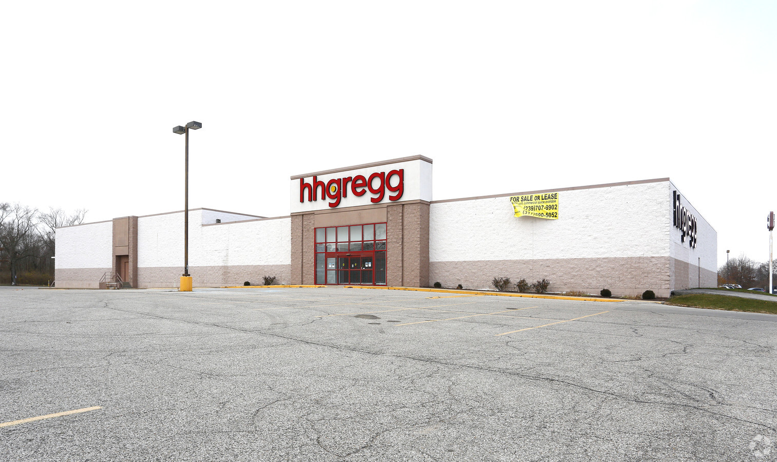
Property Record
290 W Honey Creek Pky, Terre Haute, IN 47802
NEARBY LISTINGS FOR SALE OR LEASE
Property Detail
290 W Honey Creek Pky
Terre Haute, IN
Robert E Lee S Gardendale Addition
84-09-04-304-001.000-005
GARDENDALE ADD 41' W SIDE SUBJ CITY ST D- 414/254 4-11-9 LOTS 28-29 1.56 AC
Commercialnec
Vigo
AE
Indiana
18167C0141C
28-29
2024
1.56 AC
2024
Bloomington/Terre Haute
011201
Other Market Areas
25,000 SF
DEMOGRAPHICS near 290 W Honey Creek Pky
1 Mile
3 Mile
5 Mile
2024 Total Population
3,861
28,422
67,108
2029 Population
3,849
28,520
67,333
Pop Growth 2024-2029
(0.31%)
+ 0.34%
+ 0.34%
Average Age
40
38
38
2024 Total Households
997
10,692
26,396
HH Growth 2024-2029
(0.50%)
+ 0.58%
+ 0.41%
Median Household Inc
$34,829
$37,527
$39,923
Avg Household Size
2.10
2.10
2.20
2024 Avg HH Vehicles
1.00
2.00
2.00
Median Home Value
$85,210
$103,672
$116,630
Median Year Built
1979
1969
1968
Nearby Places
- Restaurants
- Banks
- Shops
- Fitness
- Groceries
SALE & LEASE HISTORY
LISTING DATE
SALE/LEASE

Jun 06, 2017
For Lease
Jun 06, 2017
For Sale
Nearby Properties
Address
Land Use
TOTAL SIZE
Lot Size
Zoning
Address
Land Use
TOTAL SIZE
Lot Size
Zoning
20,400 SF
131.99 AC
Address
Land Use
TOTAL SIZE
Lot Size
Zoning
164,805 SF
97.22 AC
Address
Land Use
TOTAL SIZE
Lot Size
Zoning
128,350 SF
0.98 AC
Address
Land Use
TOTAL SIZE
Lot Size
Zoning
1,881 SF
21.39 AC
Address
Land Use
TOTAL SIZE
Lot Size
Zoning
263,122 SF
14.80 AC
Address
Land Use
TOTAL SIZE
Lot Size
Zoning
199,297 SF
24.64 AC
Address
Land Use
TOTAL SIZE
Lot Size
Zoning
156,558 SF
15.77 AC
Address
Land Use
TOTAL SIZE
Lot Size
Zoning
227,038 SF
22.09 AC
Address
Land Use
TOTAL SIZE
Lot Size
Zoning
63,979 SF
5.47 AC
Address
Land Use
TOTAL SIZE
Lot Size
Zoning
47,432 SF
13.50 AC
Address
Land Use
TOTAL SIZE
Lot Size
Zoning
77,170 SF
1.53 AC
Address
Land Use
TOTAL SIZE
Lot Size
Zoning
2,516 SF
14.31 AC
Address
Land Use
TOTAL SIZE
Lot Size
Zoning
9,443 SF
4.33 AC
Address
Land Use
TOTAL SIZE
Lot Size
Zoning
53,196 SF
2.21 AC
Address
Land Use
TOTAL SIZE
Lot Size
Zoning
29,679 SF
4.77 AC
Address
Land Use
TOTAL SIZE
Lot Size
Zoning
28,311 SF
40 AC
Address
Land Use
TOTAL SIZE
Lot Size
Zoning
64,196 SF
0.25 AC
Address
Land Use
TOTAL SIZE
Lot Size
Zoning
131,981 SF
17.33 AC
Address
Land Use
TOTAL SIZE
Lot Size
Zoning
111,948 SF
9.88 AC
Address
Land Use
TOTAL SIZE
Lot Size
Zoning
39,600 SF
3.95 AC
Address
Land Use
TOTAL SIZE
Lot Size
Zoning
15,953 SF
0.24 AC
Address
Land Use
TOTAL SIZE
Lot Size
Zoning
9,424 SF
28.17 AC
Address
Land Use
TOTAL SIZE
Lot Size
Zoning
93,774 SF
8.71 AC
Address
Land Use
TOTAL SIZE
Lot Size
Zoning
27,104 SF
0.45 AC
Address
Land Use
TOTAL SIZE
Lot Size
Zoning
88,318 SF
9.21 AC
Address
Land Use
TOTAL SIZE
Lot Size
Zoning
176,304 SF
8.87 AC
Address
Land Use
TOTAL SIZE
Lot Size
Zoning
63,416 SF
1.40 AC
Address
Land Use
TOTAL SIZE
Lot Size
Zoning
36,736 SF
2.69 AC
Address
Land Use
TOTAL SIZE
Lot Size
Zoning
173,611 SF
20.08 AC
Address
Land Use
TOTAL SIZE
Lot Size
Zoning
236,200 SF
33.33 AC
The World's #1 Commercial Real Estate Marketplace
Connect with us
© 2025 CoStar Group
The information above has been obtained from sources believed reliable. While we do not doubt its accuracy we have not verified it and make no guarantee, warranty or representation about it. It is your responsibility to independently confirm its accuracy and completeness. Any projections, opinions, assumptions, or estimates used are for example only and do not represent the current or future performance of the property. The value of this transaction to you depends on tax and other factors which should be evaluated by your tax, financial, and legal advisors. You and your advisors should conduct a careful, independent investigation of the property to determine to your satisfaction the suitability of the property for your needs.