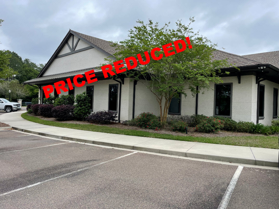
Property Record
2900 Saint Marys Rd, Saint Marys, GA 31558

NEARBY LISTINGS FOR SALE OR LEASE
Property Detail
2900 Saint Marys Rd
Other Market Areas
Camden
St. Marys, GA
Georgia
122A-001F
1.70 AC
Commercialnec
Brunswick/Kingsland
11,473 SF
DEMOGRAPHICS near 2900 Saint Marys Rd
1 Mile
3 Mile
5 Mile
2024 Total Population
2,319
14,337
37,696
2029 Population
2,537
15,665
41,303
Pop Growth 2024-2029
+ 9.40%
+ 9.26%
+ 9.57%
Average Age
44
38
36
2024 Total Households
925
5,642
13,658
HH Growth 2024-2029
+ 9.62%
+ 9.48%
+ 9.75%
Median Household Inc
$98,428
$69,725
$65,947
Avg Household Size
2.50
2.50
2.60
2024 Avg HH Vehicles
2.00
2.00
2.00
Median Home Value
$316,560
$250,187
$231,809
Median Year Built
2000
1996
1996
Nearby Places
- Restaurants
- Banks
- Shops
- Fitness
- Groceries
PUBLIC TRANSPORTATION
AIRPORT
Jacksonville International
DRIVE
WALK
Distance
Jacksonville International
35 min
26.0 mi
Freight Ports
Georgia Ports - Brunswick
DRIVE
WALK
Distance
Georgia Ports - Brunswick
45 min
34.7 mi
SALE & LEASE HISTORY
LISTING DATE
SALE/LEASE

Jun 06, 2023
For Sale
Nearby Properties
Address
Land Use
TOTAL SIZE
Lot Size
Zoning
Address
Land Use
TOTAL SIZE
Lot Size
Zoning
2,856 SF
51.84 AC
R-3
Address
Land Use
TOTAL SIZE
Lot Size
Zoning
172,807 SF
45.10 AC
R-1
Address
Land Use
TOTAL SIZE
Lot Size
Zoning
26,410 SF
3.21 AC
C-3
Address
Land Use
TOTAL SIZE
Lot Size
Zoning
80,350 SF
28 AC
PD
Address
Land Use
TOTAL SIZE
Lot Size
Zoning
64,504 SF
20 AC
C-ED
Address
Land Use
TOTAL SIZE
Lot Size
Zoning
1,456 SF
15.71 AC
R-3
Address
Land Use
TOTAL SIZE
Lot Size
Zoning
14,152 SF
14.25 AC
R-3
Address
Land Use
TOTAL SIZE
Lot Size
Zoning
2,305 SF
20.92 AC
C-2
Address
Land Use
TOTAL SIZE
Lot Size
Zoning
9,744 SF
13.84 AC
R-3
Address
Land Use
TOTAL SIZE
Lot Size
Zoning
5 AC
C-3
Address
Land Use
TOTAL SIZE
Lot Size
Zoning
139,255 SF
16.27 AC
I-L
Address
Land Use
TOTAL SIZE
Lot Size
Zoning
8,544 SF
18.64 AC
C2
Address
Land Use
TOTAL SIZE
Lot Size
Zoning
3,240 SF
13.97 AC
R-1
Address
Land Use
TOTAL SIZE
Lot Size
Zoning
95,196 SF
8.64 AC
C2
Address
Land Use
TOTAL SIZE
Lot Size
Zoning
16,598 SF
24.13 AC
PD/R-3
Address
Land Use
TOTAL SIZE
Lot Size
Zoning
182,489 SF
22.88 AC
C-2
Address
Land Use
TOTAL SIZE
Lot Size
Zoning
77,912 SF
12.76 AC
C-2
Address
Land Use
TOTAL SIZE
Lot Size
Zoning
28,858 SF
5.09 AC
R-3
Address
Land Use
TOTAL SIZE
Lot Size
Zoning
1,785.97 AC
P-D
Address
Land Use
TOTAL SIZE
Lot Size
Zoning
56,037 SF
8.66 AC
C2
Address
Land Use
TOTAL SIZE
Lot Size
Zoning
45,576 SF
12.06 AC
PD R-3
Address
Land Use
TOTAL SIZE
Lot Size
Zoning
5,472 SF
31 AC
C-2
Address
Land Use
TOTAL SIZE
Lot Size
Zoning
45,180 SF
7.46 AC
C-2
Address
Land Use
TOTAL SIZE
Lot Size
Zoning
3,000 SF
8.78 AC
C-2
Address
Land Use
TOTAL SIZE
Lot Size
Zoning
22,670 SF
16.51 AC
C-2
Address
Land Use
TOTAL SIZE
Lot Size
Zoning
127.47 AC
PD/MU/1-G
Address
Land Use
TOTAL SIZE
Lot Size
Zoning
6,720 SF
25 AC
R-3
Address
Land Use
TOTAL SIZE
Lot Size
Zoning
92,858 SF
10.67 AC
C-2
Address
Land Use
TOTAL SIZE
Lot Size
Zoning
451,960 SF
40.62 AC
I-G
Address
Land Use
TOTAL SIZE
Lot Size
Zoning
31,224 SF
11.43 AC
PD R-3
The World's #1 Commercial Real Estate Marketplace
Connect with us
© 2025 CoStar Group
The information above has been obtained from sources believed reliable. While we do not doubt its accuracy we have not verified it and make no guarantee, warranty or representation about it. It is your responsibility to independently confirm its accuracy and completeness. Any projections, opinions, assumptions, or estimates used are for example only and do not represent the current or future performance of the property. The value of this transaction to you depends on tax and other factors which should be evaluated by your tax, financial, and legal advisors. You and your advisors should conduct a careful, independent investigation of the property to determine to your satisfaction the suitability of the property for your needs.