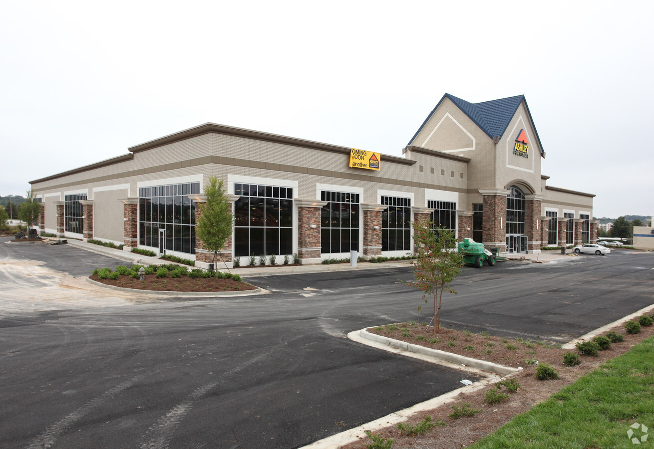
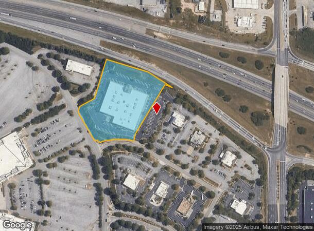
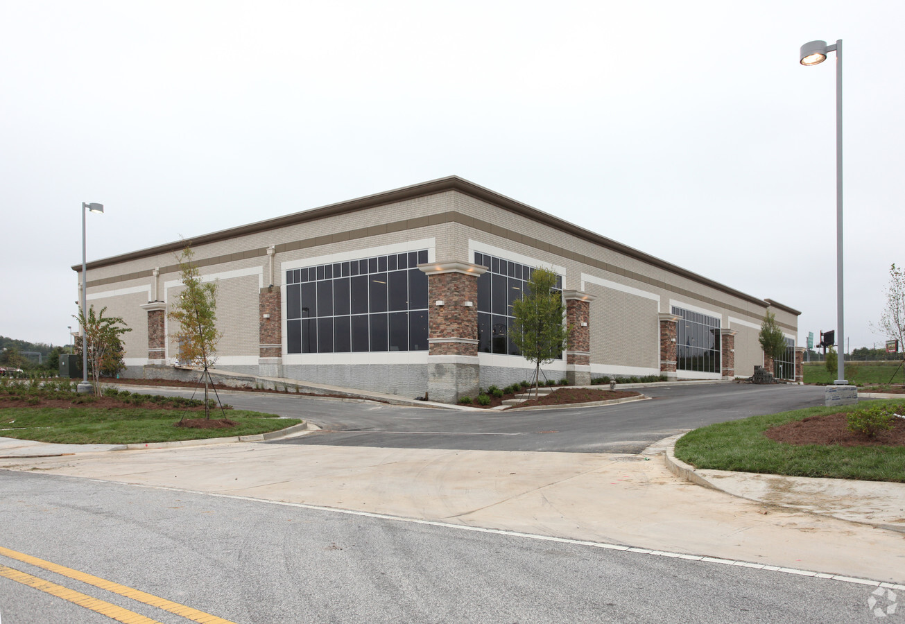
Property Record
2900 Stonecrest Cir, Lithonia, GA 30038
NEARBY LISTINGS FOR SALE OR LEASE
Property Detail
2900 Stonecrest Cir
16-170-01-050
DeKalb
Storebuilding
Georgia
X
170
13247C0080D
4 AC
2023
Lithonia/Conyers
2023
Atlanta
023440
Atlanta-Sandy Springs-Roswell, GA
55,070 SF
DEMOGRAPHICS near 2900 Stonecrest Cir
1 Mile
3 Mile
5 Mile
2024 Total Population
2,738
35,167
111,164
2029 Population
2,710
35,494
111,751
Pop Growth 2024-2029
(1.02%)
+ 0.93%
+ 0.53%
Average Age
38
37
38
2024 Total Households
1,262
13,610
40,638
HH Growth 2024-2029
(1.74%)
+ 0.68%
+ 0.40%
Median Household Inc
$55,081
$61,122
$61,684
Avg Household Size
2.10
2.50
2.70
2024 Avg HH Vehicles
1.00
2.00
2.00
Median Home Value
$220,561
$202,082
$186,955
Median Year Built
2004
1996
1993
Nearby Places
- Restaurants
- Banks
- Shops
- Fitness
- Groceries
PUBLIC TRANSPORTATION
AIRPORT
Hartsfield - Jackson Atlanta International
DRIVE
WALK
Distance
Hartsfield - Jackson Atlanta International
35 min
23.5 mi
Freight Ports
Georgia Ports - Savannah
DRIVE
WALK
Distance
Georgia Ports - Savannah
281 min
242.1 mi
SALE & LEASE HISTORY
LISTING DATE
SALE/LEASE

Nov 03, 2016
For Lease
Aug 03, 2017
For Lease
Nearby Properties
Address
Land Use
TOTAL SIZE
Lot Size
Zoning
Address
Land Use
TOTAL SIZE
Lot Size
Zoning
224,892 SF
18 AC
RM100
Address
Land Use
TOTAL SIZE
Lot Size
Zoning
257,807 SF
29.90 AC
RM100
Address
Land Use
TOTAL SIZE
Lot Size
Zoning
274,631 SF
25 AC
RM100
Address
Land Use
TOTAL SIZE
Lot Size
Zoning
764,622 SF
44.70 AC
M
Address
Land Use
TOTAL SIZE
Lot Size
Zoning
224,155 SF
23.40 AC
X
Address
Land Use
TOTAL SIZE
Lot Size
Zoning
405,288 SF
29 AC
C1
Address
Land Use
TOTAL SIZE
Lot Size
Zoning
235,521 SF
15.10 AC
RM75
Address
Land Use
TOTAL SIZE
Lot Size
Zoning
2,782 SF
29.51 AC
R3/C
Address
Land Use
TOTAL SIZE
Lot Size
Zoning
194,186 SF
18.50 AC
RM100
Address
Land Use
TOTAL SIZE
Lot Size
Zoning
108,519 SF
14.31 AC
Address
Land Use
TOTAL SIZE
Lot Size
Zoning
28,024 SF
11.24 AC
R1
Address
Land Use
TOTAL SIZE
Lot Size
Zoning
356,301 SF
15.70 AC
M
Address
Land Use
TOTAL SIZE
Lot Size
Zoning
1,810 SF
234 AC
RA8
Address
Land Use
TOTAL SIZE
Lot Size
Zoning
267,899 SF
47.90 AC
X
Address
Land Use
TOTAL SIZE
Lot Size
Zoning
140,058 SF
8.10 AC
C1
Address
Land Use
TOTAL SIZE
Lot Size
Zoning
20,964 SF
25.29 AC
R3/C
Address
Land Use
TOTAL SIZE
Lot Size
Zoning
218,152 SF
18.80 AC
RM100
Address
Land Use
TOTAL SIZE
Lot Size
Zoning
198,140 SF
18 AC
RM100
Address
Land Use
TOTAL SIZE
Lot Size
Zoning
253,861 SF
19.30 AC
X
Address
Land Use
TOTAL SIZE
Lot Size
Zoning
227,648 SF
14.40 AC
X
Address
Land Use
TOTAL SIZE
Lot Size
Zoning
314,474 SF
24.70 AC
RM75
Address
Land Use
TOTAL SIZE
Lot Size
Zoning
124,591 SF
13.60 AC
C2
Address
Land Use
TOTAL SIZE
Lot Size
Zoning
48,531 SF
13.10 AC
C1
Address
Land Use
TOTAL SIZE
Lot Size
Zoning
181,160 SF
15.60 AC
M
Address
Land Use
TOTAL SIZE
Lot Size
Zoning
207,446 SF
12.10 AC
M
Address
Land Use
TOTAL SIZE
Lot Size
Zoning
59,763 SF
12.52 AC
C-1
Address
Land Use
TOTAL SIZE
Lot Size
Zoning
96,725 SF
0.02 AC
C1
Address
Land Use
TOTAL SIZE
Lot Size
Zoning
173,427 SF
15.10 AC
X
Address
Land Use
TOTAL SIZE
Lot Size
Zoning
92,416 SF
5.50 AC
OD
Address
Land Use
TOTAL SIZE
Lot Size
Zoning
94,220 SF
4.60 AC
RM75
The World's #1 Commercial Real Estate Marketplace
Connect with us
© 2025 CoStar Group
The information above has been obtained from sources believed reliable. While we do not doubt its accuracy we have not verified it and make no guarantee, warranty or representation about it. It is your responsibility to independently confirm its accuracy and completeness. Any projections, opinions, assumptions, or estimates used are for example only and do not represent the current or future performance of the property. The value of this transaction to you depends on tax and other factors which should be evaluated by your tax, financial, and legal advisors. You and your advisors should conduct a careful, independent investigation of the property to determine to your satisfaction the suitability of the property for your needs.