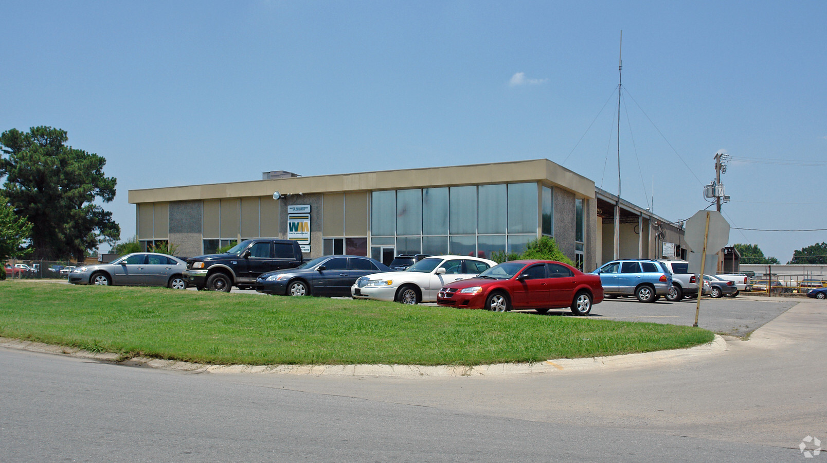
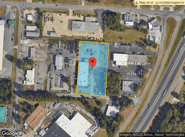
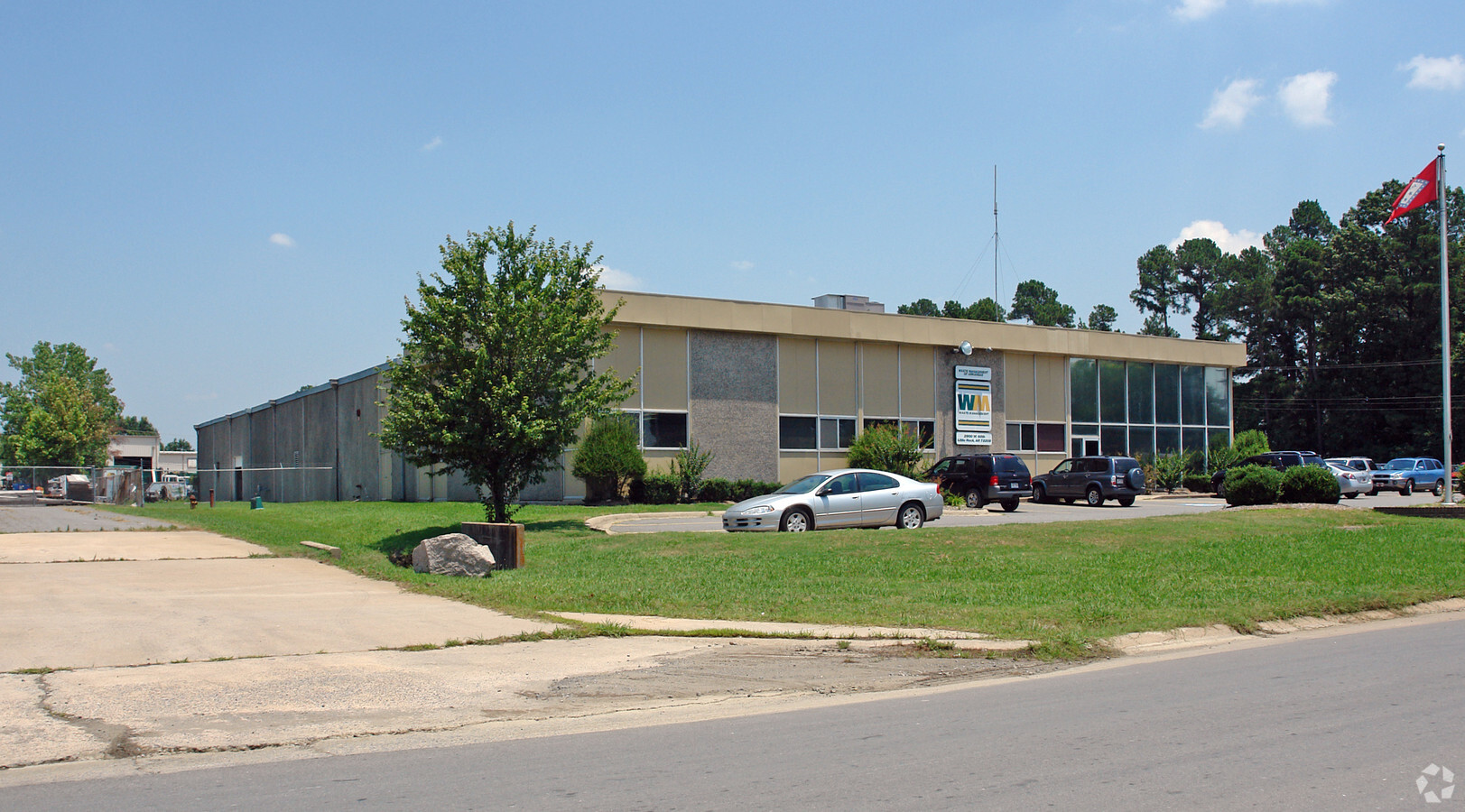
Property Record
2900 W 68Th St, Little Rock, AR 72209
NEARBY LISTINGS FOR SALE OR LEASE
Property Detail
2900 W 68Th St
34L-339-00-035-00
L R Ind Dist
Officebuilding
Pulaski
X
Arkansas
05119C0466G
o
2023
3.84 AC
2023
Southwest
0020023003
Little Rock/N Little Rock
7,242 SF
Little Rock-North Little Rock-Conway, AR
DEMOGRAPHICS near 2900 W 68Th St
1 Mile
3 Mile
5 Mile
2024 Total Population
264
34,756
100,724
2029 Population
268
35,352
101,954
Pop Growth 2024-2029
+ 1.52%
+ 1.71%
+ 1.22%
Average Age
37
35
38
2024 Total Households
97
13,119
41,884
HH Growth 2024-2029
+ 1.03%
+ 2.13%
+ 1.35%
Median Household Inc
$40,833
$34,747
$40,864
Avg Household Size
2.50
2.40
2.20
2024 Avg HH Vehicles
2.00
2.00
2.00
Median Home Value
$135,294
$76,670
$116,646
Median Year Built
1979
1972
1969
Nearby Places
- Restaurants
- Banks
- Shops
- Fitness
- Groceries
PUBLIC TRANSPORTATION
COMMUTER RAIL
Little Rock Union Station (Texas Eagle - Amtrak)
DRIVE
WALK
Distance
Little Rock Union Station (Texas Eagle - Amtrak)
12 min
7.4 mi
AIRPORT
Bill and Hillary Clinton Ntl/Adams Field
DRIVE
WALK
Distance
Bill and Hillary Clinton Ntl/Adams Field
11 min
7.2 mi
Freight Ports
Port of Shreveport
DRIVE
WALK
Distance
Port of Shreveport
245 min
228.3 mi
Nearby Properties
Address
Land Use
TOTAL SIZE
Lot Size
Zoning
Address
Land Use
TOTAL SIZE
Lot Size
Zoning
79,751 SF
28.57 AC
Address
Land Use
TOTAL SIZE
Lot Size
Zoning
239,345 SF
19.70 AC
Address
Land Use
TOTAL SIZE
Lot Size
Zoning
34,925 SF
12.59 AC
Address
Land Use
TOTAL SIZE
Lot Size
Zoning
83,466 SF
5.46 AC
Address
Land Use
TOTAL SIZE
Lot Size
Zoning
41,652 SF
10.86 AC
Address
Land Use
TOTAL SIZE
Lot Size
Zoning
50,433 SF
22.23 AC
Address
Land Use
TOTAL SIZE
Lot Size
Zoning
24,492 SF
9.10 AC
Address
Land Use
TOTAL SIZE
Lot Size
Zoning
139,410 SF
8.35 AC
Address
Land Use
TOTAL SIZE
Lot Size
Zoning
21,147 SF
10.92 AC
Address
Land Use
TOTAL SIZE
Lot Size
Zoning
6,161 SF
40.08 AC
Address
Land Use
TOTAL SIZE
Lot Size
Zoning
154,829 SF
15.40 AC
Address
Land Use
TOTAL SIZE
Lot Size
Zoning
33,216 SF
12.59 AC
Address
Land Use
TOTAL SIZE
Lot Size
Zoning
75,900 SF
20.18 AC
Address
Land Use
TOTAL SIZE
Lot Size
Zoning
35,069 SF
43.11 AC
Address
Land Use
TOTAL SIZE
Lot Size
Zoning
272,996 SF
22.27 AC
Address
Land Use
TOTAL SIZE
Lot Size
Zoning
310,000 SF
13.21 AC
Address
Land Use
TOTAL SIZE
Lot Size
Zoning
41,291 SF
1.73 AC
Address
Land Use
TOTAL SIZE
Lot Size
Zoning
70,741 SF
7.37 AC
Address
Land Use
TOTAL SIZE
Lot Size
Zoning
85,458 SF
9.86 AC
Address
Land Use
TOTAL SIZE
Lot Size
Zoning
10,629 SF
12 AC
Address
Land Use
TOTAL SIZE
Lot Size
Zoning
62,326 SF
9.11 AC
Address
Land Use
TOTAL SIZE
Lot Size
Zoning
573,416 SF
57.83 AC
Address
Land Use
TOTAL SIZE
Lot Size
Zoning
46,060 SF
4.88 AC
Address
Land Use
TOTAL SIZE
Lot Size
Zoning
85,858 SF
2.62 AC
Address
Land Use
TOTAL SIZE
Lot Size
Zoning
182,636 SF
16.86 AC
Address
Land Use
TOTAL SIZE
Lot Size
Zoning
2,881 SF
14.04 AC
Address
Land Use
TOTAL SIZE
Lot Size
Zoning
58,156 SF
4.35 AC
Address
Land Use
TOTAL SIZE
Lot Size
Zoning
1,233 SF
6.19 AC
Address
Land Use
TOTAL SIZE
Lot Size
Zoning
38,640 SF
11.48 AC
Address
Land Use
TOTAL SIZE
Lot Size
Zoning
4,407 SF
8.88 AC
The World's #1 Commercial Real Estate Marketplace
Connect with us
© 2025 CoStar Group
The information above has been obtained from sources believed reliable. While we do not doubt its accuracy we have not verified it and make no guarantee, warranty or representation about it. It is your responsibility to independently confirm its accuracy and completeness. Any projections, opinions, assumptions, or estimates used are for example only and do not represent the current or future performance of the property. The value of this transaction to you depends on tax and other factors which should be evaluated by your tax, financial, and legal advisors. You and your advisors should conduct a careful, independent investigation of the property to determine to your satisfaction the suitability of the property for your needs.