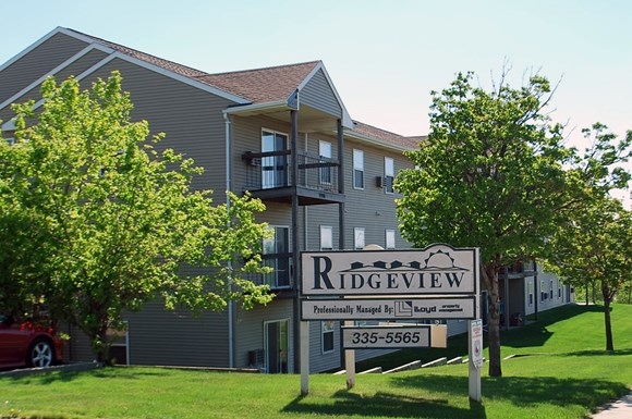
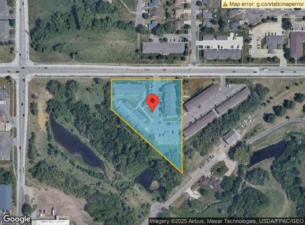
Property Record
2901 E 6Th St, Sioux Falls, SD 57103
NEARBY LISTINGS FOR SALE OR LEASE
-
-
View all Sioux Falls listings for sale on LoopNet.com
Property Detail
2901 E 6Th St
61160
Que Place 1St Addn
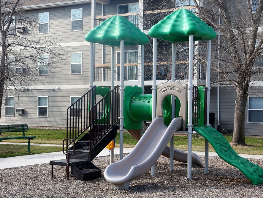
Multifamilydwelling
QUE PLACE 1ST ADDN TO CITY OF SIOUX FALLS
X
Minnehaha
46099C0462E
South Dakota
2024
3.25 AC
2023
Sioux Falls
000405
Other Market Areas
62,056 SF
Sioux Falls, SD
DEMOGRAPHICS near 2901 E 6Th St
1 Mile
3 Mile
5 Mile
2024 Total Population
15,209
78,635
137,384
2029 Population
16,479
85,118
151,834
Pop Growth 2024-2029
+ 8.35%
+ 8.24%
+ 10.52%
Average Age
36
38
39
2024 Total Households
5,958
31,623
56,480
HH Growth 2024-2029
+ 8.66%
+ 8.76%
+ 11.04%
Median Household Inc
$59,508
$63,810
$70,809
Avg Household Size
2.50
2.30
2.30
2024 Avg HH Vehicles
2.00
2.00
2.00
Median Home Value
$187,696
$226,519
$254,773
Median Year Built
1977
1976
1985
Nearby Places
- Restaurants
- Banks
- Shops
- Fitness
- Groceries
PUBLIC TRANSPORTATION
AIRPORT
Joe Foss Field
DRIVE
WALK
Distance
Joe Foss Field
24 min
6.4 mi
Freight Ports
Port Milwaukee
DRIVE
WALK
Distance
Port Milwaukee
545 min
502.3 mi
Nearby Properties
Address
Land Use
TOTAL SIZE
Lot Size
Zoning
Address
Land Use
TOTAL SIZE
Lot Size
Zoning
8.90 AC
C1;NEIGHBO
Address
Land Use
TOTAL SIZE
Lot Size
Zoning
3,306 SF
17.41 AC
Address
Land Use
TOTAL SIZE
Lot Size
Zoning
11,800 SF
11.78 AC
Address
Land Use
TOTAL SIZE
Lot Size
Zoning
14,820 SF
80.57 AC
FP;FP
Address
Land Use
TOTAL SIZE
Lot Size
Zoning
1.57 AC
C2;GENERAL
Address
Land Use
TOTAL SIZE
Lot Size
Zoning
89,935 SF
4.81 AC
Address
Land Use
TOTAL SIZE
Lot Size
Zoning
28,098 SF
13.13 AC
Address
Land Use
TOTAL SIZE
Lot Size
Zoning
15.39 AC
Address
Land Use
TOTAL SIZE
Lot Size
Zoning
1,806 SF
170.92 AC
FP;FP
Address
Land Use
TOTAL SIZE
Lot Size
Zoning
125,520 SF
5.61 AC
Address
Land Use
TOTAL SIZE
Lot Size
Zoning
1,860 SF
86.79 AC
Address
Land Use
TOTAL SIZE
Lot Size
Zoning
94,624 SF
12.31 AC
Address
Land Use
TOTAL SIZE
Lot Size
Zoning
70,747 SF
0.26 AC
Address
Land Use
TOTAL SIZE
Lot Size
Zoning
39.68 AC
Address
Land Use
TOTAL SIZE
Lot Size
Zoning
3,152 SF
6.73 AC
Address
Land Use
TOTAL SIZE
Lot Size
Zoning
15,864 SF
4.51 AC
Address
Land Use
TOTAL SIZE
Lot Size
Zoning
1,104 SF
24.58 AC
Address
Land Use
TOTAL SIZE
Lot Size
Zoning
212,260 SF
20.37 AC
Address
Land Use
TOTAL SIZE
Lot Size
Zoning
1,872 SF
26.52 AC
Address
Land Use
TOTAL SIZE
Lot Size
Zoning
219,120 SF
18.65 AC
Address
Land Use
TOTAL SIZE
Lot Size
Zoning
4,536 SF
50.29 AC
Address
Land Use
TOTAL SIZE
Lot Size
Zoning
88,814 SF
8.36 AC
Address
Land Use
TOTAL SIZE
Lot Size
Zoning
16,182 SF
2.76 AC
NO;SPECIAL
Address
Land Use
TOTAL SIZE
Lot Size
Zoning
1,020 SF
27.39 AC
NO;SPECIAL
Address
Land Use
TOTAL SIZE
Lot Size
Zoning
24,396 SF
13.29 AC
NO;SPECIAL
Address
Land Use
TOTAL SIZE
Lot Size
Zoning
7,072 SF
2.94 AC
Address
Land Use
TOTAL SIZE
Lot Size
Zoning
62,056 SF
2.68 AC
Address
Land Use
TOTAL SIZE
Lot Size
Zoning
70,972 SF
1.92 AC
Address
Land Use
TOTAL SIZE
Lot Size
Zoning
54,708 SF
3.27 AC
Address
Land Use
TOTAL SIZE
Lot Size
Zoning
70,972 SF
1.98 AC
The World's #1 Commercial Real Estate Marketplace
Connect with us
© 2025 CoStar Group
The information above has been obtained from sources believed reliable. While we do not doubt its accuracy we have not verified it and make no guarantee, warranty or representation about it. It is your responsibility to independently confirm its accuracy and completeness. Any projections, opinions, assumptions, or estimates used are for example only and do not represent the current or future performance of the property. The value of this transaction to you depends on tax and other factors which should be evaluated by your tax, financial, and legal advisors. You and your advisors should conduct a careful, independent investigation of the property to determine to your satisfaction the suitability of the property for your needs.