Property Record
2901 E Milton Ave, Youngsville, LA 70592

Property Detail
2901 E Milton Ave
Lafayette, LA
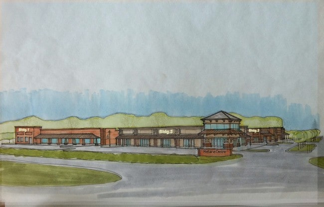
28.71 AC (LOT 1 OF NEW SOUTH LAFAYETTE SCHOOL SUB)SEC 1 T11S R4E (GALLET ELEMENTARY SCHOOL)
6103432
LAFAYETTE
Privateschool
Louisiana
AE The base floodplain where base flood elevations are provided. AE Zones are now used on new format FIRMs instead of A1-A30 Zones.
1
2024
28.71 AC
2024
Outlying Lafayette Parish
0014044034
Lafayette
NEARBY LISTINGS FOR SALE OR LEASE
DEMOGRAPHICS near 2901 E Milton Ave
1 mile
3 mile
5 mile
2025 Total Population
7,472
39,258
90,815
2030 Population
7,818
41,088
94,988
Pop Growth 2025-2030
+ 4.63%
+ 4.66%
+ 4.60%
Average Age
36
36
38
2025 Total Households
2,804
14,231
35,753
HH Growth 2025-2030
+ 4.96%
+ 4.78%
+ 4.73%
Median Household Inc
$84,868
$95,929
$84,357
Avg Household Size
2.60
2.70
2.50
2025 Avg HH Vehicles
2.00
2.00
2.00
Median Home Value
$308,007
$286,715
$290,907
Median Year Built
2010
2008
2002
Nearby Places
Map Layers
Map Styles
 Street
 Aerial
Transit
 Traffic
 Biking
Places
Listings with unknown addresses are not visible on the map
- Restaurants
- Banks
- Shops
- Fitness
- Groceries
PUBLIC TRANSPORTATION
AIRPORT
Lafayette Regional/Paul Fournet Field
Drive
Walk
Distance
Lafayette Regional/Paul Fournet Field
19 min
9.8 mi
Freight Ports
Port of Iberia
Drive
Walk
Distance
Port of Iberia
27 min
18.2 mi
Nearby Properties
Address
Land Use
TOTAL SIZE
Lot Size
Zoning
Address
Land Use
TOTAL SIZE
Lot Size
Zoning
274.26 AC
Address
Land Use
TOTAL SIZE
Lot Size
Zoning
Address
Land Use
TOTAL SIZE
Lot Size
Zoning
120,024 SF
Address
Land Use
TOTAL SIZE
Lot Size
Zoning
Address
Land Use
TOTAL SIZE
Lot Size
Zoning
210,169 SF
20.75 AC
Address
Land Use
TOTAL SIZE
Lot Size
Zoning
Address
Land Use
TOTAL SIZE
Lot Size
Zoning
Address
Land Use
TOTAL SIZE
Lot Size
Zoning
11,772 SF
5.95 AC
Address
Land Use
TOTAL SIZE
Lot Size
Zoning
102,718 SF
6.26 AC
Address
Land Use
TOTAL SIZE
Lot Size
Zoning
9.02 AC
Address
Land Use
TOTAL SIZE
Lot Size
Zoning
141,600 SF
24.31 AC
Address
Land Use
TOTAL SIZE
Lot Size
Zoning
16.63 AC
Address
Land Use
TOTAL SIZE
Lot Size
Zoning
78,219 SF
5.84 AC
Address
Land Use
TOTAL SIZE
Lot Size
Zoning
7,020 SF
222.16 AC
Address
Land Use
TOTAL SIZE
Lot Size
Zoning
5.16 AC
Address
Land Use
TOTAL SIZE
Lot Size
Zoning
Address
Land Use
TOTAL SIZE
Lot Size
Zoning
59,280 SF
6 AC
Address
Land Use
TOTAL SIZE
Lot Size
Zoning
Address
Land Use
TOTAL SIZE
Lot Size
Zoning
58,410 SF
6.52 AC
Address
Land Use
TOTAL SIZE
Lot Size
Zoning
8.54 AC
Address
Land Use
TOTAL SIZE
Lot Size
Zoning
69.42 AC
Address
Land Use
TOTAL SIZE
Lot Size
Zoning
118,550 SF
2.01 AC
Address
Land Use
TOTAL SIZE
Lot Size
Zoning
81,275 SF
2.83 AC
Address
Land Use
TOTAL SIZE
Lot Size
Zoning
34,222 SF
2.75 AC
Address
Land Use
TOTAL SIZE
Lot Size
Zoning
3,103 SF
4.02 AC
Address
Land Use
TOTAL SIZE
Lot Size
Zoning
49,700 SF
5.50 AC
Address
Land Use
TOTAL SIZE
Lot Size
Zoning
Address
Land Use
TOTAL SIZE
Lot Size
Zoning
4,354 SF
11.33 AC
Address
Land Use
TOTAL SIZE
Lot Size
Zoning
119,983 SF
6 AC
The World's #1 Commercial Real Estate Marketplace
Connect with us
© 2026 CoStar Group
The information above has been obtained from sources believed reliable. While we do not doubt its accuracy we have not verified it and make no guarantee, warranty or representation about it. It is your responsibility to independently confirm its accuracy and completeness. Any projections, opinions, assumptions, or estimates used are for example only and do not represent the current or future performance of the property. The value of this transaction to you depends on tax and other factors which should be evaluated by your tax, financial, and legal advisors. You and your advisors should conduct a careful, independent investigation of the property to determine to your satisfaction the suitability of the property for your needs.