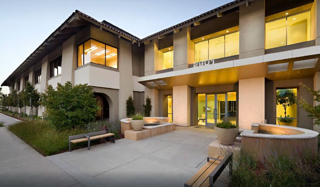
Property Record
2901 Tasman Dr, Santa Clara, CA 95054
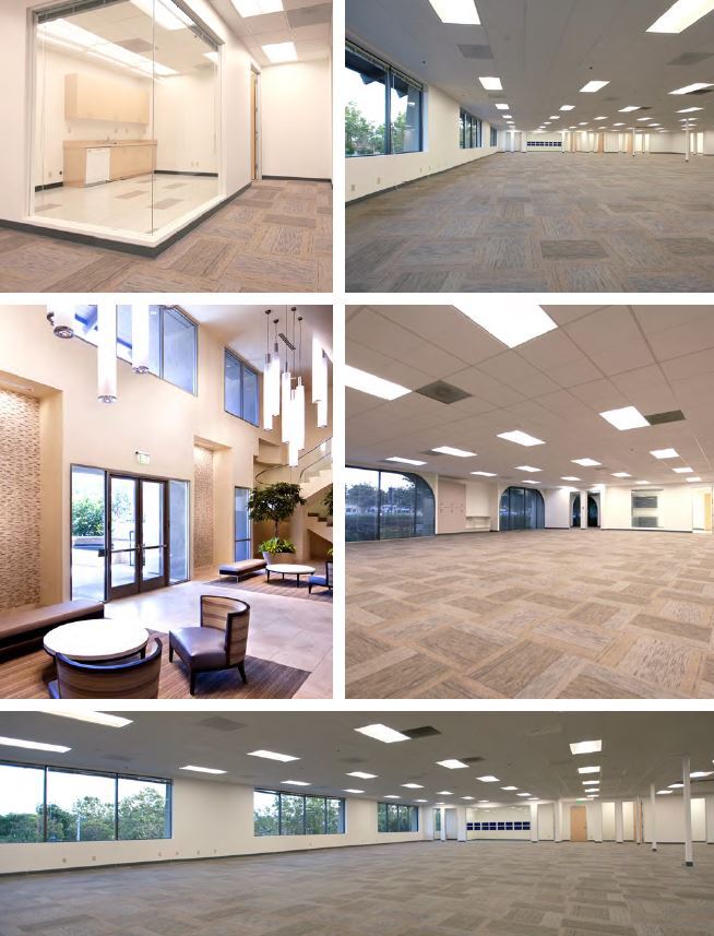

Current Lease Availabilities
NEARBY LISTINGS FOR SALE OR LEASE
Property Detail
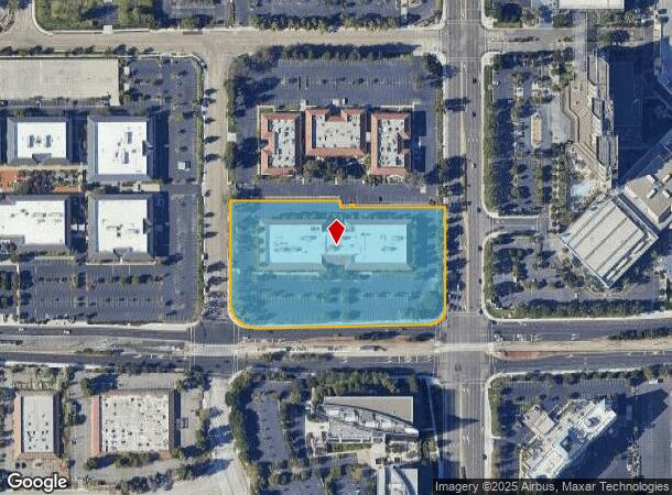
2901 Tasman Dr
104-49-026
MAP A4 813
Financialbuilding
Santa Clara
X
California
06085C0063H
4.64 AC
2023
North Santa Clara
2023
South Bay/San Jose
505010
San Jose-Sunnyvale-Santa Clara, CA
104,400 SF
DEMOGRAPHICS near 2901 Tasman Dr
1 Mile
3 Mile
5 Mile
2024 Total Population
6,747
117,589
339,407
2029 Population
6,352
114,176
329,138
Pop Growth 2024-2029
(5.85%)
(2.90%)
(3.03%)
Average Age
41
36
37
2024 Total Households
2,340
45,415
127,705
HH Growth 2024-2029
(6.54%)
(3.01%)
(3.18%)
Median Household Inc
$134,375
$165,853
$164,191
Avg Household Size
2.70
2.50
2.60
2024 Avg HH Vehicles
2.00
2.00
2.00
Median Home Value
$766,483
$1,065,403
$1,095,013
Median Year Built
1992
1997
1984
Nearby Places
- Restaurants
- Banks
- Shops
- Fitness
- Groceries
PUBLIC TRANSPORTATION
TRANSIT/SUBWAY
Old Ironsides Station (Mountain View - Winchester Line - Santa Clara VTA Light Rail)
DRIVE
WALK
Distance
Old Ironsides Station (Mountain View - Winchester Line - Santa Clara VTA Light Rail)
0 min
2 min
0.1 mi
Great America Station (Mountain View - Winchester Line - Santa Clara VTA Light Rail)
DRIVE
WALK
Distance
Great America Station (Mountain View - Winchester Line - Santa Clara VTA Light Rail)
2 min
5 min
0.3 mi
Patrick Henry Pocket Track (Old Ironsides - Winchester - VTA, Old Ironsides - Winchester Modified (North Portion) - VTA)
DRIVE
WALK
Distance
Patrick Henry Pocket Track (Old Ironsides - Winchester - VTA, Old Ironsides - Winchester Modified (North Portion) - VTA)
0 min
6 min
0.3 mi
Reamwood Station (Mountain View - Winchester Line - Santa Clara VTA Light Rail)
DRIVE
WALK
Distance
Reamwood Station (Mountain View - Winchester Line - Santa Clara VTA Light Rail)
2 min
11 min
0.6 mi
Lick Mill Station (Mountain View - Winchester Line - Santa Clara VTA Light Rail)
DRIVE
WALK
Distance
Lick Mill Station (Mountain View - Winchester Line - Santa Clara VTA Light Rail)
2 min
18 min
1.0 mi
COMMUTER RAIL
Great America (Altamont Corridor Express - Altamont Commuter Express (ACE))
DRIVE
WALK
Distance
Great America (Altamont Corridor Express - Altamont Commuter Express (ACE))
3 min
18 min
0.9 mi
Lawrence (Caltrain - Caltrain (Caltrain))
DRIVE
WALK
Distance
Lawrence (Caltrain - Caltrain (Caltrain))
6 min
3.3 mi
AIRPORT
Norman Y Mineta San Jose International
DRIVE
WALK
Distance
Norman Y Mineta San Jose International
10 min
5.1 mi
San Francisco International
DRIVE
WALK
Distance
San Francisco International
38 min
29.8 mi
Metro Oakland International
DRIVE
WALK
Distance
Metro Oakland International
43 min
33.6 mi
Freight Ports
Port of Redwood City
DRIVE
WALK
Distance
Port of Redwood City
23 min
16.6 mi
Nearby Properties
Address
Land Use
TOTAL SIZE
Lot Size
Zoning
Address
Land Use
TOTAL SIZE
Lot Size
Zoning
553,793 SF
38.06 AC
ML
Address
Land Use
TOTAL SIZE
Lot Size
Zoning
238,239 SF
24.66 AC
ML
Address
Land Use
TOTAL SIZE
Lot Size
Zoning
777,000 SF
17.84 AC
MS
Address
Land Use
TOTAL SIZE
Lot Size
Zoning
424,316 SF
22.37 AC
SU
Address
Land Use
TOTAL SIZE
Lot Size
Zoning
107,203 SF
21.74 AC
MXD2
Address
Land Use
TOTAL SIZE
Lot Size
Zoning
181,709 SF
24.01 AC
MPI
Address
Land Use
TOTAL SIZE
Lot Size
Zoning
180,846 SF
12.19 AC
ML
Address
Land Use
TOTAL SIZE
Lot Size
Zoning
818,051 SF
13.81 AC
CP
Address
Land Use
TOTAL SIZE
Lot Size
Zoning
181,562 SF
16.51 AC
ML
Address
Land Use
TOTAL SIZE
Lot Size
Zoning
636,145 SF
9.44 AC
IP
Address
Land Use
TOTAL SIZE
Lot Size
Zoning
208,562 SF
9.10 AC
CP
Address
Land Use
TOTAL SIZE
Lot Size
Zoning
350,633 SF
1.27 AC
MPTOD
Address
Land Use
TOTAL SIZE
Lot Size
Zoning
23.19 AC
MP-I
Address
Land Use
TOTAL SIZE
Lot Size
Zoning
530,457 SF
6.71 AC
A(PD)
Address
Land Use
TOTAL SIZE
Lot Size
Zoning
288,259 SF
0.94 AC
MP-TO
Address
Land Use
TOTAL SIZE
Lot Size
Zoning
81,250 SF
14.73 AC
MPT
Address
Land Use
TOTAL SIZE
Lot Size
Zoning
17.25 AC
MPI
Address
Land Use
TOTAL SIZE
Lot Size
Zoning
107.73 AC
CT
Address
Land Use
TOTAL SIZE
Lot Size
Zoning
314,352 SF
3.36 AC
MP-TO
Address
Land Use
TOTAL SIZE
Lot Size
Zoning
23,709 SF
7.48 AC
PPSP
Address
Land Use
TOTAL SIZE
Lot Size
Zoning
162,205 SF
18.69 AC
MS
Address
Land Use
TOTAL SIZE
Lot Size
Zoning
22,400 SF
11.43 AC
MP-TO
Address
Land Use
TOTAL SIZE
Lot Size
Zoning
22.40 AC
PD
Address
Land Use
TOTAL SIZE
Lot Size
Zoning
22.40 AC
PD
Address
Land Use
TOTAL SIZE
Lot Size
Zoning
350,633 SF
1.27 AC
MPTOD
Address
Land Use
TOTAL SIZE
Lot Size
Zoning
309,559 SF
5.69 AC
ML
Address
Land Use
TOTAL SIZE
Lot Size
Zoning
7.08 AC
IP
Address
Land Use
TOTAL SIZE
Lot Size
Zoning
314,352 SF
0.94 AC
MP-TO
Address
Land Use
TOTAL SIZE
Lot Size
Zoning
314,352 SF
0.91 AC
MPTOD
Address
Land Use
TOTAL SIZE
Lot Size
Zoning
314,352 SF
0.94 AC
MP-TO
The World's #1 Commercial Real Estate Marketplace
Connect with us
© 2025 CoStar Group
The information above has been obtained from sources believed reliable. While we do not doubt its accuracy we have not verified it and make no guarantee, warranty or representation about it. It is your responsibility to independently confirm its accuracy and completeness. Any projections, opinions, assumptions, or estimates used are for example only and do not represent the current or future performance of the property. The value of this transaction to you depends on tax and other factors which should be evaluated by your tax, financial, and legal advisors. You and your advisors should conduct a careful, independent investigation of the property to determine to your satisfaction the suitability of the property for your needs.