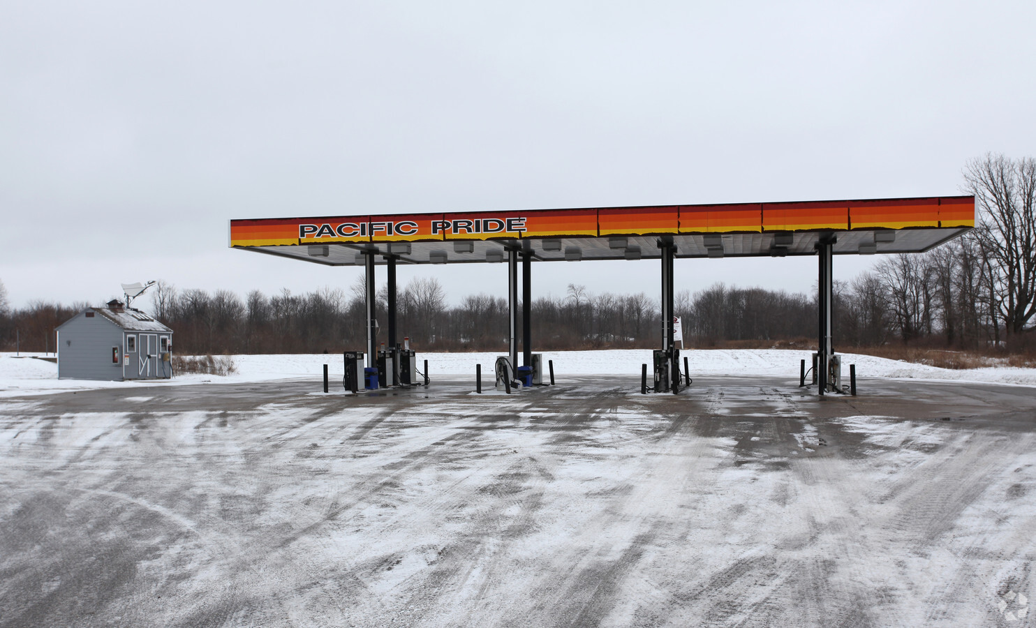
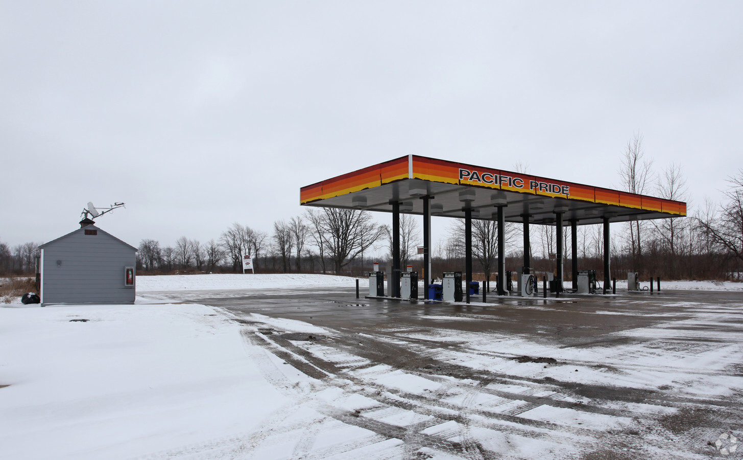
Property Record
2904 N Williamston Rd, Williamston, MI 48895
NEARBY LISTINGS FOR SALE OR LEASE
Property Detail
2904 N Williamston Rd
18-07-12-100-012
A PARCEL OF LAND IN THE NW 1/4 OF SEC 12 T3N R1E; THE BOUNDARY OF SAID PARCEL DESCRIBED AS: COM AT NW COR SEC 12 - S 02 DEG
Supermarket
Ingham
X
Michigan
26065C0192D
2.02 AC
2023
Williamston/Weberville
2024
West Michigan
005700
Lansing-East Lansing, MI
DEMOGRAPHICS near 2904 N Williamston Rd
1 Mile
3 Mile
5 Mile
2024 Total Population
892
6,889
10,317
2029 Population
884
6,796
10,161
Pop Growth 2024-2029
(0.90%)
(1.35%)
(1.51%)
Average Age
40
41
42
2024 Total Households
374
2,753
4,032
HH Growth 2024-2029
(1.07%)
(1.38%)
(1.54%)
Median Household Inc
$78,676
$97,401
$101,971
Avg Household Size
2.40
2.50
2.50
2024 Avg HH Vehicles
2.00
2.00
2.00
Median Home Value
$238,690
$261,454
$260,887
Median Year Built
1984
1986
1980
Nearby Places
- Restaurants
- Banks
- Shops
- Fitness
- Groceries
PUBLIC TRANSPORTATION
AIRPORT
Capital Region International
DRIVE
WALK
Distance
Capital Region International
30 min
21.5 mi
Freight Ports
Port of Toledo
DRIVE
WALK
Distance
Port of Toledo
128 min
108.0 mi
Nearby Properties
Address
Land Use
TOTAL SIZE
Lot Size
Zoning
Address
Land Use
TOTAL SIZE
Lot Size
Zoning
75,760 SF
105.10 AC
I-1
Address
Land Use
TOTAL SIZE
Lot Size
Zoning
75,760 SF
37.51 AC
I-1
Address
Land Use
TOTAL SIZE
Lot Size
Zoning
153,984 SF
12.03 AC
I-2
Address
Land Use
TOTAL SIZE
Lot Size
Zoning
63.34 AC
I-1
Address
Land Use
TOTAL SIZE
Lot Size
Zoning
48,846 SF
0.97 AC
C-1
Address
Land Use
TOTAL SIZE
Lot Size
Zoning
21,294 SF
4.02 AC
C-2
Address
Land Use
TOTAL SIZE
Lot Size
Zoning
37,347 SF
16.98 AC
C-2
Address
Land Use
TOTAL SIZE
Lot Size
Zoning
34,769 SF
2.02 AC
C-1
Address
Land Use
TOTAL SIZE
Lot Size
Zoning
13,016 SF
4.69 AC
R-3
Address
Land Use
TOTAL SIZE
Lot Size
Zoning
142.21 AC
A-1
Address
Land Use
TOTAL SIZE
Lot Size
Zoning
8,212 SF
5 AC
Address
Land Use
TOTAL SIZE
Lot Size
Zoning
13,680 SF
2.99 AC
R-3
Address
Land Use
TOTAL SIZE
Lot Size
Zoning
4,000 SF
7.22 AC
C-3
Address
Land Use
TOTAL SIZE
Lot Size
Zoning
10,140 SF
2.58 AC
I-2
Address
Land Use
TOTAL SIZE
Lot Size
Zoning
5,720 SF
0.76 AC
PO-1
Address
Land Use
TOTAL SIZE
Lot Size
Zoning
7,964 SF
7.84 AC
B-2
Address
Land Use
TOTAL SIZE
Lot Size
Zoning
9,260 SF
0.58 AC
R-3
Address
Land Use
TOTAL SIZE
Lot Size
Zoning
14,598 SF
1.78 AC
C-2
Address
Land Use
TOTAL SIZE
Lot Size
Zoning
2,100 SF
3.01 AC
I-1
Address
Land Use
TOTAL SIZE
Lot Size
Zoning
1,920 SF
30 AC
MH
Address
Land Use
TOTAL SIZE
Lot Size
Zoning
8,544 SF
4.78 AC
C-2
Address
Land Use
TOTAL SIZE
Lot Size
Zoning
3,252 SF
11.47 AC
MH
Address
Land Use
TOTAL SIZE
Lot Size
Zoning
6,068 SF
3.15 AC
PO-1
Address
Land Use
TOTAL SIZE
Lot Size
Zoning
177.11 AC
A-1 AGR
Address
Land Use
TOTAL SIZE
Lot Size
Zoning
226.80 AC
A-1
Address
Land Use
TOTAL SIZE
Lot Size
Zoning
10,418 SF
39.90 AC
R-1
Address
Land Use
TOTAL SIZE
Lot Size
Zoning
151.50 AC
AG-SF
Address
Land Use
TOTAL SIZE
Lot Size
Zoning
2,480 SF
2.06 AC
C-2
Address
Land Use
TOTAL SIZE
Lot Size
Zoning
157.05 AC
AG-C
Address
Land Use
TOTAL SIZE
Lot Size
Zoning
12,409 SF
1.13 AC
B-1
The World's #1 Commercial Real Estate Marketplace
Connect with us
© 2025 CoStar Group
The information above has been obtained from sources believed reliable. While we do not doubt its accuracy we have not verified it and make no guarantee, warranty or representation about it. It is your responsibility to independently confirm its accuracy and completeness. Any projections, opinions, assumptions, or estimates used are for example only and do not represent the current or future performance of the property. The value of this transaction to you depends on tax and other factors which should be evaluated by your tax, financial, and legal advisors. You and your advisors should conduct a careful, independent investigation of the property to determine to your satisfaction the suitability of the property for your needs.