Property Record
2904 S State Road 135, Greenwood, IN 46143
NEARBY LISTINGS FOR SALE OR LEASE
Property Detail
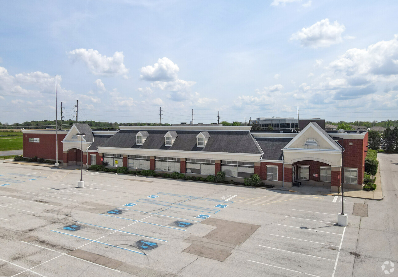
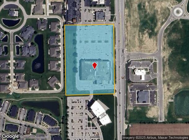
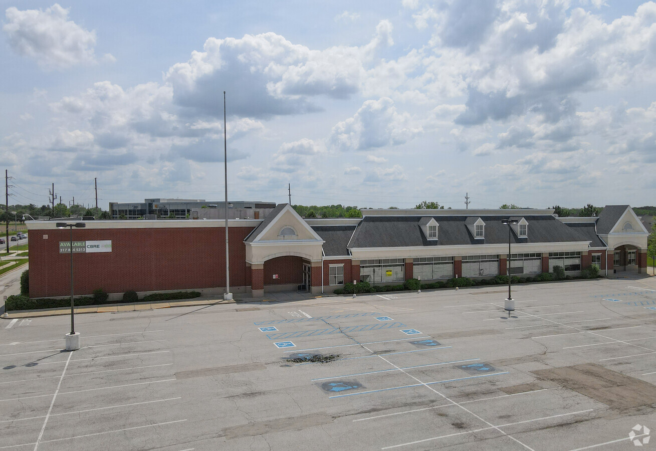
2904 S State Road 135
Indianapolis-Carmel-Anderson, IN
Stones Crossing Commercial Center
41-04-14-011-003.000-039
STONES CROSSING COMMERCIAL CENTER LOT 3
Supermarket
Johnson
X
Indiana
18109C0200E
3
2023
7.27 AC
2024
Far South Johnson Cty
610705
Indianapolis
55,632 SF
DEMOGRAPHICS near 2904 S State Road 135
1 Mile
3 Mile
5 Mile
2024 Total Population
5,091
47,145
123,319
2029 Population
5,413
50,139
130,615
Pop Growth 2024-2029
+ 6.32%
+ 6.35%
+ 5.92%
Average Age
40
38
39
2024 Total Households
1,793
16,668
46,730
HH Growth 2024-2029
+ 6.53%
+ 6.49%
+ 5.99%
Median Household Inc
$86,495
$93,637
$80,779
Avg Household Size
2.80
2.80
2.60
2024 Avg HH Vehicles
2.00
2.00
2.00
Median Home Value
$344,635
$283,827
$233,436
Median Year Built
2002
1998
1991
Nearby Places
- Restaurants
- Banks
- Shops
- Fitness
- Groceries
PUBLIC TRANSPORTATION
AIRPORT
Indianapolis International
DRIVE
WALK
Distance
Indianapolis International
39 min
23.4 mi
Freight Ports
Port of Toledo
DRIVE
WALK
Distance
Port of Toledo
291 min
241.2 mi
SALE & LEASE HISTORY
LISTING DATE
SALE/LEASE

Jan 24, 2018
For Lease
Nearby Properties
Address
Land Use
TOTAL SIZE
Lot Size
Zoning
Address
Land Use
TOTAL SIZE
Lot Size
Zoning
4,582 SF
30.22 AC
R4
Address
Land Use
TOTAL SIZE
Lot Size
Zoning
3,346 SF
21.35 AC
Address
Land Use
TOTAL SIZE
Lot Size
Zoning
19,104 SF
27.27 AC
R2
Address
Land Use
TOTAL SIZE
Lot Size
Zoning
39,866 SF
19.99 AC
Address
Land Use
TOTAL SIZE
Lot Size
Zoning
13,896 SF
20.98 AC
Address
Land Use
TOTAL SIZE
Lot Size
Zoning
33,790 SF
13.01 AC
Address
Land Use
TOTAL SIZE
Lot Size
Zoning
11,546 SF
14.18 AC
Address
Land Use
TOTAL SIZE
Lot Size
Zoning
6,272 SF
21.90 AC
Address
Land Use
TOTAL SIZE
Lot Size
Zoning
141,533 SF
16.65 AC
Address
Land Use
TOTAL SIZE
Lot Size
Zoning
82,619 SF
13.50 AC
Address
Land Use
TOTAL SIZE
Lot Size
Zoning
1,426 SF
11.73 AC
Address
Land Use
TOTAL SIZE
Lot Size
Zoning
2,008 SF
9.86 AC
Address
Land Use
TOTAL SIZE
Lot Size
Zoning
748 SF
6.83 AC
Address
Land Use
TOTAL SIZE
Lot Size
Zoning
193,178 SF
14.48 AC
Address
Land Use
TOTAL SIZE
Lot Size
Zoning
28,590 SF
7.16 AC
Address
Land Use
TOTAL SIZE
Lot Size
Zoning
69,215 SF
4.90 AC
B1
Address
Land Use
TOTAL SIZE
Lot Size
Zoning
3,877 SF
12.91 AC
Address
Land Use
TOTAL SIZE
Lot Size
Zoning
173,052 SF
17.35 AC
Address
Land Use
TOTAL SIZE
Lot Size
Zoning
152,664 SF
14.82 AC
Address
Land Use
TOTAL SIZE
Lot Size
Zoning
217,468 SF
28.06 AC
Address
Land Use
TOTAL SIZE
Lot Size
Zoning
15,024 SF
5.62 AC
Address
Land Use
TOTAL SIZE
Lot Size
Zoning
24,483 SF
5.48 AC
R4
Address
Land Use
TOTAL SIZE
Lot Size
Zoning
51,840 SF
4.31 AC
Address
Land Use
TOTAL SIZE
Lot Size
Zoning
98,409 SF
8.82 AC
Address
Land Use
TOTAL SIZE
Lot Size
Zoning
98,316 SF
10.58 AC
Address
Land Use
TOTAL SIZE
Lot Size
Zoning
Address
Land Use
TOTAL SIZE
Lot Size
Zoning
63,084 SF
9.14 AC
Address
Land Use
TOTAL SIZE
Lot Size
Zoning
74,067 SF
9.38 AC
R2
Address
Land Use
TOTAL SIZE
Lot Size
Zoning
47,171 SF
4.48 AC
Address
Land Use
TOTAL SIZE
Lot Size
Zoning
26,880 SF
4.70 AC
B1
The World's #1 Commercial Real Estate Marketplace
Connect with us
© 2025 CoStar Group
The information above has been obtained from sources believed reliable. While we do not doubt its accuracy we have not verified it and make no guarantee, warranty or representation about it. It is your responsibility to independently confirm its accuracy and completeness. Any projections, opinions, assumptions, or estimates used are for example only and do not represent the current or future performance of the property. The value of this transaction to you depends on tax and other factors which should be evaluated by your tax, financial, and legal advisors. You and your advisors should conduct a careful, independent investigation of the property to determine to your satisfaction the suitability of the property for your needs.