Property Record
2909 Old Knoxville Hwy, Maryville, TN 37804
NEARBY LISTINGS FOR SALE OR LEASE
Property Detail
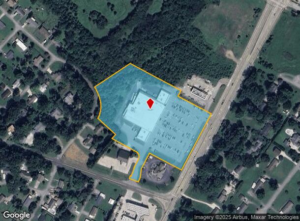
2909 Old Knoxville Hwy
Knoxville, TN
Clark Property
037B-A-022.00
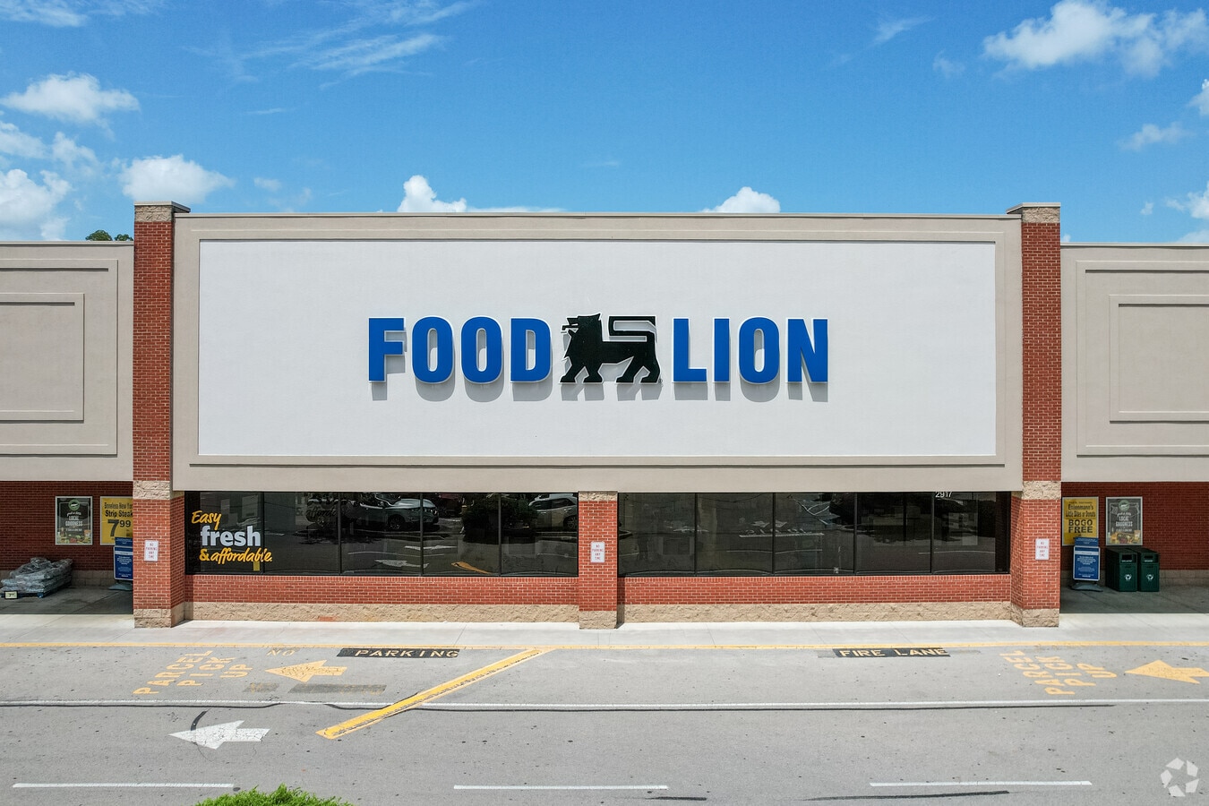
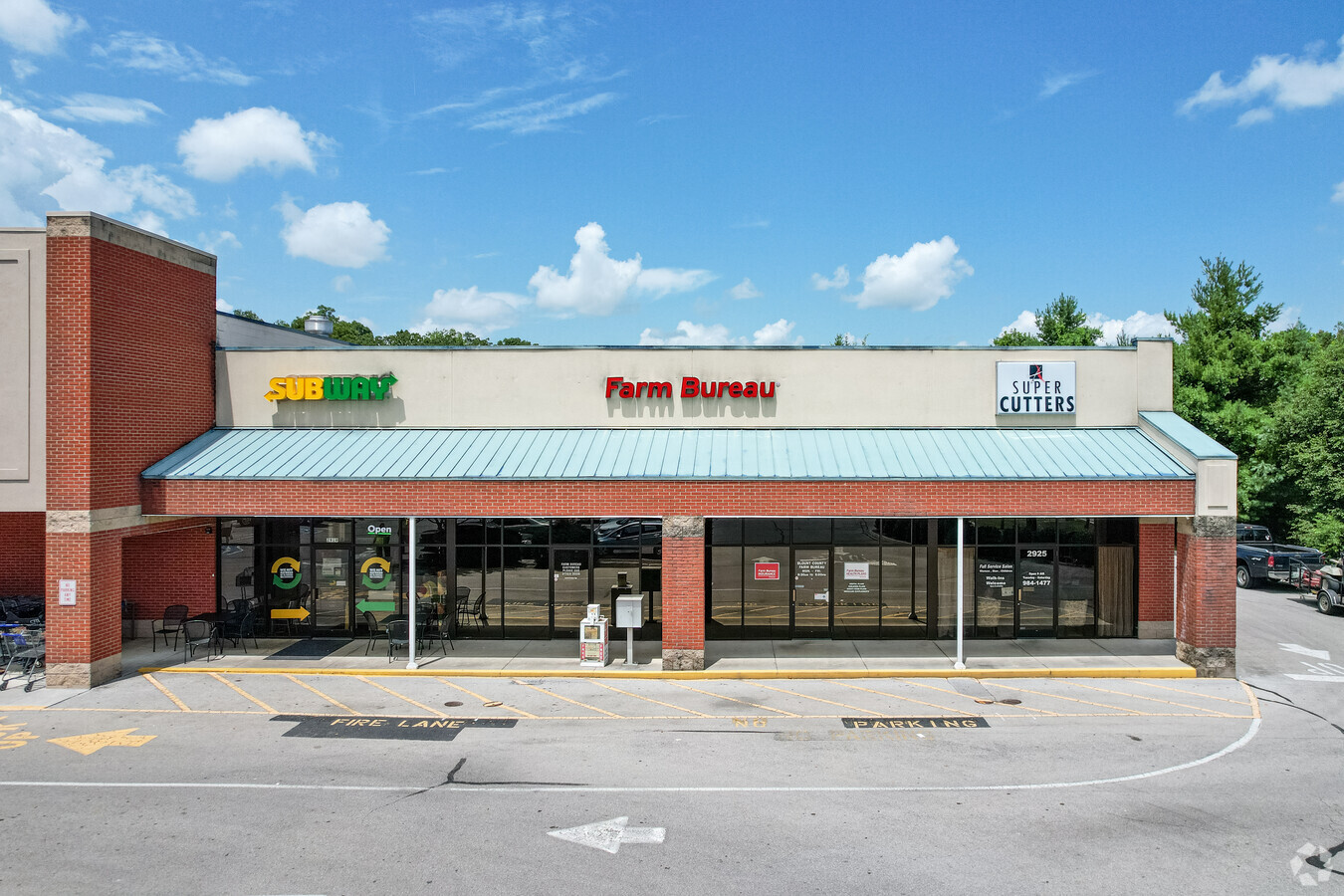
#1467 2174B FOOD LION/SUB- WAY/FARM BUREAU/SUPER CUTS
Commercialnec
Blount
X
Tennessee
47009C0137C
1r
0
7.05 AC
2024
Blount County
010400
Knoxville
49,167 SF
DEMOGRAPHICS near 2909 Old Knoxville Hwy
1 Mile
3 Mile
5 Mile
2024 Total Population
3,567
25,211
61,656
2029 Population
3,871
27,375
66,991
Pop Growth 2024-2029
+ 8.52%
+ 8.58%
+ 8.65%
Average Age
41
40
41
2024 Total Households
1,484
10,155
25,079
HH Growth 2024-2029
+ 8.49%
+ 8.63%
+ 8.70%
Median Household Inc
$49,874
$57,418
$58,538
Avg Household Size
2.40
2.40
2.30
2024 Avg HH Vehicles
2.00
2.00
2.00
Median Home Value
$154,121
$168,292
$220,619
Median Year Built
1964
1970
1979
Nearby Places
- Restaurants
- Banks
- Shops
- Fitness
- Groceries
PUBLIC TRANSPORTATION
AIRPORT
McGhee Tyson
DRIVE
WALK
Distance
McGhee Tyson
11 min
5.8 mi
Freight Ports
Georgia Ports - Savannah
DRIVE
WALK
Distance
Georgia Ports - Savannah
495 min
419.3 mi
SALE & LEASE HISTORY
LISTING DATE
SALE/LEASE

May 12, 2017
For Lease
Nearby Properties
Address
Land Use
TOTAL SIZE
Lot Size
Zoning
Address
Land Use
TOTAL SIZE
Lot Size
Zoning
2,612,320 SF
84.53 AC
Address
Land Use
TOTAL SIZE
Lot Size
Zoning
1,401.64 AC
AIR
Address
Land Use
TOTAL SIZE
Lot Size
Zoning
222.60 AC
G
Address
Land Use
TOTAL SIZE
Lot Size
Zoning
29,040 SF
8.91 AC
G
Address
Land Use
TOTAL SIZE
Lot Size
Zoning
46.37 AC
AIR
Address
Land Use
TOTAL SIZE
Lot Size
Zoning
144,298 SF
4.51 AC
G
Address
Land Use
TOTAL SIZE
Lot Size
Zoning
477.90 AC
I
Address
Land Use
TOTAL SIZE
Lot Size
Zoning
150,532 SF
5.41 AC
G
Address
Land Use
TOTAL SIZE
Lot Size
Zoning
64,033 SF
5.65 AC
O-3
Address
Land Use
TOTAL SIZE
Lot Size
Zoning
258,532 SF
20 AC
O3
Address
Land Use
TOTAL SIZE
Lot Size
Zoning
18,936 SF
19.66 AC
I
Address
Land Use
TOTAL SIZE
Lot Size
Zoning
45,913 SF
9.18 AC
RSF
Address
Land Use
TOTAL SIZE
Lot Size
Zoning
9,040 SF
27.85 AC
OS
Address
Land Use
TOTAL SIZE
Lot Size
Zoning
172.05 AC
G
Address
Land Use
TOTAL SIZE
Lot Size
Zoning
86.20 AC
F
Address
Land Use
TOTAL SIZE
Lot Size
Zoning
96,738 SF
23.34 AC
F
Address
Land Use
TOTAL SIZE
Lot Size
Zoning
175,681 SF
AIR
Address
Land Use
TOTAL SIZE
Lot Size
Zoning
68,180 SF
35.92 AC
AIR
Address
Land Use
TOTAL SIZE
Lot Size
Zoning
68,441 SF
0.17 AC
R
Address
Land Use
TOTAL SIZE
Lot Size
Zoning
53,524 SF
6.95 AC
C
Address
Land Use
TOTAL SIZE
Lot Size
Zoning
48,590 SF
16.67 AC
G
Address
Land Use
TOTAL SIZE
Lot Size
Zoning
215,478 SF
29.02 AC
F
Address
Land Use
TOTAL SIZE
Lot Size
Zoning
63,292 SF
2.03 AC
G
Address
Land Use
TOTAL SIZE
Lot Size
Zoning
33,375 SF
4.20 AC
BT
Address
Land Use
TOTAL SIZE
Lot Size
Zoning
4,510 SF
13.72 AC
B
Address
Land Use
TOTAL SIZE
Lot Size
Zoning
57,988 SF
7.18 AC
G
Address
Land Use
TOTAL SIZE
Lot Size
Zoning
48,216 SF
2.26 AC
Address
Land Use
TOTAL SIZE
Lot Size
Zoning
23,254 SF
2.37 AC
O3
Address
Land Use
TOTAL SIZE
Lot Size
Zoning
49,296 SF
1.80 AC
R
Address
Land Use
TOTAL SIZE
Lot Size
Zoning
55,689 SF
2.28 AC
E
The World's #1 Commercial Real Estate Marketplace
Connect with us
© 2025 CoStar Group
The information above has been obtained from sources believed reliable. While we do not doubt its accuracy we have not verified it and make no guarantee, warranty or representation about it. It is your responsibility to independently confirm its accuracy and completeness. Any projections, opinions, assumptions, or estimates used are for example only and do not represent the current or future performance of the property. The value of this transaction to you depends on tax and other factors which should be evaluated by your tax, financial, and legal advisors. You and your advisors should conduct a careful, independent investigation of the property to determine to your satisfaction the suitability of the property for your needs.