Property Record
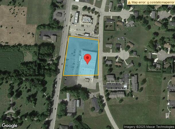
291 S Main St, Iola, WI 54945
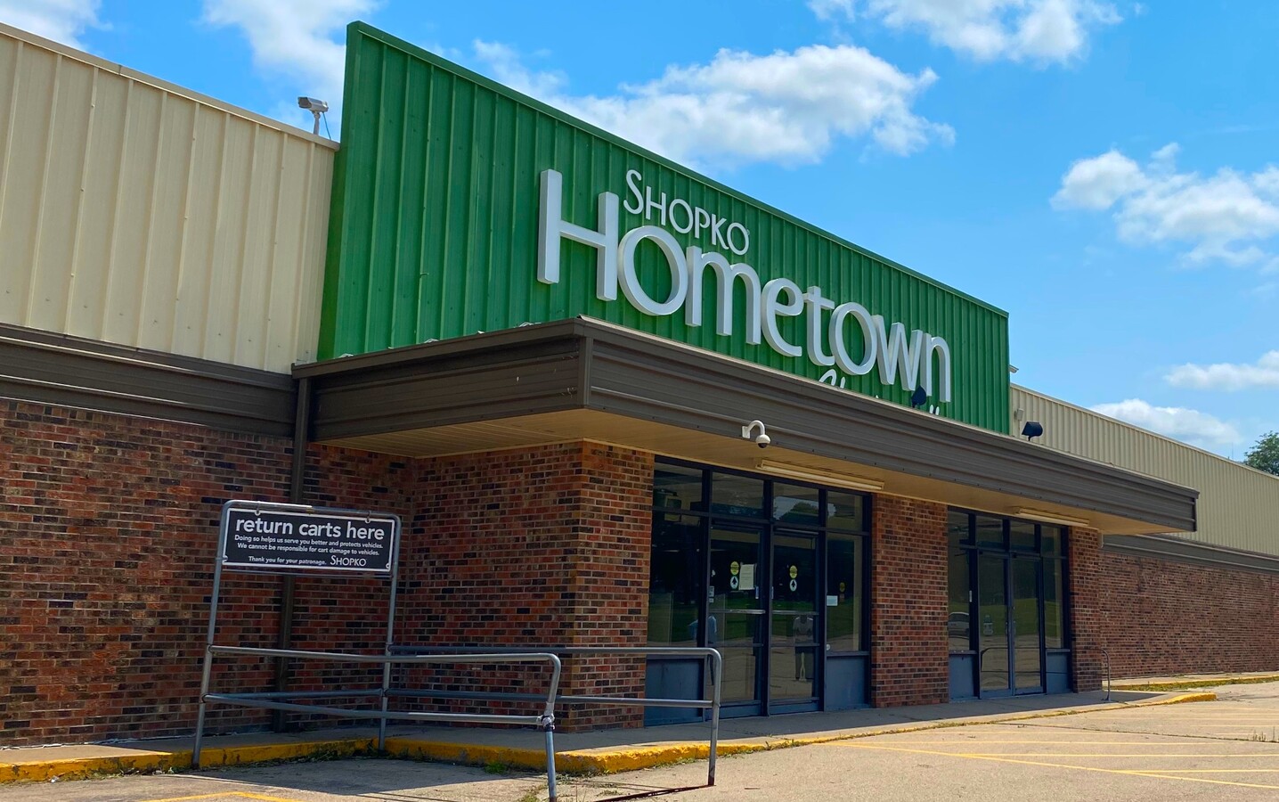
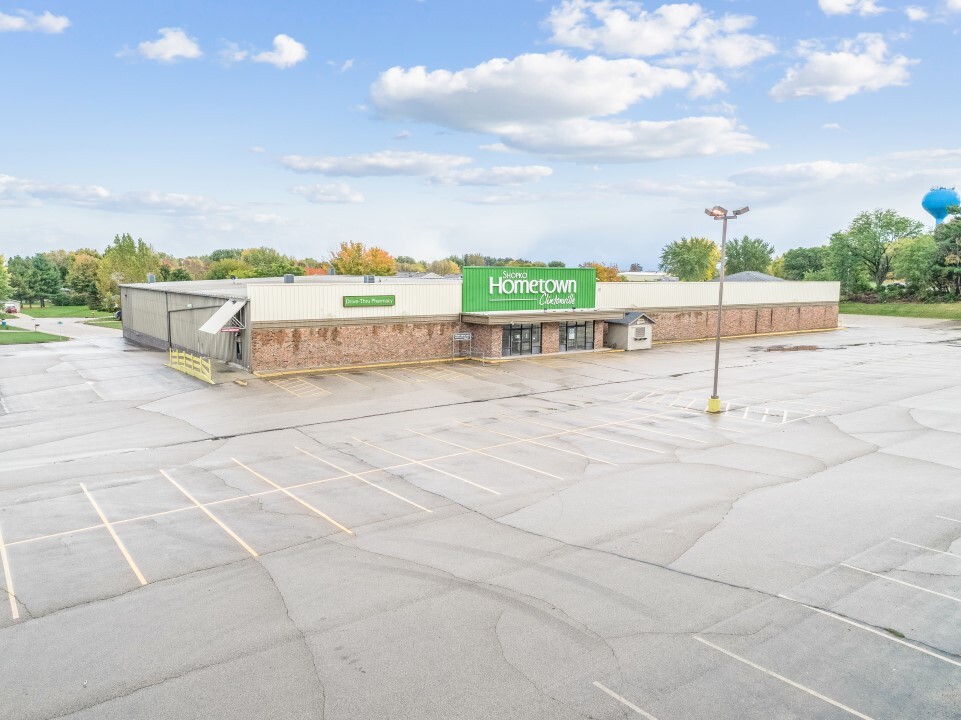
This Property Is For Sale
Current Lease Availabilities
NEARBY LISTINGS FOR SALE OR LEASE
Property Detail
291 S Main St
30-26-42-7
SEC26 T25N R14E PRT NWSE COM INT MAIN ST & CA MELLIA AVE S7DG W275FT-POB S83DG E291FT-WLY/L MORNINGLORY DR S349FT S88DG W340FT-MAIN ST N 7DG E399FT-POB EX N10FT DESC V916P195 V513P 443 V526P791 V552P708 EX V916P195 2.61A M/L
Commercialnec
Waupaca
X
Wisconsin
55135C0232D
1
2023
2.61 AC
2023
Wisconsin North Area
100300
Other Market Areas
37,500 SF
DEMOGRAPHICS near 291 S Main St
1 Mile
3 Mile
5 Mile
2024 Total Population
2,073
5,763
7,315
2029 Population
2,078
5,810
7,355
Pop Growth 2024-2029
+ 0.24%
+ 0.82%
+ 0.55%
Average Age
41
42
43
2024 Total Households
952
2,605
3,220
HH Growth 2024-2029
+ 0.32%
+ 0.84%
+ 0.59%
Median Household Inc
$48,450
$55,323
$58,172
Avg Household Size
2.10
2.20
2.20
2024 Avg HH Vehicles
2.00
2.00
2.00
Median Home Value
$104,420
$124,598
$142,865
Median Year Built
1976
1973
1973
Nearby Places
- Restaurants
- Banks
- Shops
- Fitness
- Groceries
PUBLIC TRANSPORTATION
AIRPORT
Appleton International
DRIVE
WALK
Distance
Appleton International
52 min
33.8 mi
Freight Ports
Port Milwaukee
DRIVE
WALK
Distance
Port Milwaukee
162 min
133.5 mi
Nearby Properties
Address
Land Use
TOTAL SIZE
Lot Size
Zoning
Address
Land Use
TOTAL SIZE
Lot Size
Zoning
19.95 AC
Address
Land Use
TOTAL SIZE
Lot Size
Zoning
Address
Land Use
TOTAL SIZE
Lot Size
Zoning
76,264 SF
6.27 AC
Address
Land Use
TOTAL SIZE
Lot Size
Zoning
30,128 SF
11.23 AC
Address
Land Use
TOTAL SIZE
Lot Size
Zoning
24,334 SF
22.62 AC
Address
Land Use
TOTAL SIZE
Lot Size
Zoning
7.53 AC
Address
Land Use
TOTAL SIZE
Lot Size
Zoning
14.02 AC
Address
Land Use
TOTAL SIZE
Lot Size
Zoning
40,661 SF
5.24 AC
Address
Land Use
TOTAL SIZE
Lot Size
Zoning
Address
Land Use
TOTAL SIZE
Lot Size
Zoning
42 AC
A-G
Address
Land Use
TOTAL SIZE
Lot Size
Zoning
5,799 SF
2.50 AC
Address
Land Use
TOTAL SIZE
Lot Size
Zoning
20,876 SF
4.40 AC
Address
Land Use
TOTAL SIZE
Lot Size
Zoning
16,580 SF
7.28 AC
Address
Land Use
TOTAL SIZE
Lot Size
Zoning
46,080 SF
3.39 AC
Address
Land Use
TOTAL SIZE
Lot Size
Zoning
29,670 SF
3.37 AC
Address
Land Use
TOTAL SIZE
Lot Size
Zoning
33.22 AC
Address
Land Use
TOTAL SIZE
Lot Size
Zoning
Address
Land Use
TOTAL SIZE
Lot Size
Zoning
13,650 SF
1.30 AC
Address
Land Use
TOTAL SIZE
Lot Size
Zoning
14,348 SF
0.52 AC
Address
Land Use
TOTAL SIZE
Lot Size
Zoning
50,610 SF
8.52 AC
Address
Land Use
TOTAL SIZE
Lot Size
Zoning
21,618 SF
4.06 AC
Address
Land Use
TOTAL SIZE
Lot Size
Zoning
8,601 SF
1.77 AC
Address
Land Use
TOTAL SIZE
Lot Size
Zoning
9,108 SF
97.07 AC
A-G
Address
Land Use
TOTAL SIZE
Lot Size
Zoning
0.17 AC
Address
Land Use
TOTAL SIZE
Lot Size
Zoning
6.72 AC
Address
Land Use
TOTAL SIZE
Lot Size
Zoning
37,267 SF
3 AC
Address
Land Use
TOTAL SIZE
Lot Size
Zoning
Address
Land Use
TOTAL SIZE
Lot Size
Zoning
17,120 SF
1.10 AC
Address
Land Use
TOTAL SIZE
Lot Size
Zoning
23,652 SF
1.26 AC
Address
Land Use
TOTAL SIZE
Lot Size
Zoning
5,116 SF
1.75 AC
The World's #1 Commercial Real Estate Marketplace
Connect with us
© 2025 CoStar Group
The information above has been obtained from sources believed reliable. While we do not doubt its accuracy we have not verified it and make no guarantee, warranty or representation about it. It is your responsibility to independently confirm its accuracy and completeness. Any projections, opinions, assumptions, or estimates used are for example only and do not represent the current or future performance of the property. The value of this transaction to you depends on tax and other factors which should be evaluated by your tax, financial, and legal advisors. You and your advisors should conduct a careful, independent investigation of the property to determine to your satisfaction the suitability of the property for your needs.