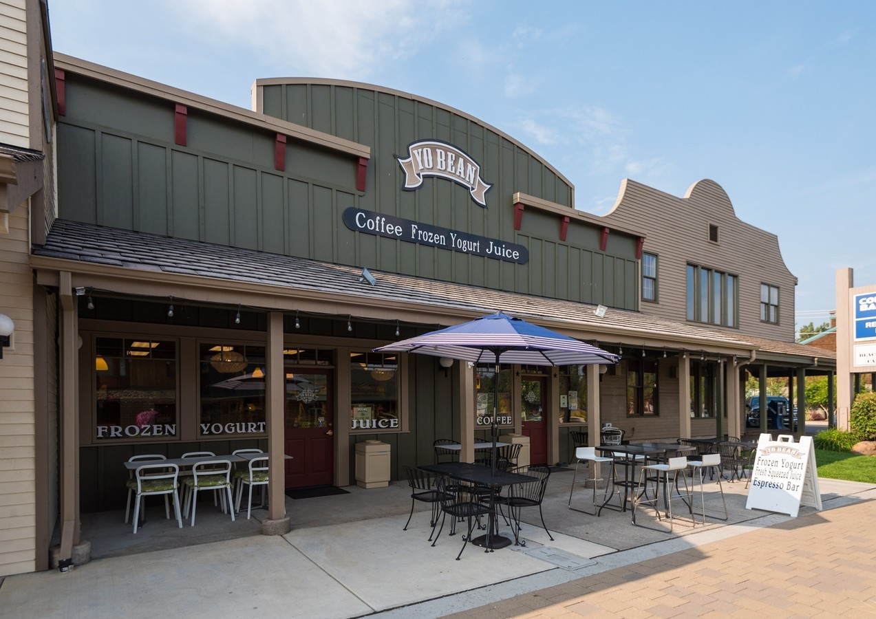
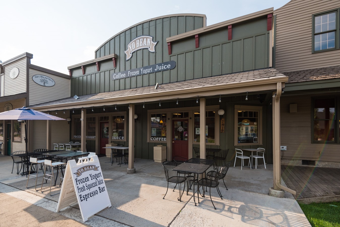
Property Record
291 W Cascade Ave, Sisters, OR 97759
NEARBY LISTINGS FOR SALE OR LEASE
Property Detail
291 W Cascade Ave
Bend-Redmond, OR
Davidson Addition To Sisters
134762
DAVIDSON ADDITION TO SISTERS BLOCK 7 LOT 5.&.6
Commercialnec
Deschutes
X
Oregon
41017C0245E
5
2024
0.21 AC
2024
Deschutes County
000501
Portland
7,821 SF
DEMOGRAPHICS near 291 W Cascade Ave
1 Mile
3 Mile
5 Mile
2024 Total Population
4,006
8,159
9,769
2029 Population
4,584
9,503
11,356
Pop Growth 2024-2029
+ 14.43%
+ 16.47%
+ 16.25%
Average Age
46
49
49
2024 Total Households
1,717
3,503
4,186
HH Growth 2024-2029
+ 14.44%
+ 16.61%
+ 16.41%
Median Household Inc
$78,977
$81,909
$84,248
Avg Household Size
2.30
2.30
2.30
2024 Avg HH Vehicles
2.00
2.00
2.00
Median Home Value
$665,421
$690,583
$703,577
Median Year Built
2003
2004
2003
Nearby Places
- Restaurants
- Banks
- Shops
- Fitness
- Groceries
PUBLIC TRANSPORTATION
AIRPORT
Roberts Field
DRIVE
WALK
Distance
Roberts Field
36 min
22.4 mi
Freight Ports
Port of Portland
DRIVE
WALK
Distance
Port of Portland
205 min
157.3 mi
SALE & LEASE HISTORY
LISTING DATE
SALE/LEASE

Sep 27, 2017
For Sale
Aug 23, 2017
For Sale
Nearby Properties
Address
Land Use
TOTAL SIZE
Lot Size
Zoning
Address
Land Use
TOTAL SIZE
Lot Size
Zoning
64,450 SF
5.27 AC
DC
Address
Land Use
TOTAL SIZE
Lot Size
Zoning
67,150 SF
5.82 AC
HC
Address
Land Use
TOTAL SIZE
Lot Size
Zoning
9,461.34 AC
F1
Address
Land Use
TOTAL SIZE
Lot Size
Zoning
9,461.34 AC
F1
Address
Land Use
TOTAL SIZE
Lot Size
Zoning
864 SF
11.57 AC
PF
Address
Land Use
TOTAL SIZE
Lot Size
Zoning
47,248 SF
7.67 AC
HC
Address
Land Use
TOTAL SIZE
Lot Size
Zoning
7.67 AC
HC
Address
Land Use
TOTAL SIZE
Lot Size
Zoning
1,800 SF
3.03 AC
MFR
Address
Land Use
TOTAL SIZE
Lot Size
Zoning
51,356 SF
5.01 AC
HC
Address
Land Use
TOTAL SIZE
Lot Size
Zoning
5,690.60 AC
F1
Address
Land Use
TOTAL SIZE
Lot Size
Zoning
5,690.60 AC
F1
Address
Land Use
TOTAL SIZE
Lot Size
Zoning
35,227 SF
4.98 AC
HC
Address
Land Use
TOTAL SIZE
Lot Size
Zoning
39,856 SF
2.09 AC
MFR
Address
Land Use
TOTAL SIZE
Lot Size
Zoning
28,696 SF
1.41 AC
MFR
Address
Land Use
TOTAL SIZE
Lot Size
Zoning
16,759 SF
1.40 AC
HC
Address
Land Use
TOTAL SIZE
Lot Size
Zoning
40,880 SF
2.51 AC
Address
Land Use
TOTAL SIZE
Lot Size
Zoning
23,760 SF
1.13 AC
HC
Address
Land Use
TOTAL SIZE
Lot Size
Zoning
9,056 SF
1.34 AC
HC
Address
Land Use
TOTAL SIZE
Lot Size
Zoning
55,514 SF
2.19 AC
LI
Address
Land Use
TOTAL SIZE
Lot Size
Zoning
2.19 AC
LI
Address
Land Use
TOTAL SIZE
Lot Size
Zoning
5,961 SF
0.78 AC
MFR
Address
Land Use
TOTAL SIZE
Lot Size
Zoning
32,460 SF
2.73 AC
LI
Address
Land Use
TOTAL SIZE
Lot Size
Zoning
150.32 AC
F1
Address
Land Use
TOTAL SIZE
Lot Size
Zoning
150.32 AC
F1
Address
Land Use
TOTAL SIZE
Lot Size
Zoning
8,962 SF
0.82 AC
PF
Address
Land Use
TOTAL SIZE
Lot Size
Zoning
1,200 SF
11.80 AC
A
Address
Land Use
TOTAL SIZE
Lot Size
Zoning
29,667 SF
11.80 AC
A
Address
Land Use
TOTAL SIZE
Lot Size
Zoning
3,280 SF
0.98 AC
MFR
Address
Land Use
TOTAL SIZE
Lot Size
Zoning
300 SF
2.04 AC
Address
Land Use
TOTAL SIZE
Lot Size
Zoning
10,010 SF
34.01 AC
F2
The World's #1 Commercial Real Estate Marketplace
Connect with us
© 2025 CoStar Group
The information above has been obtained from sources believed reliable. While we do not doubt its accuracy we have not verified it and make no guarantee, warranty or representation about it. It is your responsibility to independently confirm its accuracy and completeness. Any projections, opinions, assumptions, or estimates used are for example only and do not represent the current or future performance of the property. The value of this transaction to you depends on tax and other factors which should be evaluated by your tax, financial, and legal advisors. You and your advisors should conduct a careful, independent investigation of the property to determine to your satisfaction the suitability of the property for your needs.