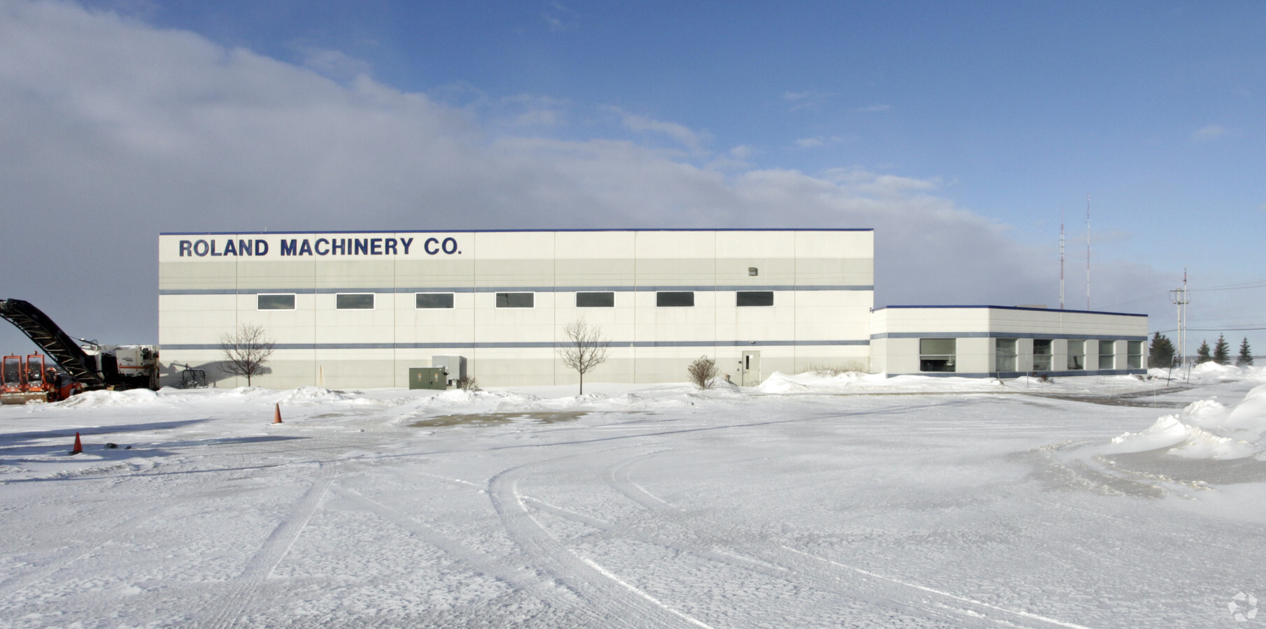
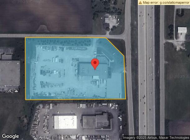
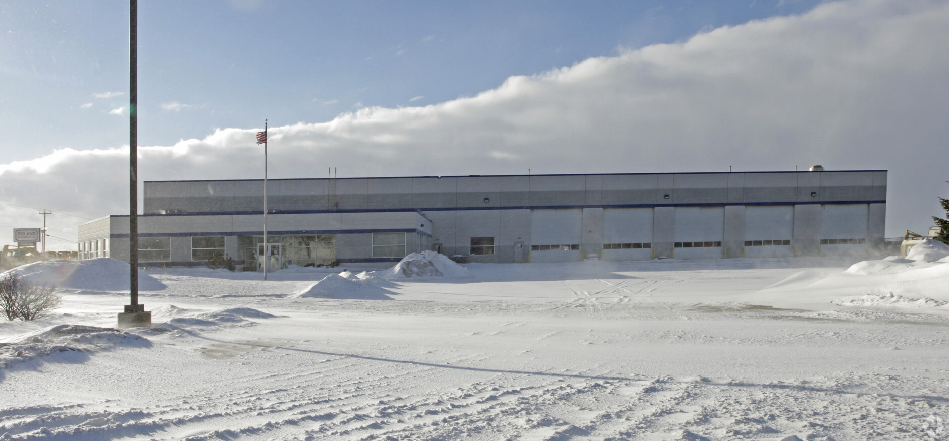
Property Record
2916 N Sylvania Ave, Franksville, WI 53126
NEARBY LISTINGS FOR SALE OR LEASE
-
-
-
Park 94 at Mount Pleasant, Building Four
Mount Pleasant, WI 53177
Rent Upon Request
226,200 SF
Industrial
-
-
-
-
-
View all Franksville listings for sale on LoopNet.com
Property Detail
2916 N Sylvania Ave
Racine, WI
Ne4&Nw4ne4 S01t03nr21e
194-032101001000
PT NE 1/4 BEG N1/4 COR S 1379 E2379 N134 N1020 NW 276 W2179 TO POB EXC #1976308 #2298133 PT TO 018032101001010 IN 04 FOR 05
Commercialnec
Racine
X
Wisconsin
55101C0089D
11.72 AC
2024
Racine East
2024
Milwaukee/Madison
001802
DEMOGRAPHICS near 2916 N Sylvania Ave
1 Mile
3 Mile
5 Mile
2024 Total Population
145
3,816
18,524
2029 Population
140
3,743
18,329
Pop Growth 2024-2029
(3.45%)
(1.91%)
(1.05%)
Average Age
44
43
43
2024 Total Households
55
1,464
6,912
HH Growth 2024-2029
(1.82%)
(2.05%)
(0.77%)
Median Household Inc
$112,500
$108,680
$95,457
Avg Household Size
2.60
2.60
2.40
2024 Avg HH Vehicles
3.00
3.00
2.00
Median Home Value
$366,666
$332,506
$310,182
Median Year Built
1965
1970
1985
Nearby Places
- Restaurants
- Banks
- Shops
- Fitness
- Groceries
PUBLIC TRANSPORTATION
COMMUTER RAIL
Sturtevant Amtrak Station (Hiawatha Service - Amtrak)
DRIVE
WALK
Distance
Sturtevant Amtrak Station (Hiawatha Service - Amtrak)
11 min
4.9 mi
AIRPORT
General Mitchell International
DRIVE
WALK
Distance
General Mitchell International
23 min
15.4 mi
Freight Ports
Port Milwaukee
DRIVE
WALK
Distance
Port Milwaukee
27 min
19.3 mi
Nearby Properties
Address
Land Use
TOTAL SIZE
Lot Size
Zoning
Address
Land Use
TOTAL SIZE
Lot Size
Zoning
23.10 AC
Address
Land Use
TOTAL SIZE
Lot Size
Zoning
32.09 AC
Address
Land Use
TOTAL SIZE
Lot Size
Zoning
23.32 AC
Address
Land Use
TOTAL SIZE
Lot Size
Zoning
Address
Land Use
TOTAL SIZE
Lot Size
Zoning
10.72 AC
Address
Land Use
TOTAL SIZE
Lot Size
Zoning
Address
Land Use
TOTAL SIZE
Lot Size
Zoning
Address
Land Use
TOTAL SIZE
Lot Size
Zoning
Address
Land Use
TOTAL SIZE
Lot Size
Zoning
Address
Land Use
TOTAL SIZE
Lot Size
Zoning
Address
Land Use
TOTAL SIZE
Lot Size
Zoning
15.37 AC
Address
Land Use
TOTAL SIZE
Lot Size
Zoning
Address
Land Use
TOTAL SIZE
Lot Size
Zoning
Address
Land Use
TOTAL SIZE
Lot Size
Zoning
Address
Land Use
TOTAL SIZE
Lot Size
Zoning
11.74 AC
Address
Land Use
TOTAL SIZE
Lot Size
Zoning
13.10 AC
Address
Land Use
TOTAL SIZE
Lot Size
Zoning
10.21 AC
Address
Land Use
TOTAL SIZE
Lot Size
Zoning
12.92 AC
Address
Land Use
TOTAL SIZE
Lot Size
Zoning
Address
Land Use
TOTAL SIZE
Lot Size
Zoning
Address
Land Use
TOTAL SIZE
Lot Size
Zoning
Address
Land Use
TOTAL SIZE
Lot Size
Zoning
Address
Land Use
TOTAL SIZE
Lot Size
Zoning
Address
Land Use
TOTAL SIZE
Lot Size
Zoning
5.32 AC
Address
Land Use
TOTAL SIZE
Lot Size
Zoning
14.34 AC
Address
Land Use
TOTAL SIZE
Lot Size
Zoning
39.67 AC
Address
Land Use
TOTAL SIZE
Lot Size
Zoning
Address
Land Use
TOTAL SIZE
Lot Size
Zoning
Address
Land Use
TOTAL SIZE
Lot Size
Zoning
10.11 AC
Address
Land Use
TOTAL SIZE
Lot Size
Zoning
The World's #1 Commercial Real Estate Marketplace
Connect with us
© 2025 CoStar Group
The information above has been obtained from sources believed reliable. While we do not doubt its accuracy we have not verified it and make no guarantee, warranty or representation about it. It is your responsibility to independently confirm its accuracy and completeness. Any projections, opinions, assumptions, or estimates used are for example only and do not represent the current or future performance of the property. The value of this transaction to you depends on tax and other factors which should be evaluated by your tax, financial, and legal advisors. You and your advisors should conduct a careful, independent investigation of the property to determine to your satisfaction the suitability of the property for your needs.