Property Record
2917 S Mcintire Dr, Bloomington, IN 47403


NEARBY LISTINGS FOR SALE OR LEASE
Property Detail
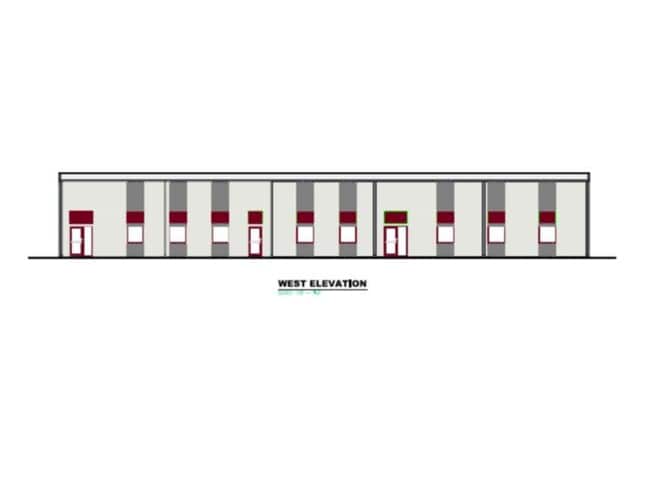
2917 S Mcintire Dr
Bloomington, IN
Southern Indiana Medical Park
53-08-18-201-005.000-009
015-25540-20 SOUTHERN INDIANA MEDICAL PARK PHASE 3-AMENDMENT 1 PART LOT 6
Storageyardopenstoragelightequipmentmaterial
Monroe
X
Indiana
18105C0139D
6
2024
3.32 AC
2024
Bloomington/Terre Haute
001102
Other Market Areas
10,000 SF
DEMOGRAPHICS near 2917 S Mcintire Dr
1 Mile
3 Mile
5 Mile
2024 Total Population
4,834
45,874
98,309
2029 Population
4,770
45,711
97,956
Pop Growth 2024-2029
(1.32%)
(0.36%)
(0.36%)
Average Age
37
37
35
2024 Total Households
2,232
21,527
41,336
HH Growth 2024-2029
(1.43%)
(0.40%)
(0.39%)
Median Household Inc
$59,400
$49,857
$44,404
Avg Household Size
2.10
2.00
2.10
2024 Avg HH Vehicles
2.00
2.00
2.00
Median Home Value
$164,968
$189,406
$235,067
Median Year Built
1989
1987
1986
Nearby Places
Map Layers
Map Styles
 Street
 Aerial
- Restaurants
- Banks
- Shops
- Fitness
- Groceries
SALE & LEASE HISTORY
LISTING DATE
SALE/LEASE

Jan 14, 2020
For Lease
Feb 07, 2024
For Sale
Nearby Properties
Address
Land Use
TOTAL SIZE
Lot Size
Zoning
Address
Land Use
TOTAL SIZE
Lot Size
Zoning
442,250 SF
37.15 AC
Address
Land Use
TOTAL SIZE
Lot Size
Zoning
35,777 SF
11.68 AC
Address
Land Use
TOTAL SIZE
Lot Size
Zoning
19,128 SF
24.44 AC
Address
Land Use
TOTAL SIZE
Lot Size
Zoning
60,434 SF
29.85 AC
IG
Address
Land Use
TOTAL SIZE
Lot Size
Zoning
169,170 SF
0.72 AC
Address
Land Use
TOTAL SIZE
Lot Size
Zoning
8,190 SF
4.22 AC
Address
Land Use
TOTAL SIZE
Lot Size
Zoning
64,687 SF
9.96 AC
Address
Land Use
TOTAL SIZE
Lot Size
Zoning
134,566 SF
0.60 AC
Address
Land Use
TOTAL SIZE
Lot Size
Zoning
7,500 SF
0.40 AC
Address
Land Use
TOTAL SIZE
Lot Size
Zoning
32,737 SF
0.93 AC
Address
Land Use
TOTAL SIZE
Lot Size
Zoning
18,772 SF
2.69 AC
Address
Land Use
TOTAL SIZE
Lot Size
Zoning
17,312 SF
31.90 AC
Address
Land Use
TOTAL SIZE
Lot Size
Zoning
14,376 SF
11.03 AC
Address
Land Use
TOTAL SIZE
Lot Size
Zoning
576 SF
13 AC
Address
Land Use
TOTAL SIZE
Lot Size
Zoning
1,986 SF
3.28 AC
Address
Land Use
TOTAL SIZE
Lot Size
Zoning
1,120 SF
11.95 AC
Address
Land Use
TOTAL SIZE
Lot Size
Zoning
87,842 SF
11.14 AC
GB
Address
Land Use
TOTAL SIZE
Lot Size
Zoning
64,798 SF
18.32 AC
RE1
Address
Land Use
TOTAL SIZE
Lot Size
Zoning
19,623 SF
8.21 AC
Address
Land Use
TOTAL SIZE
Lot Size
Zoning
119,952 SF
0.82 AC
Address
Land Use
TOTAL SIZE
Lot Size
Zoning
6,120 SF
36.03 AC
Address
Land Use
TOTAL SIZE
Lot Size
Zoning
17,950 SF
12.06 AC
Address
Land Use
TOTAL SIZE
Lot Size
Zoning
218,783 SF
24.97 AC
GB
Address
Land Use
TOTAL SIZE
Lot Size
Zoning
11,488 SF
14.33 AC
Address
Land Use
TOTAL SIZE
Lot Size
Zoning
107,519 SF
0.03 AC
Address
Land Use
TOTAL SIZE
Lot Size
Zoning
64,139 SF
2.82 AC
Address
Land Use
TOTAL SIZE
Lot Size
Zoning
40,960 SF
11.76 AC
PUD
Address
Land Use
TOTAL SIZE
Lot Size
Zoning
2,715 SF
22.92 AC
Address
Land Use
TOTAL SIZE
Lot Size
Zoning
17,550 SF
9.05 AC
Address
Land Use
TOTAL SIZE
Lot Size
Zoning
19,800 SF
12.08 AC
The World's #1 Commercial Real Estate Marketplace
Connect with us
© 2026 CoStar Group
The information above has been obtained from sources believed reliable. While we do not doubt its accuracy we have not verified it and make no guarantee, warranty or representation about it. It is your responsibility to independently confirm its accuracy and completeness. Any projections, opinions, assumptions, or estimates used are for example only and do not represent the current or future performance of the property. The value of this transaction to you depends on tax and other factors which should be evaluated by your tax, financial, and legal advisors. You and your advisors should conduct a careful, independent investigation of the property to determine to your satisfaction the suitability of the property for your needs.