Property Record
2918 Bragg Blvd, Fayetteville, NC 28303


NEARBY LISTINGS FOR SALE OR LEASE
Property Detail
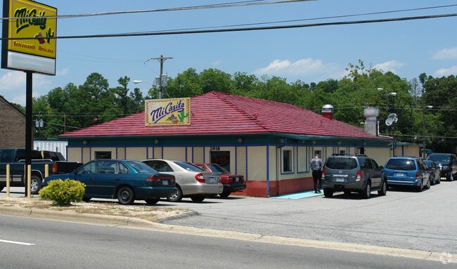
2918 Bragg Blvd
Fayetteville, NC
Bragg Blvd/Stamper To King S C
0428-12-4088
MRS R B EVANS LO:9-12 BL:A PL:0010-0028
Restaurantbuilding
Cumberland
X
North Carolina
3720042800J
9
2025
0.34 AC
2025
North Fayetteville
000900
Fayetteville
3,672 SF
DEMOGRAPHICS near 2918 Bragg Blvd
1 Mile
3 Mile
5 Mile
2024 Total Population
6,589
60,342
143,059
2029 Population
6,584
60,682
143,438
Pop Growth 2024-2029
(0.08%)
+ 0.56%
+ 0.26%
Average Age
40
38
37
2024 Total Households
2,889
26,600
59,836
HH Growth 2024-2029
+ 0.07%
+ 0.58%
+ 0.28%
Median Household Inc
$49,215
$45,963
$46,402
Avg Household Size
2.20
2.10
2.20
2024 Avg HH Vehicles
1.00
1.00
2.00
Median Home Value
$190,239
$161,225
$145,310
Median Year Built
1969
1975
1978
Nearby Places
Map Layers
Map Styles
 Street
 Aerial
- Restaurants
- Banks
- Shops
- Fitness
- Groceries
PUBLIC TRANSPORTATION
COMMUTER RAIL
DRIVE
WALK
Distance
7 min
3.3 mi
AIRPORT
Fayetteville Regional/Grannis Field
DRIVE
WALK
Distance
Fayetteville Regional/Grannis Field
14 min
8.5 mi
SALE & LEASE HISTORY
LISTING DATE
SALE/LEASE

Nov 29, 2022
For Lease
Nearby Properties
Address
Land Use
TOTAL SIZE
Lot Size
Zoning
Address
Land Use
TOTAL SIZE
Lot Size
Zoning
182,282 SF
38.72 AC
OI
Address
Land Use
TOTAL SIZE
Lot Size
Zoning
2,193 SF
133.52 AC
MR5
Address
Land Use
TOTAL SIZE
Lot Size
Zoning
46,110 SF
25.72 AC
OI
Address
Land Use
TOTAL SIZE
Lot Size
Zoning
3,641 SF
20.54 AC
MR5
Address
Land Use
TOTAL SIZE
Lot Size
Zoning
2,744 SF
21.34 AC
MR5
Address
Land Use
TOTAL SIZE
Lot Size
Zoning
3,320 SF
16 AC
MR5
Address
Land Use
TOTAL SIZE
Lot Size
Zoning
5,755 SF
23.12 AC
CC-COMMUNI
Address
Land Use
TOTAL SIZE
Lot Size
Zoning
2,025 SF
27.17 AC
SF6
Address
Land Use
TOTAL SIZE
Lot Size
Zoning
1,113 SF
24.36 AC
MR5-MIXED
Address
Land Use
TOTAL SIZE
Lot Size
Zoning
19.46 AC
MR5
Address
Land Use
TOTAL SIZE
Lot Size
Zoning
11,894 SF
8.39 AC
DTCZ
Address
Land Use
TOTAL SIZE
Lot Size
Zoning
2,842 SF
23.27 AC
MR5
Address
Land Use
TOTAL SIZE
Lot Size
Zoning
13.94 AC
CCCZ
Address
Land Use
TOTAL SIZE
Lot Size
Zoning
54,316 SF
28.64 AC
CC
Address
Land Use
TOTAL SIZE
Lot Size
Zoning
3,999 SF
44.59 AC
MR5
Address
Land Use
TOTAL SIZE
Lot Size
Zoning
1,556 SF
15.80 AC
MR5
Address
Land Use
TOTAL SIZE
Lot Size
Zoning
58,704 SF
23.38 AC
CC
Address
Land Use
TOTAL SIZE
Lot Size
Zoning
181,147 SF
24.02 AC
CCCZ
Address
Land Use
TOTAL SIZE
Lot Size
Zoning
1,352 SF
43.38 AC
MR5
Address
Land Use
TOTAL SIZE
Lot Size
Zoning
4,522 SF
12.59 AC
MR5
Address
Land Use
TOTAL SIZE
Lot Size
Zoning
135,996 SF
14.28 AC
CCCZ
Address
Land Use
TOTAL SIZE
Lot Size
Zoning
38,656 SF
6.53 AC
CC
Address
Land Use
TOTAL SIZE
Lot Size
Zoning
7,434 SF
5.87 AC
R5CZ
Address
Land Use
TOTAL SIZE
Lot Size
Zoning
1,064 SF
9.88 AC
R5C
Address
Land Use
TOTAL SIZE
Lot Size
Zoning
1,682 SF
30.53 AC
CC-COMMUNI
Address
Land Use
TOTAL SIZE
Lot Size
Zoning
1 AC
DTCZ
Address
Land Use
TOTAL SIZE
Lot Size
Zoning
5,112 SF
28.44 AC
CC-COMMUNI
Address
Land Use
TOTAL SIZE
Lot Size
Zoning
2,797 SF
54.38 AC
(UC) UNIVE
Address
Land Use
TOTAL SIZE
Lot Size
Zoning
1 AC
DTCZ-DOWNT
Address
Land Use
TOTAL SIZE
Lot Size
Zoning
1,039 SF
13.65 AC
MR5
The World's #1 Commercial Real Estate Marketplace
Connect with us
© 2026 CoStar Group
The information above has been obtained from sources believed reliable. While we do not doubt its accuracy we have not verified it and make no guarantee, warranty or representation about it. It is your responsibility to independently confirm its accuracy and completeness. Any projections, opinions, assumptions, or estimates used are for example only and do not represent the current or future performance of the property. The value of this transaction to you depends on tax and other factors which should be evaluated by your tax, financial, and legal advisors. You and your advisors should conduct a careful, independent investigation of the property to determine to your satisfaction the suitability of the property for your needs.