Property Record
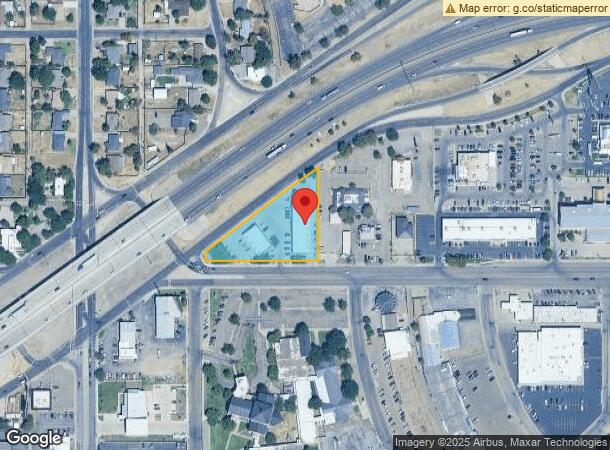
2921 W Interstate 40, Amarillo, TX 79109

NEARBY LISTINGS FOR SALE OR LEASE
Property Detail
2921 W Interstate 40
R-001-0780-3800-0
Anderson Sub # 6
Communitycenter
ANDERSON SUB # 6, LOT 001, BLK 0006
X
Potter
48375C0530C
Texas
2023
1
2024
1.30 AC
010300
Other Market Areas
4,549 SF
Amarillo, TX
DEMOGRAPHICS near 2921 W Interstate 40
1 Mile
3 Mile
5 Mile
2024 Total Population
11,093
88,762
169,721
2029 Population
10,921
91,652
176,162
Pop Growth 2024-2029
(1.55%)
+ 3.26%
+ 3.80%
Average Age
36
38
38
2024 Total Households
4,872
37,532
68,080
HH Growth 2024-2029
(1.72%)
+ 3.24%
+ 3.93%
Median Household Inc
$45,824
$48,195
$54,885
Avg Household Size
2.20
2.30
2.40
2024 Avg HH Vehicles
2.00
2.00
2.00
Median Home Value
$152,477
$143,212
$156,715
Median Year Built
1959
1965
1971
Nearby Places
- Restaurants
- Banks
- Shops
- Fitness
- Groceries
PUBLIC TRANSPORTATION
AIRPORT
Amarillo International
DRIVE
WALK
Distance
Amarillo International
13 min
11.0 mi
Freight Ports
Port of Shreveport
DRIVE
WALK
Distance
Port of Shreveport
1 min
512.4 mi
Nearby Properties
Address
Land Use
TOTAL SIZE
Lot Size
Zoning
Address
Land Use
TOTAL SIZE
Lot Size
Zoning
5,948 SF
30.60 AC
Address
Land Use
TOTAL SIZE
Lot Size
Zoning
329,835 SF
16.26 AC
Address
Land Use
TOTAL SIZE
Lot Size
Zoning
47,021 SF
14.82 AC
Address
Land Use
TOTAL SIZE
Lot Size
Zoning
8,733 SF
9.76 AC
PD
Address
Land Use
TOTAL SIZE
Lot Size
Zoning
71,435 SF
2.07 AC
Address
Land Use
TOTAL SIZE
Lot Size
Zoning
56,751 SF
34.57 AC
PD
Address
Land Use
TOTAL SIZE
Lot Size
Zoning
5,068 SF
39.36 AC
Address
Land Use
TOTAL SIZE
Lot Size
Zoning
250,705 SF
2.07 AC
CB
Address
Land Use
TOTAL SIZE
Lot Size
Zoning
37,290 SF
2.15 AC
Address
Land Use
TOTAL SIZE
Lot Size
Zoning
326,387 SF
10.71 AC
Address
Land Use
TOTAL SIZE
Lot Size
Zoning
2,419 SF
8.93 AC
PD
Address
Land Use
TOTAL SIZE
Lot Size
Zoning
207,120 SF
16.54 AC
GR
Address
Land Use
TOTAL SIZE
Lot Size
Zoning
38,325 SF
23.69 AC
PD
Address
Land Use
TOTAL SIZE
Lot Size
Zoning
10,864 SF
2.62 AC
LC
Address
Land Use
TOTAL SIZE
Lot Size
Zoning
77,308 SF
2.07 AC
CB
Address
Land Use
TOTAL SIZE
Lot Size
Zoning
91,830 SF
2.07 AC
CB
Address
Land Use
TOTAL SIZE
Lot Size
Zoning
107,723 SF
7.04 AC
Address
Land Use
TOTAL SIZE
Lot Size
Zoning
23,907 SF
10.85 AC
Address
Land Use
TOTAL SIZE
Lot Size
Zoning
75,150 SF
0.62 AC
CB
Address
Land Use
TOTAL SIZE
Lot Size
Zoning
143,608 SF
20.53 AC
Address
Land Use
TOTAL SIZE
Lot Size
Zoning
168,130 SF
16.32 AC
Address
Land Use
TOTAL SIZE
Lot Size
Zoning
10,162 SF
4.34 AC
LC
Address
Land Use
TOTAL SIZE
Lot Size
Zoning
110,796 SF
0.55 AC
MF2
Address
Land Use
TOTAL SIZE
Lot Size
Zoning
16,541 SF
3.88 AC
R2
Address
Land Use
TOTAL SIZE
Lot Size
Zoning
95,992 SF
14.98 AC
PD
Address
Land Use
TOTAL SIZE
Lot Size
Zoning
4,062 SF
2.07 AC
CB
Address
Land Use
TOTAL SIZE
Lot Size
Zoning
151,200 SF
2.07 AC
CB
Address
Land Use
TOTAL SIZE
Lot Size
Zoning
116,842 SF
4.17 AC
Address
Land Use
TOTAL SIZE
Lot Size
Zoning
71,680 SF
32.06 AC
PD
The World's #1 Commercial Real Estate Marketplace
Connect with us
© 2025 CoStar Group
The information above has been obtained from sources believed reliable. While we do not doubt its accuracy we have not verified it and make no guarantee, warranty or representation about it. It is your responsibility to independently confirm its accuracy and completeness. Any projections, opinions, assumptions, or estimates used are for example only and do not represent the current or future performance of the property. The value of this transaction to you depends on tax and other factors which should be evaluated by your tax, financial, and legal advisors. You and your advisors should conduct a careful, independent investigation of the property to determine to your satisfaction the suitability of the property for your needs.