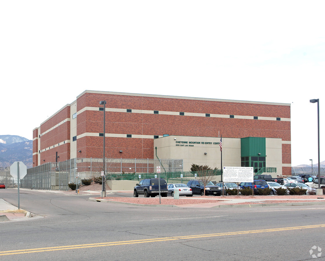
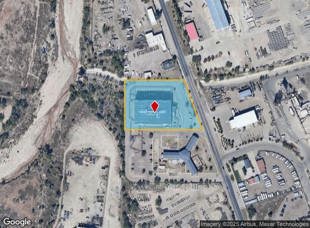
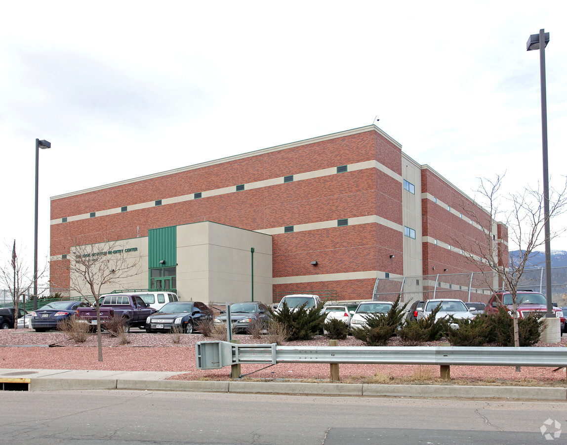
Property Record
2925 E Las Vegas St, Colorado Springs, CO 80906
NEARBY LISTINGS FOR SALE OR LEASE
-
-
View all Colorado Springs listings for sale on LoopNet.com
Property Detail
2925 E Las Vegas St
Colorado Springs, CO
Rickemoh Sub Fil No 1
64343-06-007
LOT 1 RICKEMOH SUB FIL NO 1
Commercialnec
El Paso
AE
Colorado
08041C0742G
1
2023
2.98 AC
2024
Southeast
004501
Colorado Springs
94,517 SF
DEMOGRAPHICS near 2925 E Las Vegas St
1 Mile
3 Mile
5 Mile
2024 Total Population
5,048
103,815
205,923
2029 Population
5,233
108,656
215,422
Pop Growth 2024-2029
+ 3.66%
+ 4.66%
+ 4.61%
Average Age
37
35
36
2024 Total Households
1,344
38,487
78,400
HH Growth 2024-2029
+ 4.02%
+ 5.06%
+ 4.98%
Median Household Inc
$57,073
$58,618
$58,992
Avg Household Size
2.70
2.50
2.40
2024 Avg HH Vehicles
2.00
2.00
2.00
Median Home Value
$218,800
$295,621
$320,770
Median Year Built
1979
1984
1979
Nearby Places
- Restaurants
- Banks
- Shops
- Fitness
- Groceries
PUBLIC TRANSPORTATION
AIRPORT
City of Colorado Springs Municipal
DRIVE
WALK
Distance
City of Colorado Springs Municipal
20 min
10.4 mi
Freight Ports
Tulsa Port Of Catoosa
DRIVE
WALK
Distance
Tulsa Port Of Catoosa
746 min
696.8 mi
Nearby Properties
Address
Land Use
TOTAL SIZE
Lot Size
Zoning
Address
Land Use
TOTAL SIZE
Lot Size
Zoning
309,046 SF
28.95 AC
PF SS
Address
Land Use
TOTAL SIZE
Lot Size
Zoning
152,977 SF
39.50 AC
PBC/CR PBC
Address
Land Use
TOTAL SIZE
Lot Size
Zoning
233,194 SF
30 AC
R1-6 SS AO
Address
Land Use
TOTAL SIZE
Lot Size
Zoning
24,445 SF
Address
Land Use
TOTAL SIZE
Lot Size
Zoning
166,182 SF
26.35 AC
PIP1/CR
Address
Land Use
TOTAL SIZE
Lot Size
Zoning
200,642 SF
6.65 AC
PBC HR AO
Address
Land Use
TOTAL SIZE
Lot Size
Zoning
704,240 SF
41.99 AC
PIP2/CR UV
Address
Land Use
TOTAL SIZE
Lot Size
Zoning
261,184 SF
17.39 AC
PBC CU
Address
Land Use
TOTAL SIZE
Lot Size
Zoning
100,020 SF
9.03 AC
Address
Land Use
TOTAL SIZE
Lot Size
Zoning
168,835 SF
33 AC
PF SS
Address
Land Use
TOTAL SIZE
Lot Size
Zoning
215,377 SF
11.24 AC
R5/CR
Address
Land Use
TOTAL SIZE
Lot Size
Zoning
60,730 SF
4.26 AC
PIP2
Address
Land Use
TOTAL SIZE
Lot Size
Zoning
162,945 SF
20.05 AC
PIP2/CR CU
Address
Land Use
TOTAL SIZE
Lot Size
Zoning
131,040 SF
8.50 AC
PIP2/CR AO
Address
Land Use
TOTAL SIZE
Lot Size
Zoning
148,414 SF
24.09 AC
C5 UV
Address
Land Use
TOTAL SIZE
Lot Size
Zoning
109,200 SF
6.13 AC
PIP2/CR AO
Address
Land Use
TOTAL SIZE
Lot Size
Zoning
23,535 SF
15.91 AC
PIP2/CR AO
Address
Land Use
TOTAL SIZE
Lot Size
Zoning
12.69 AC
APD RPZ AO
Address
Land Use
TOTAL SIZE
Lot Size
Zoning
123,644 SF
74.14 AC
PF M2 SS
Address
Land Use
TOTAL SIZE
Lot Size
Zoning
71,438 SF
9.81 AC
R5/CR
Address
Land Use
TOTAL SIZE
Lot Size
Zoning
68,075 SF
Address
Land Use
TOTAL SIZE
Lot Size
Zoning
70,466 SF
4.26 AC
OC AO
Address
Land Use
TOTAL SIZE
Lot Size
Zoning
131,040 SF
9.68 AC
PIP2 AO
Address
Land Use
TOTAL SIZE
Lot Size
Zoning
98,638 SF
7.22 AC
PBC AO
Address
Land Use
TOTAL SIZE
Lot Size
Zoning
99,960 SF
8.21 AC
PIP2 AO
Address
Land Use
TOTAL SIZE
Lot Size
Zoning
117,631 SF
4.64 AC
PBC HR AO
Address
Land Use
TOTAL SIZE
Lot Size
Zoning
Address
Land Use
TOTAL SIZE
Lot Size
Zoning
217,418 SF
13.05 AC
SU AO
Address
Land Use
TOTAL SIZE
Lot Size
Zoning
163,073 SF
14.57 AC
PUD
Address
Land Use
TOTAL SIZE
Lot Size
Zoning
48,255 SF
17.35 AC
A-5 CAD-O
The World's #1 Commercial Real Estate Marketplace
Connect with us
© 2025 CoStar Group
The information above has been obtained from sources believed reliable. While we do not doubt its accuracy we have not verified it and make no guarantee, warranty or representation about it. It is your responsibility to independently confirm its accuracy and completeness. Any projections, opinions, assumptions, or estimates used are for example only and do not represent the current or future performance of the property. The value of this transaction to you depends on tax and other factors which should be evaluated by your tax, financial, and legal advisors. You and your advisors should conduct a careful, independent investigation of the property to determine to your satisfaction the suitability of the property for your needs.