Property Record
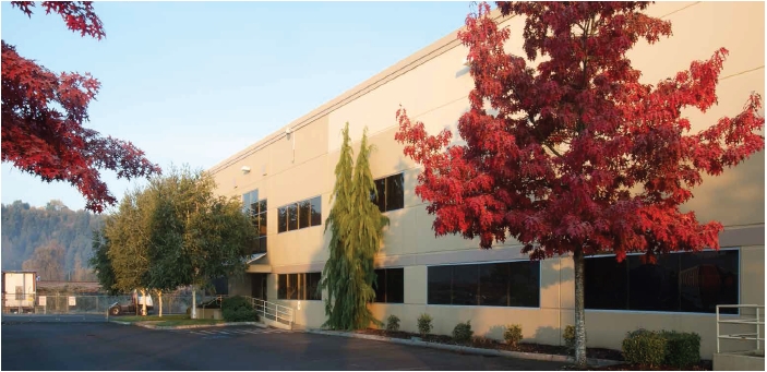
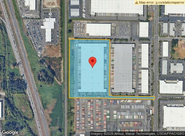
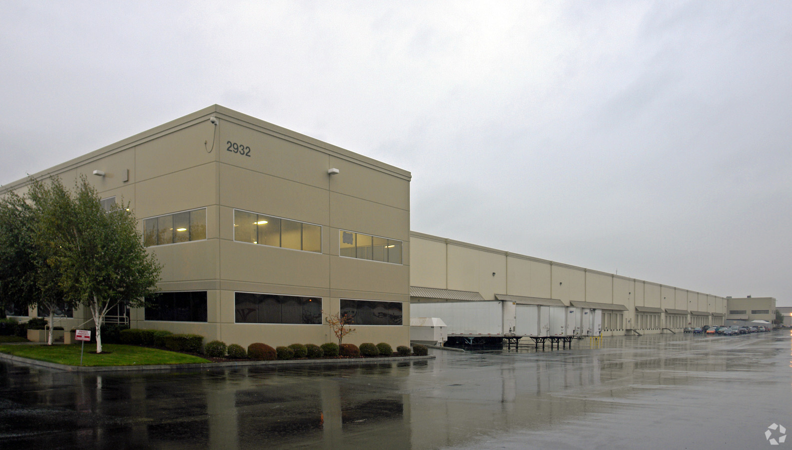
2932 142Nd Ave E, Sumner, WA 98390
NEARBY LISTINGS FOR SALE OR LEASE
Property Detail
2932 142Nd Ave E
042012-7008
SECTION 12 TOWNSHIP 20 RANGE 04 QUARTER 34 LOT 4 OF DBLR 2000-06-07-5001 DESC AS L 4 OF S P 99-07-30-5002 TOG/W THAT POR 32ND ST E VAC BY ORD 1898 & SR 167 CYD BY AFN 2007-07-30-0269 DESC AS BEG AT INTER OF N LI OF SEC 13 & E LI OF CMSTPAUL RR R/W TH
Warehouse
Pierce
AE
Washington
53033C1476F
4
2024
17.77 AC
2024
Puyallup/S Hill
073301
Seattle/Puget Sound
350,000 SF
Seattle-Tacoma-Bellevue, WA
DEMOGRAPHICS near 2932 142Nd Ave E
1 Mile
3 Mile
5 Mile
2024 Total Population
524
58,381
166,331
2029 Population
530
59,933
170,052
Pop Growth 2024-2029
+ 1.15%
+ 2.66%
+ 2.24%
Average Age
41
39
39
2024 Total Households
189
21,994
61,219
HH Growth 2024-2029
+ 1.59%
+ 2.71%
+ 2.31%
Median Household Inc
$97,634
$98,553
$92,618
Avg Household Size
2.80
2.60
2.60
2024 Avg HH Vehicles
3.00
2.00
2.00
Median Home Value
$721,311
$493,047
$477,217
Median Year Built
1989
1993
1988
Nearby Places
- Restaurants
- Banks
- Shops
- Fitness
- Groceries
PUBLIC TRANSPORTATION
COMMUTER RAIL
Sumner Station (Sounder South Line - Central Puget Sound Regional Transit Authority Rail (Link Light Rail/Sounder))
DRIVE
WALK
Distance
Sumner Station (Sounder South Line - Central Puget Sound Regional Transit Authority Rail (Link Light Rail/Sounder))
7 min
2.4 mi
Puyallup Station (Sounder South Line - Central Puget Sound Regional Transit Authority Rail (Link Light Rail/Sounder))
DRIVE
WALK
Distance
Puyallup Station (Sounder South Line - Central Puget Sound Regional Transit Authority Rail (Link Light Rail/Sounder))
13 min
5.9 mi
AIRPORT
Seattle-Tacoma International
DRIVE
WALK
Distance
Seattle-Tacoma International
35 min
19.5 mi
Freight Ports
Port of Tacoma
DRIVE
WALK
Distance
Port of Tacoma
23 min
11.8 mi
Nearby Properties
Address
Land Use
TOTAL SIZE
Lot Size
Zoning
Address
Land Use
TOTAL SIZE
Lot Size
Zoning
833,773 SF
94.01 AC
M1
Address
Land Use
TOTAL SIZE
Lot Size
Zoning
258,297 SF
16.13 AC
BP
Address
Land Use
TOTAL SIZE
Lot Size
Zoning
321,680 SF
31.59 AC
RM
Address
Land Use
TOTAL SIZE
Lot Size
Zoning
425,832 SF
11 AC
RM-20
Address
Land Use
TOTAL SIZE
Lot Size
Zoning
957,681 SF
56.53 AC
ML
Address
Land Use
TOTAL SIZE
Lot Size
Zoning
438,065 SF
20.43 AC
PUY
Address
Land Use
TOTAL SIZE
Lot Size
Zoning
648,679 SF
27.43 AC
M1
Address
Land Use
TOTAL SIZE
Lot Size
Zoning
Address
Land Use
TOTAL SIZE
Lot Size
Zoning
501,104 SF
21.73 AC
Address
Land Use
TOTAL SIZE
Lot Size
Zoning
255,871 SF
11.17 AC
EDGWD
Address
Land Use
TOTAL SIZE
Lot Size
Zoning
208,900 SF
8.72 AC
EDGWD
Address
Land Use
TOTAL SIZE
Lot Size
Zoning
506,925 SF
24.22 AC
M1
Address
Land Use
TOTAL SIZE
Lot Size
Zoning
521,674 SF
24.55 AC
M1
Address
Land Use
TOTAL SIZE
Lot Size
Zoning
492,124 SF
21.54 AC
M1
Address
Land Use
TOTAL SIZE
Lot Size
Zoning
251,498 SF
13.79 AC
LAKELAND H
Address
Land Use
TOTAL SIZE
Lot Size
Zoning
441,316 SF
20.26 AC
Address
Land Use
TOTAL SIZE
Lot Size
Zoning
503,526 SF
16.52 AC
M1
Address
Land Use
TOTAL SIZE
Lot Size
Zoning
430,880 SF
23.46 AC
M1
Address
Land Use
TOTAL SIZE
Lot Size
Zoning
218,293 SF
12.20 AC
RM-20
Address
Land Use
TOTAL SIZE
Lot Size
Zoning
223,969 SF
16.97 AC
RM-20
Address
Land Use
TOTAL SIZE
Lot Size
Zoning
428,056 SF
17.45 AC
M1
Address
Land Use
TOTAL SIZE
Lot Size
Zoning
401,076 SF
16.77 AC
M1
Address
Land Use
TOTAL SIZE
Lot Size
Zoning
385,468 SF
18.22 AC
M1
Address
Land Use
TOTAL SIZE
Lot Size
Zoning
127,096 SF
12.48 AC
LAKELAND H
Address
Land Use
TOTAL SIZE
Lot Size
Zoning
427,253 SF
18.46 AC
M1
Address
Land Use
TOTAL SIZE
Lot Size
Zoning
215,619 SF
21.57 AC
TV
Address
Land Use
TOTAL SIZE
Lot Size
Zoning
382,800 SF
19.15 AC
M1
Address
Land Use
TOTAL SIZE
Lot Size
Zoning
370,087 SF
15.61 AC
M1
Address
Land Use
TOTAL SIZE
Lot Size
Zoning
204,727 SF
18.63 AC
TV
Address
Land Use
TOTAL SIZE
Lot Size
Zoning
350,075 SF
16.66 AC
M1
The World's #1 Commercial Real Estate Marketplace
Connect with us
© 2025 CoStar Group
The information above has been obtained from sources believed reliable. While we do not doubt its accuracy we have not verified it and make no guarantee, warranty or representation about it. It is your responsibility to independently confirm its accuracy and completeness. Any projections, opinions, assumptions, or estimates used are for example only and do not represent the current or future performance of the property. The value of this transaction to you depends on tax and other factors which should be evaluated by your tax, financial, and legal advisors. You and your advisors should conduct a careful, independent investigation of the property to determine to your satisfaction the suitability of the property for your needs.