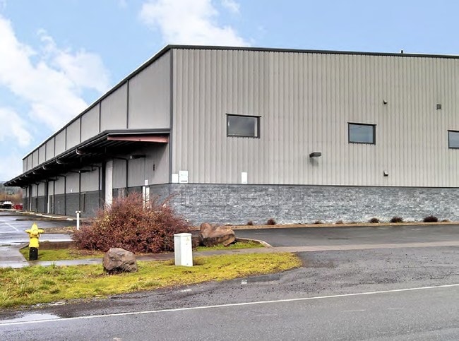
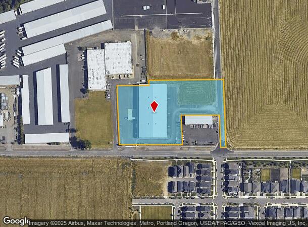
Property Record
29345 Nw West Union Rd, North Plains, OR 97133

NEARBY LISTINGS FOR SALE OR LEASE
Property Detail
29345 Nw West Union Rd
Portland-Vancouver-Hillsboro, OR-WA
North Plains
R0654232
ACRES 3.85, UNZONED FARMLAND LIEN $8,302.00, POTENTIAL ADDL TAX LIABILITY
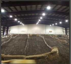
Commercialbuilding
Washington
X
Oregon
41067C0326E
30
2024
3.85 AC
2026
Sunset Corridor/Hillsboro
032700
Portland
47,850 SF
DEMOGRAPHICS near 29345 Nw West Union Rd
1 Mile
3 Mile
5 Mile
2024 Total Population
2,575
5,452
31,714
2029 Population
2,617
5,500
31,754
Pop Growth 2024-2029
+ 1.63%
+ 0.88%
+ 0.13%
Average Age
38
40
40
2024 Total Households
913
1,951
11,466
HH Growth 2024-2029
+ 1.64%
+ 0.87%
+ 0.18%
Median Household Inc
$113,483
$115,467
$107,593
Avg Household Size
2.80
2.80
2.70
2024 Avg HH Vehicles
2.00
2.00
2.00
Median Home Value
$510,989
$596,428
$501,538
Median Year Built
2005
1997
1989
Nearby Places
Map Layers
Map Styles
 Street
 Aerial
- Restaurants
- Banks
- Shops
- Fitness
- Groceries
PUBLIC TRANSPORTATION
AIRPORT
Portland International
DRIVE
WALK
Distance
Portland International
47 min
30.6 mi
Freight Ports
Port of Vancouver
DRIVE
WALK
Distance
Port of Vancouver
44 min
27.8 mi
SALE & LEASE HISTORY
LISTING DATE
SALE/LEASE

Sep 24, 2016
For Sale
Jan 17, 2017
For Lease
Nearby Properties
Address
Land Use
TOTAL SIZE
Lot Size
Zoning
Address
Land Use
TOTAL SIZE
Lot Size
Zoning
2,522 SF
66.38 AC
FD-20
Address
Land Use
TOTAL SIZE
Lot Size
Zoning
10 AC
IPU
Address
Land Use
TOTAL SIZE
Lot Size
Zoning
11,904 SF
128.70 AC
Address
Land Use
TOTAL SIZE
Lot Size
Zoning
18,004 SF
308.88 AC
EFU
Address
Land Use
TOTAL SIZE
Lot Size
Zoning
46,913 SF
13.92 AC
IPU
Address
Land Use
TOTAL SIZE
Lot Size
Zoning
10.40 AC
M-2
Address
Land Use
TOTAL SIZE
Lot Size
Zoning
178,368 SF
14.77 AC
M-2
Address
Land Use
TOTAL SIZE
Lot Size
Zoning
1,502 SF
13.07 AC
FD-20
Address
Land Use
TOTAL SIZE
Lot Size
Zoning
4,202 SF
14.67 AC
FD-20
Address
Land Use
TOTAL SIZE
Lot Size
Zoning
3.05 AC
IPU
Address
Land Use
TOTAL SIZE
Lot Size
Zoning
5,946 SF
19.77 AC
I-S
Address
Land Use
TOTAL SIZE
Lot Size
Zoning
Address
Land Use
TOTAL SIZE
Lot Size
Zoning
18,222 SF
0.46 AC
C-1
Address
Land Use
TOTAL SIZE
Lot Size
Zoning
5,496 SF
7.17 AC
FD-20
Address
Land Use
TOTAL SIZE
Lot Size
Zoning
2,112 SF
6.80 AC
FD-20
Address
Land Use
TOTAL SIZE
Lot Size
Zoning
15,816 SF
2.60 AC
M-1
Address
Land Use
TOTAL SIZE
Lot Size
Zoning
7.12 AC
M-2
Address
Land Use
TOTAL SIZE
Lot Size
Zoning
12,310 SF
4.04 AC
M-2
Address
Land Use
TOTAL SIZE
Lot Size
Zoning
19,305 SF
2.78 AC
C-2
Address
Land Use
TOTAL SIZE
Lot Size
Zoning
50,656 SF
3.99 AC
M-2
Address
Land Use
TOTAL SIZE
Lot Size
Zoning
2,000 SF
4.83 AC
FD-20
Address
Land Use
TOTAL SIZE
Lot Size
Zoning
38,652 SF
11.28 AC
EFU
Address
Land Use
TOTAL SIZE
Lot Size
Zoning
51.09 AC
EFU
Address
Land Use
TOTAL SIZE
Lot Size
Zoning
98,075 SF
4.36 AC
M-2
Address
Land Use
TOTAL SIZE
Lot Size
Zoning
2,000 SF
21.51 AC
R-IND
Address
Land Use
TOTAL SIZE
Lot Size
Zoning
3,892 SF
5.02 AC
FD-20
Address
Land Use
TOTAL SIZE
Lot Size
Zoning
3,248 SF
5 AC
FD-20
Address
Land Use
TOTAL SIZE
Lot Size
Zoning
49,988 SF
43.64 AC
EFU
The World's #1 Commercial Real Estate Marketplace
Connect with us
© 2026 CoStar Group
The information above has been obtained from sources believed reliable. While we do not doubt its accuracy we have not verified it and make no guarantee, warranty or representation about it. It is your responsibility to independently confirm its accuracy and completeness. Any projections, opinions, assumptions, or estimates used are for example only and do not represent the current or future performance of the property. The value of this transaction to you depends on tax and other factors which should be evaluated by your tax, financial, and legal advisors. You and your advisors should conduct a careful, independent investigation of the property to determine to your satisfaction the suitability of the property for your needs.