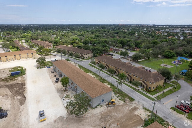
Property Record
29355 S Dixie Hwy, Homestead, FL 33033


NEARBY LISTINGS FOR SALE OR LEASE
Property Detail
29355 S Dixie Hwy
30-7905-000-0370
5 57 39 65.07 AC M/L S3/4 OF SE1/4 LYG SELY OF SR #5 LESS N1/2 OF SW1/4 OF NE1/4 OF SE1/4 ELY OF SR 5 & LESS N1/2 OF NE1/4 OF SW1/4 OF SE1/4 ELY OF SR 5 & LESS NW1/4 OF NW1/4 OF SE1/4 OF SE1/4 & LESS E & S40FT FOR RDS & LESS S1/2 OF SW1/4 OF NE1/4 OF
Municipalproperty
Miami/Dade
X
Florida
12086C0727L
65.07 AC
0
Outer Homestead/South Dade
2025
South Florida
010900
Miami-Miami Beach-Kendall, FL
228,908 SF
DEMOGRAPHICS near 29355 S Dixie Hwy
1 Mile
3 Mile
5 Mile
2024 Total Population
17,847
122,727
182,778
2029 Population
17,569
120,508
179,482
Pop Growth 2024-2029
(1.56%)
(1.81%)
(1.80%)
Average Age
38
36
36
2024 Total Households
5,181
36,780
54,562
HH Growth 2024-2029
(1.87%)
(2.25%)
(2.24%)
Median Household Inc
$48,779
$56,468
$55,225
Avg Household Size
3.20
3.20
3.20
2024 Avg HH Vehicles
2.00
2.00
2.00
Median Home Value
$315,639
$307,553
$309,179
Median Year Built
1979
1999
1998
Nearby Places
Map Layers
Map Styles
 Street
 Aerial
- Restaurants
- Banks
- Shops
- Fitness
- Groceries
PUBLIC TRANSPORTATION
AIRPORT
Miami International
DRIVE
WALK
Distance
Miami International
44 min
29.2 mi
Freight Ports
Port of Miami
DRIVE
WALK
Distance
Port of Miami
53 min
36.3 mi
Nearby Properties
Address
Land Use
TOTAL SIZE
Lot Size
Zoning
Address
Land Use
TOTAL SIZE
Lot Size
Zoning
487,531 SF
60 AC
9300
Address
Land Use
TOTAL SIZE
Lot Size
Zoning
289,905 SF
29.74 AC
6500
Address
Land Use
TOTAL SIZE
Lot Size
Zoning
321,122 SF
7.31 AC
3161
Address
Land Use
TOTAL SIZE
Lot Size
Zoning
313,656 SF
10.71 AC
3900
Address
Land Use
TOTAL SIZE
Lot Size
Zoning
149,022 SF
34.85 AC
9300
Address
Land Use
TOTAL SIZE
Lot Size
Zoning
253,088 SF
2.90 AC
6072
Address
Land Use
TOTAL SIZE
Lot Size
Zoning
225,691 SF
8.22 AC
3900
Address
Land Use
TOTAL SIZE
Lot Size
Zoning
216,282 SF
20.04 AC
6300
Address
Land Use
TOTAL SIZE
Lot Size
Zoning
183,244 SF
4 AC
6500
Address
Land Use
TOTAL SIZE
Lot Size
Zoning
183,940 SF
4.80 AC
3050
Address
Land Use
TOTAL SIZE
Lot Size
Zoning
252,526 SF
29.86 AC
6000
Address
Land Use
TOTAL SIZE
Lot Size
Zoning
169,474 SF
5.76 AC
6300
Address
Land Use
TOTAL SIZE
Lot Size
Zoning
183,633 SF
3.78 AC
3802
Address
Land Use
TOTAL SIZE
Lot Size
Zoning
199,350 SF
3.75 AC
3161
Address
Land Use
TOTAL SIZE
Lot Size
Zoning
208,951 SF
20 AC
6300
Address
Land Use
TOTAL SIZE
Lot Size
Zoning
409,347 SF
33.88 AC
3000
Address
Land Use
TOTAL SIZE
Lot Size
Zoning
179,608 SF
8.06 AC
9300
Address
Land Use
TOTAL SIZE
Lot Size
Zoning
144,931 SF
10.69 AC
6200
Address
Land Use
TOTAL SIZE
Lot Size
Zoning
119,534 SF
8.55 AC
6200
Address
Land Use
TOTAL SIZE
Lot Size
Zoning
374,632 SF
23.28 AC
3000
Address
Land Use
TOTAL SIZE
Lot Size
Zoning
172,811 SF
22.02 AC
9300
Address
Land Use
TOTAL SIZE
Lot Size
Zoning
159,298 SF
4.93 AC
5300
Address
Land Use
TOTAL SIZE
Lot Size
Zoning
185,907 SF
57.94 AC
3100
Address
Land Use
TOTAL SIZE
Lot Size
Zoning
24.37 AC
6600
Address
Land Use
TOTAL SIZE
Lot Size
Zoning
169,748 SF
15.47 AC
6400
Address
Land Use
TOTAL SIZE
Lot Size
Zoning
96,971 SF
3.08 AC
6500
Address
Land Use
TOTAL SIZE
Lot Size
Zoning
92,290 SF
7.41 AC
6500
Address
Land Use
TOTAL SIZE
Lot Size
Zoning
226,882 SF
18.27 AC
3050
The World's #1 Commercial Real Estate Marketplace
Connect with us
© 2026 CoStar Group
The information above has been obtained from sources believed reliable. While we do not doubt its accuracy we have not verified it and make no guarantee, warranty or representation about it. It is your responsibility to independently confirm its accuracy and completeness. Any projections, opinions, assumptions, or estimates used are for example only and do not represent the current or future performance of the property. The value of this transaction to you depends on tax and other factors which should be evaluated by your tax, financial, and legal advisors. You and your advisors should conduct a careful, independent investigation of the property to determine to your satisfaction the suitability of the property for your needs.