Property Record
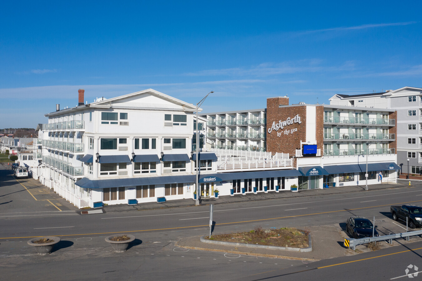
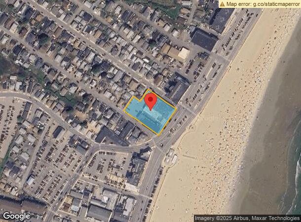
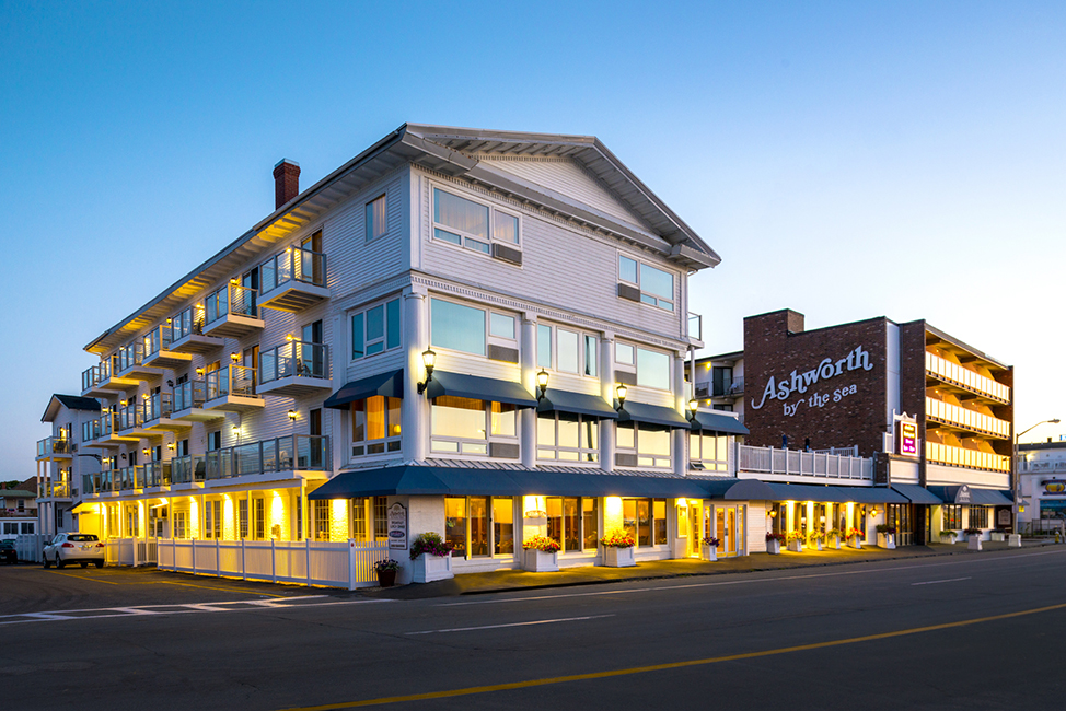
295 Ocean Blvd, Hampton, NH 03842
NEARBY LISTINGS FOR SALE OR LEASE
-
-
View all Hampton listings for sale on LoopNet.com
Property Detail
295 Ocean Blvd
Commercialnec
Rockingham
X
New Hampshire
33015C0441F
0.94 AC
2023
Portsmouth
2023
Boston
065008
Boston-Cambridge-Newton, MA-NH
850 SF
HMPT-000282-000000-000053
DEMOGRAPHICS near 295 Ocean Blvd
1 Mile
3 Mile
5 Mile
2024 Total Population
4,420
18,694
36,720
2029 Population
4,909
19,972
38,815
Pop Growth 2024-2029
+ 11.06%
+ 6.84%
+ 5.71%
Average Age
52
50
48
2024 Total Households
2,402
8,993
16,691
HH Growth 2024-2029
+ 10.95%
+ 7.07%
+ 5.91%
Median Household Inc
$73,160
$94,637
$97,022
Avg Household Size
1.70
2.00
2.10
2024 Avg HH Vehicles
2.00
2.00
2.00
Median Home Value
$494,444
$496,539
$479,130
Median Year Built
1970
1976
1979
Nearby Places
- Restaurants
- Banks
- Shops
- Fitness
- Groceries
PUBLIC TRANSPORTATION
AIRPORT
Portsmouth International at Pease
DRIVE
WALK
Distance
Portsmouth International at Pease
25 min
15.7 mi
Freight Ports
Port of Boston
DRIVE
WALK
Distance
Port of Boston
70 min
50.3 mi
Nearby Properties
Address
Land Use
TOTAL SIZE
Lot Size
Zoning
Address
Land Use
TOTAL SIZE
Lot Size
Zoning
4,884 SF
40 AC
RB
Address
Land Use
TOTAL SIZE
Lot Size
Zoning
46,328 SF
49.50 AC
RA
Address
Land Use
TOTAL SIZE
Lot Size
Zoning
112,708 SF
40 AC
50
Address
Land Use
TOTAL SIZE
Lot Size
Zoning
116,112 SF
4.52 AC
BS1
Address
Land Use
TOTAL SIZE
Lot Size
Zoning
25,867 SF
9.17 AC
BS
Address
Land Use
TOTAL SIZE
Lot Size
Zoning
142,369 SF
8.82 AC
POR
Address
Land Use
TOTAL SIZE
Lot Size
Zoning
70,876 SF
17.38 AC
RA
Address
Land Use
TOTAL SIZE
Lot Size
Zoning
11,338 SF
28.90 AC
I
Address
Land Use
TOTAL SIZE
Lot Size
Zoning
57,215 SF
4.40 AC
TOWN C
Address
Land Use
TOTAL SIZE
Lot Size
Zoning
47,508 SF
4.94 AC
TC-S
Address
Land Use
TOTAL SIZE
Lot Size
Zoning
41,864 SF
7.50 AC
RA
Address
Land Use
TOTAL SIZE
Lot Size
Zoning
59,268 SF
6.46 AC
BUSINE
Address
Land Use
TOTAL SIZE
Lot Size
Zoning
52,319 SF
5.90 AC
POR
Address
Land Use
TOTAL SIZE
Lot Size
Zoning
29,408 SF
9.49 AC
RB
Address
Land Use
TOTAL SIZE
Lot Size
Zoning
6,892 SF
5.70 AC
B
Address
Land Use
TOTAL SIZE
Lot Size
Zoning
18,228 SF
4.10 AC
TC-S
Address
Land Use
TOTAL SIZE
Lot Size
Zoning
44,860 SF
5.54 AC
TC-N
Address
Land Use
TOTAL SIZE
Lot Size
Zoning
26,928 SF
25.11 AC
G
Address
Land Use
TOTAL SIZE
Lot Size
Zoning
9,632 SF
4.20 AC
I
Address
Land Use
TOTAL SIZE
Lot Size
Zoning
29,360 SF
4.05 AC
TOWN C
Address
Land Use
TOTAL SIZE
Lot Size
Zoning
29,904 SF
1 AC
R3
Address
Land Use
TOTAL SIZE
Lot Size
Zoning
34,021 SF
0.22 AC
BS
Address
Land Use
TOTAL SIZE
Lot Size
Zoning
11,904 SF
31.40 AC
I
Address
Land Use
TOTAL SIZE
Lot Size
Zoning
26,617 SF
3.86 AC
TOWN C
Address
Land Use
TOTAL SIZE
Lot Size
Zoning
13,956 SF
3.36 AC
POR
Address
Land Use
TOTAL SIZE
Lot Size
Zoning
11,212 SF
0.42 AC
BS1
Address
Land Use
TOTAL SIZE
Lot Size
Zoning
26,652 SF
23.60 AC
I
Address
Land Use
TOTAL SIZE
Lot Size
Zoning
33,771 SF
0.41 AC
BS
Address
Land Use
TOTAL SIZE
Lot Size
Zoning
6,103 SF
0.55 AC
RA
The World's #1 Commercial Real Estate Marketplace
Connect with us
© 2025 CoStar Group
The information above has been obtained from sources believed reliable. While we do not doubt its accuracy we have not verified it and make no guarantee, warranty or representation about it. It is your responsibility to independently confirm its accuracy and completeness. Any projections, opinions, assumptions, or estimates used are for example only and do not represent the current or future performance of the property. The value of this transaction to you depends on tax and other factors which should be evaluated by your tax, financial, and legal advisors. You and your advisors should conduct a careful, independent investigation of the property to determine to your satisfaction the suitability of the property for your needs.