Property Record
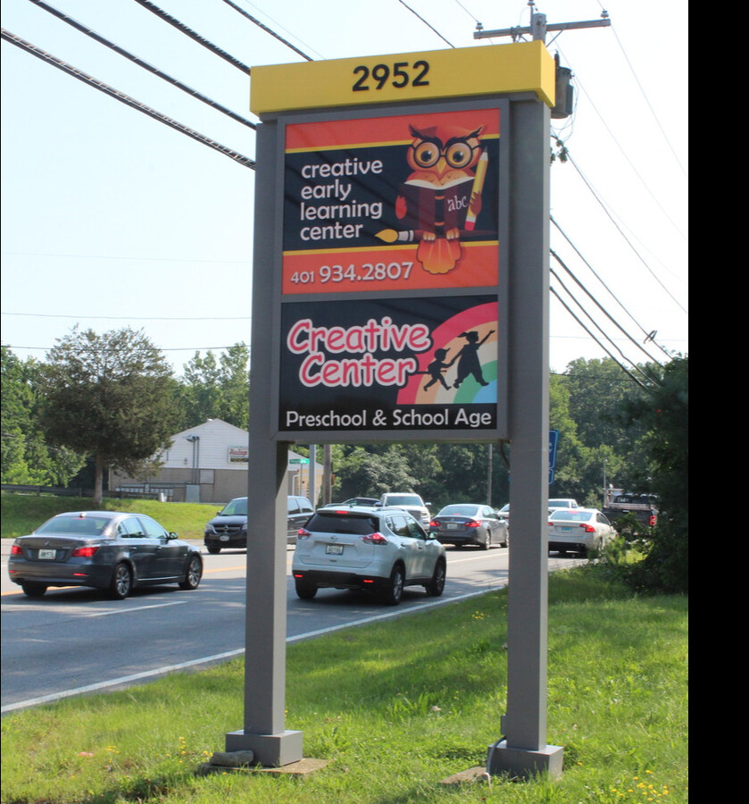
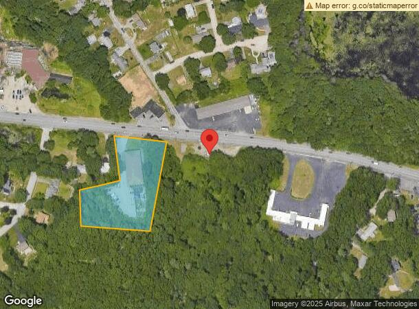
2952 Hartford Ave, Johnston, RI 02919
NEARBY LISTINGS FOR SALE OR LEASE
Property Detail
2952 Hartford Ave
JOHN-000057-000000-000140
Providence
Commercialbuilding
Rhode Island
X
140
44007C0280G
2.10 AC
2024
Johnston
2024
Providence
012200
Providence-Warwick, RI-MA
8,400 SF
DEMOGRAPHICS near 2952 Hartford Ave
1 Mile
3 Mile
5 Mile
2024 Total Population
1,827
14,349
64,401
2029 Population
1,840
14,468
64,687
Pop Growth 2024-2029
+ 0.71%
+ 0.83%
+ 0.44%
Average Age
44
45
44
2024 Total Households
707
5,644
25,992
HH Growth 2024-2029
+ 0.57%
+ 0.76%
+ 0.34%
Median Household Inc
$107,341
$105,971
$87,915
Avg Household Size
2.60
2.50
2.40
2024 Avg HH Vehicles
2.00
2.00
2.00
Median Home Value
$384,945
$382,933
$344,857
Median Year Built
1968
1971
1971
Nearby Places
- Restaurants
- Banks
- Shops
- Fitness
- Groceries
PUBLIC TRANSPORTATION
COMMUTER RAIL
Providence (Providence/Stoughton Line - Massachusetts Bay Transportation Authority Commuter Rail (Purple Line))
DRIVE
WALK
Distance
Providence (Providence/Stoughton Line - Massachusetts Bay Transportation Authority Commuter Rail (Purple Line))
13 min
9.6 mi
AIRPORT
Rhode Island Tf Green International
DRIVE
WALK
Distance
Rhode Island Tf Green International
21 min
14.1 mi
Freight Ports
Port of Davisville, RI
DRIVE
WALK
Distance
Port of Davisville, RI
33 min
23.3 mi
SALE & LEASE HISTORY
LISTING DATE
SALE/LEASE

Aug 27, 2021
For Lease
Nearby Properties
Address
Land Use
TOTAL SIZE
Lot Size
Zoning
Address
Land Use
TOTAL SIZE
Lot Size
Zoning
123.25 AC
R40
Address
Land Use
TOTAL SIZE
Lot Size
Zoning
1,792 SF
28.46 AC
Address
Land Use
TOTAL SIZE
Lot Size
Zoning
135,831 SF
34.48 AC
RR-1
Address
Land Use
TOTAL SIZE
Lot Size
Zoning
9.59 AC
MU
Address
Land Use
TOTAL SIZE
Lot Size
Zoning
1 AC
PD
Address
Land Use
TOTAL SIZE
Lot Size
Zoning
78,346 SF
10.75 AC
PD
Address
Land Use
TOTAL SIZE
Lot Size
Zoning
40.40 AC
RS-1
Address
Land Use
TOTAL SIZE
Lot Size
Zoning
4.57 AC
B2
Address
Land Use
TOTAL SIZE
Lot Size
Zoning
40,586 SF
3.40 AC
RS-1
Address
Land Use
TOTAL SIZE
Lot Size
Zoning
33,340 SF
5 AC
PD
Address
Land Use
TOTAL SIZE
Lot Size
Zoning
23.22 AC
IL
Address
Land Use
TOTAL SIZE
Lot Size
Zoning
45,809 SF
1.97 AC
PD
Address
Land Use
TOTAL SIZE
Lot Size
Zoning
30,275 SF
1.42 AC
MU
Address
Land Use
TOTAL SIZE
Lot Size
Zoning
1.81 AC
V
Address
Land Use
TOTAL SIZE
Lot Size
Zoning
11.28 AC
B2
Address
Land Use
TOTAL SIZE
Lot Size
Zoning
50,886 SF
5.28 AC
BG
Address
Land Use
TOTAL SIZE
Lot Size
Zoning
36,973 SF
4.71 AC
R20
Address
Land Use
TOTAL SIZE
Lot Size
Zoning
67,142 SF
3.48 AC
I
Address
Land Use
TOTAL SIZE
Lot Size
Zoning
19,286 SF
2.01 AC
PD
Address
Land Use
TOTAL SIZE
Lot Size
Zoning
2.37 AC
V
Address
Land Use
TOTAL SIZE
Lot Size
Zoning
76,570 SF
4.09 AC
I
Address
Land Use
TOTAL SIZE
Lot Size
Zoning
19,244 SF
0.70 AC
RS-1
Address
Land Use
TOTAL SIZE
Lot Size
Zoning
26,091 SF
3.06 AC
B2
Address
Land Use
TOTAL SIZE
Lot Size
Zoning
18,400 SF
4.71 AC
B2
Address
Land Use
TOTAL SIZE
Lot Size
Zoning
18,351 SF
1.20 AC
R40
Address
Land Use
TOTAL SIZE
Lot Size
Zoning
14,856 SF
2.57 AC
PD
Address
Land Use
TOTAL SIZE
Lot Size
Zoning
53,824 SF
3.13 AC
V
Address
Land Use
TOTAL SIZE
Lot Size
Zoning
29,955 SF
2.99 AC
RS-1
Address
Land Use
TOTAL SIZE
Lot Size
Zoning
5.13 AC
V
Address
Land Use
TOTAL SIZE
Lot Size
Zoning
19,473 SF
52 AC
10
The World's #1 Commercial Real Estate Marketplace
Connect with us
© 2025 CoStar Group
The information above has been obtained from sources believed reliable. While we do not doubt its accuracy we have not verified it and make no guarantee, warranty or representation about it. It is your responsibility to independently confirm its accuracy and completeness. Any projections, opinions, assumptions, or estimates used are for example only and do not represent the current or future performance of the property. The value of this transaction to you depends on tax and other factors which should be evaluated by your tax, financial, and legal advisors. You and your advisors should conduct a careful, independent investigation of the property to determine to your satisfaction the suitability of the property for your needs.