Property Record
2970 Military Ave, Baxter Springs, KS 66713

NEARBY LISTINGS FOR SALE OR LEASE
-
-
View all Baxter Springs listings for lease on LoopNet.com
Property Detail
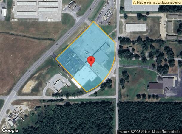
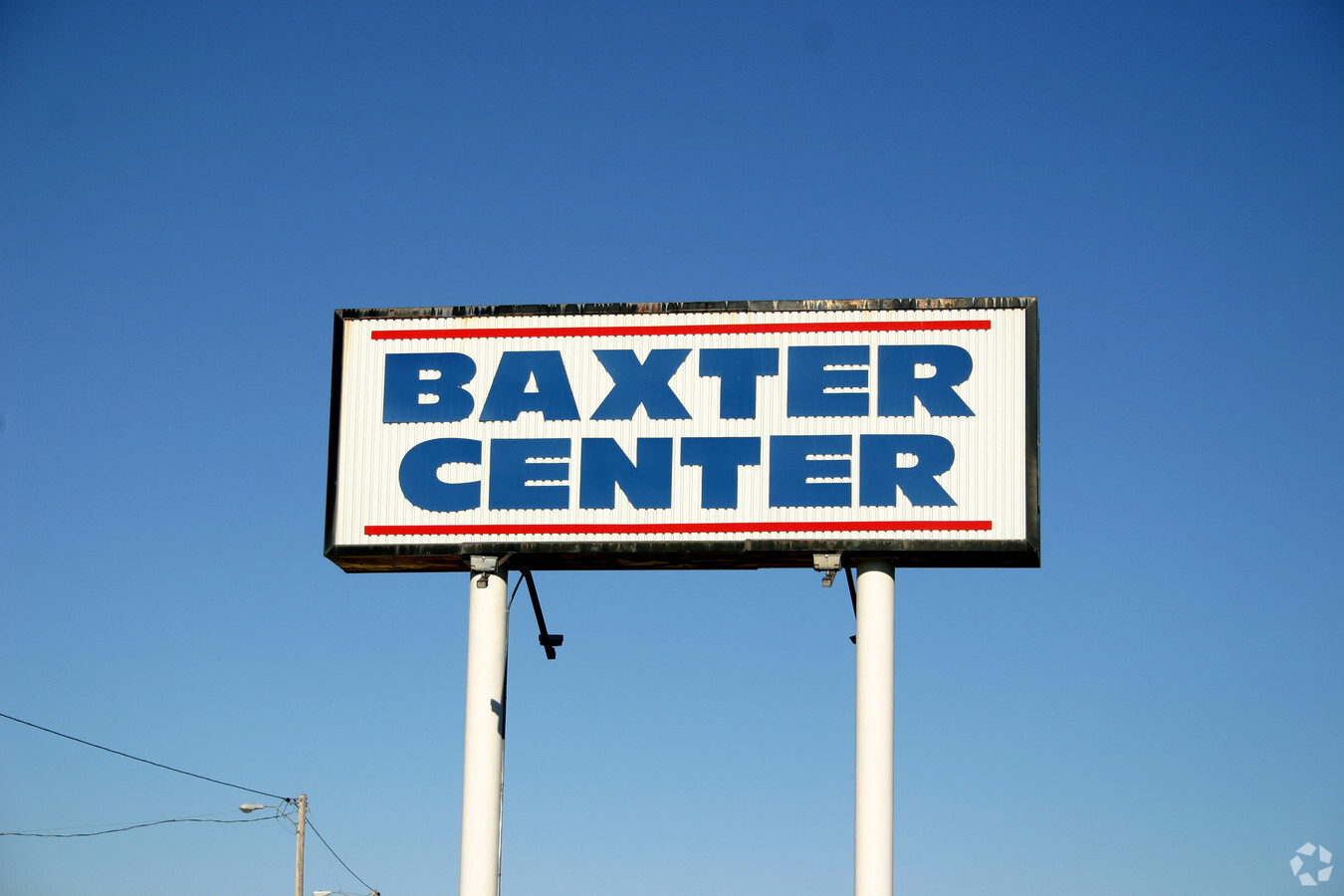
2970 Military Ave
Stripcommercialcenter
S12, T35, R24, ACRES 3.29, BEG 345.7W & 57.7N SE COR NW/4 SW/4 TH NWLY 466.9 TO HWY R/W NELY 410 ALG R/W NELY 180 SEL Y 327.2
X
Cherokee
20021C0340C
Kansas
2023
6.10 AC
2024
Kansas Area
958600
Other Market Areas
25,000 SF
221-12-0-30-02-002.00-0
DEMOGRAPHICS near 2970 Military Ave
1 Mile
3 Mile
5 Mile
2024 Total Population
2,170
4,879
7,392
2029 Population
2,146
4,846
7,290
Pop Growth 2024-2029
(1.11%)
(0.68%)
(1.38%)
Average Age
41
40
41
2024 Total Households
904
1,992
2,968
HH Growth 2024-2029
(1.00%)
(0.60%)
(1.31%)
Median Household Inc
$47,371
$48,166
$52,220
Avg Household Size
2.40
2.40
2.40
2024 Avg HH Vehicles
2.00
2.00
2.00
Median Home Value
$91,935
$88,895
$98,010
Median Year Built
1971
1966
1972
Nearby Places
- Restaurants
- Banks
- Shops
- Fitness
- Groceries
SALE & LEASE HISTORY
LISTING DATE
SALE/LEASE

Sep 25, 2016
For Lease
Nearby Properties
Address
Land Use
TOTAL SIZE
Lot Size
Zoning
Address
Land Use
TOTAL SIZE
Lot Size
Zoning
83,569 SF
30.82 AC
R1
Address
Land Use
TOTAL SIZE
Lot Size
Zoning
27,976 SF
7.90 AC
Address
Land Use
TOTAL SIZE
Lot Size
Zoning
26,049 SF
2.01 AC
R1
Address
Land Use
TOTAL SIZE
Lot Size
Zoning
10,800 SF
10.20 AC
M1
Address
Land Use
TOTAL SIZE
Lot Size
Zoning
20,842 SF
1.10 AC
R1
Address
Land Use
TOTAL SIZE
Lot Size
Zoning
19,166 SF
9.40 AC
R1
Address
Land Use
TOTAL SIZE
Lot Size
Zoning
5,632 SF
9.40 AC
R1
Address
Land Use
TOTAL SIZE
Lot Size
Zoning
6,912 SF
8.90 AC
R1
Address
Land Use
TOTAL SIZE
Lot Size
Zoning
25,824 SF
0.57 AC
C1
Address
Land Use
TOTAL SIZE
Lot Size
Zoning
14,016 SF
0.32 AC
Address
Land Use
TOTAL SIZE
Lot Size
Zoning
43,077 SF
34.30 AC
M1
Address
Land Use
TOTAL SIZE
Lot Size
Zoning
31,024 SF
0.65 AC
C1
Address
Land Use
TOTAL SIZE
Lot Size
Zoning
15,031 SF
1.80 AC
C2
Address
Land Use
TOTAL SIZE
Lot Size
Zoning
0.12 AC
R1
Address
Land Use
TOTAL SIZE
Lot Size
Zoning
6,016 SF
2.60 AC
Address
Land Use
TOTAL SIZE
Lot Size
Zoning
4,536 SF
0.40 AC
Address
Land Use
TOTAL SIZE
Lot Size
Zoning
6,368 SF
2.06 AC
R1
Address
Land Use
TOTAL SIZE
Lot Size
Zoning
12,550 SF
0.57 AC
R1
Address
Land Use
TOTAL SIZE
Lot Size
Zoning
63,106 SF
8.20 AC
M1
Address
Land Use
TOTAL SIZE
Lot Size
Zoning
11,210 SF
0.97 AC
C2
Address
Land Use
TOTAL SIZE
Lot Size
Zoning
8,633 SF
1.60 AC
C2
Address
Land Use
TOTAL SIZE
Lot Size
Zoning
1,442 SF
9.40 AC
Address
Land Use
TOTAL SIZE
Lot Size
Zoning
9,313 SF
1.07 AC
R1
Address
Land Use
TOTAL SIZE
Lot Size
Zoning
0.93 AC
C1
Address
Land Use
TOTAL SIZE
Lot Size
Zoning
9,492 SF
0.88 AC
C1
Address
Land Use
TOTAL SIZE
Lot Size
Zoning
11,197 SF
2.60 AC
R4
Address
Land Use
TOTAL SIZE
Lot Size
Zoning
7,500 SF
6.20 AC
R1
Address
Land Use
TOTAL SIZE
Lot Size
Zoning
9,519 SF
0.65 AC
C1
Address
Land Use
TOTAL SIZE
Lot Size
Zoning
3,762 SF
1.68 AC
M1
Address
Land Use
TOTAL SIZE
Lot Size
Zoning
4,128 SF
0.33 AC
R1
The World's #1 Commercial Real Estate Marketplace
Connect with us
© 2025 CoStar Group
The information above has been obtained from sources believed reliable. While we do not doubt its accuracy we have not verified it and make no guarantee, warranty or representation about it. It is your responsibility to independently confirm its accuracy and completeness. Any projections, opinions, assumptions, or estimates used are for example only and do not represent the current or future performance of the property. The value of this transaction to you depends on tax and other factors which should be evaluated by your tax, financial, and legal advisors. You and your advisors should conduct a careful, independent investigation of the property to determine to your satisfaction the suitability of the property for your needs.