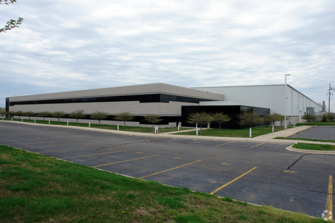
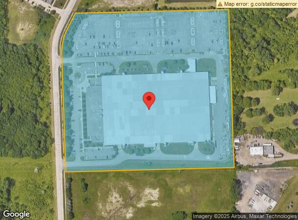
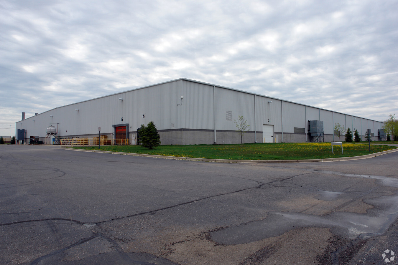
Property Record
29700 Commerce Blvd, Chesterfield, MI 48051
NEARBY LISTINGS FOR SALE OR LEASE
Property Detail
29700 Commerce Blvd
15-09-04-300-010
North Bay
Lightindustrial
T3N, R14E, SW 1/4 SEC 4 DESC AS: COMM AT THE S 1/4 COR SEC 4; TH N1*52'43"W (N2*10'45"W REC), 1290.84 FT ALG THE N-S 1/4 LINE
X
Macomb
26099C0258G
Michigan
2023
21.18 AC
2024
Groesbeck North
221500
Detroit
316,907 SF
Detroit-Warren-Dearborn, MI
DEMOGRAPHICS near 29700 Commerce Blvd
1 Mile
3 Mile
5 Mile
2024 Total Population
1,537
34,849
75,360
2029 Population
1,516
34,837
75,151
Pop Growth 2024-2029
(1.37%)
(0.03%)
(0.28%)
Average Age
41
39
41
2024 Total Households
559
13,006
28,472
HH Growth 2024-2029
(1.43%)
+ 0.01%
(0.25%)
Median Household Inc
$113,874
$75,940
$81,333
Avg Household Size
2.70
2.60
2.50
2024 Avg HH Vehicles
2.00
2.00
2.00
Median Home Value
$275,635
$239,320
$258,372
Median Year Built
2001
1997
1994
Nearby Places
- Restaurants
- Banks
- Shops
- Fitness
- Groceries
Nearby Properties
Address
Land Use
TOTAL SIZE
Lot Size
Zoning
Address
Land Use
TOTAL SIZE
Lot Size
Zoning
808,240 SF
60.31 AC
RM 3 MU
Address
Land Use
TOTAL SIZE
Lot Size
Zoning
181,094 SF
14.89 AC
C3 GEN
Address
Land Use
TOTAL SIZE
Lot Size
Zoning
143,731 SF
16.25 AC
C2 SHO
Address
Land Use
TOTAL SIZE
Lot Size
Zoning
167,281 SF
16.12 AC
C3 GEN
Address
Land Use
TOTAL SIZE
Lot Size
Zoning
179,200 SF
10.12 AC
RT TECH
Address
Land Use
TOTAL SIZE
Lot Size
Zoning
124,956 SF
15.78 AC
C2 SHO
Address
Land Use
TOTAL SIZE
Lot Size
Zoning
204,318 SF
27.75 AC
C3 GEN
Address
Land Use
TOTAL SIZE
Lot Size
Zoning
179,250 SF
26.35 AC
M2 GEN
Address
Land Use
TOTAL SIZE
Lot Size
Zoning
184,401 SF
19.98 AC
RM 3 MU
Address
Land Use
TOTAL SIZE
Lot Size
Zoning
156,262 SF
16.23 AC
RM2 MU
Address
Land Use
TOTAL SIZE
Lot Size
Zoning
5,541 SF
130.51 AC
MHP MO
Address
Land Use
TOTAL SIZE
Lot Size
Zoning
88,183 SF
27.97 AC
RM1 MU
Address
Land Use
TOTAL SIZE
Lot Size
Zoning
137,092 SF
18.25 AC
C2 SHO
Address
Land Use
TOTAL SIZE
Lot Size
Zoning
Address
Land Use
TOTAL SIZE
Lot Size
Zoning
103,725 SF
12.79 AC
C2 SHO
Address
Land Use
TOTAL SIZE
Lot Size
Zoning
21,615 SF
77.49 AC
C4 MULT
Address
Land Use
TOTAL SIZE
Lot Size
Zoning
117,374 SF
12.95 AC
C2 SHO
Address
Land Use
TOTAL SIZE
Lot Size
Zoning
41,125 SF
3.55 AC
RM 3 MU
Address
Land Use
TOTAL SIZE
Lot Size
Zoning
72,184 SF
69.68 AC
M2 GEN
Address
Land Use
TOTAL SIZE
Lot Size
Zoning
3,799 SF
56.46 AC
MH
Address
Land Use
TOTAL SIZE
Lot Size
Zoning
5.84 AC
C2 SHO
Address
Land Use
TOTAL SIZE
Lot Size
Zoning
100,259 SF
8.80 AC
C2 SHO
Address
Land Use
TOTAL SIZE
Lot Size
Zoning
39,075 SF
3.45 AC
C2 SHO
Address
Land Use
TOTAL SIZE
Lot Size
Zoning
50,789 SF
5.47 AC
C2 SHO
Address
Land Use
TOTAL SIZE
Lot Size
Zoning
88,452 SF
8.36 AC
C3 GEN
Address
Land Use
TOTAL SIZE
Lot Size
Zoning
40,767 SF
15.87 AC
C3 GEN
Address
Land Use
TOTAL SIZE
Lot Size
Zoning
50,091 SF
4.80 AC
RM1 MU
Address
Land Use
TOTAL SIZE
Lot Size
Zoning
45,676 SF
5.66 AC
C2 SHO
Address
Land Use
TOTAL SIZE
Lot Size
Zoning
73,436 SF
6.65 AC
C3 GEN
The World's #1 Commercial Real Estate Marketplace
Connect with us
© 2025 CoStar Group
The information above has been obtained from sources believed reliable. While we do not doubt its accuracy we have not verified it and make no guarantee, warranty or representation about it. It is your responsibility to independently confirm its accuracy and completeness. Any projections, opinions, assumptions, or estimates used are for example only and do not represent the current or future performance of the property. The value of this transaction to you depends on tax and other factors which should be evaluated by your tax, financial, and legal advisors. You and your advisors should conduct a careful, independent investigation of the property to determine to your satisfaction the suitability of the property for your needs.