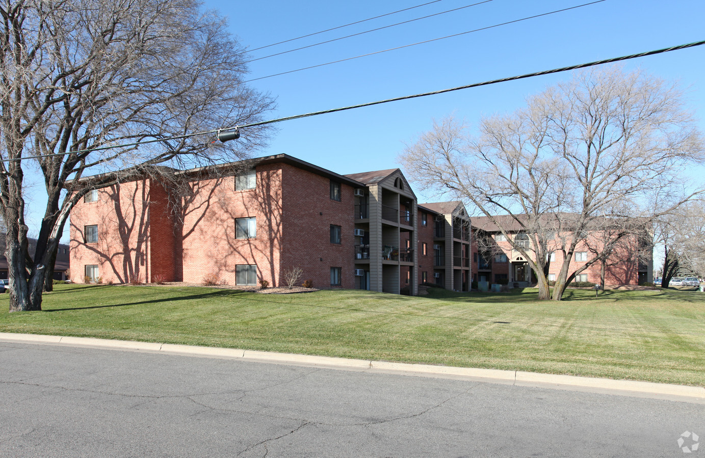
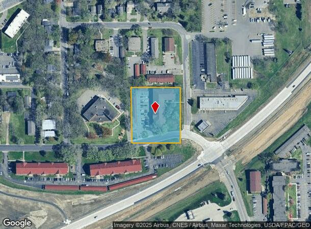
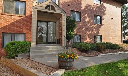
Property Record
3 14Th Ave Ne, Saint Cloud, MN 56304
NEARBY LISTINGS FOR SALE OR LEASE
Property Detail
3 14Th Ave Ne
St. Cloud, MN
Eastern Park Addn To St Cloud
17.01116.00
SECT-36 TWP-036 RANGE-031 EASTERN PARK ADDN TO ST CLOUD LOT-004 BLOCK-003 LESS WLY 26 FT
Multifamilydwelling
Benton
X
Minnesota
27145C0635E
4
2023
1.79 AC
2023
Outlying Benton County
0212003007
Minneapolis/St Paul
DEMOGRAPHICS near 3 14Th Ave Ne
1 Mile
3 Mile
5 Mile
2024 Total Population
7,558
53,495
96,101
2029 Population
7,684
55,244
99,275
Pop Growth 2024-2029
+ 1.67%
+ 3.27%
+ 3.30%
Average Age
35
35
37
2024 Total Households
3,353
20,703
38,217
HH Growth 2024-2029
+ 1.55%
+ 3.30%
+ 3.33%
Median Household Inc
$46,073
$49,734
$54,118
Avg Household Size
2.20
2.30
2.30
2024 Avg HH Vehicles
1.00
2.00
2.00
Median Home Value
$153,810
$165,923
$192,584
Median Year Built
1976
1974
1983
Nearby Places
- Restaurants
- Banks
- Shops
- Fitness
- Groceries
PUBLIC TRANSPORTATION
COMMUTER RAIL
St. Cloud Amtrak Station (Empire Builder - Amtrak)
Drive
Walk
Distance
St. Cloud Amtrak Station (Empire Builder - Amtrak)
2 min
15 min
0.8 mi
Freight Ports
Port Milwaukee
Drive
Walk
Distance
Port Milwaukee
449 min
402.3 mi
Nearby Properties
Address
Land Use
TOTAL SIZE
Lot Size
Zoning
Address
Land Use
TOTAL SIZE
Lot Size
Zoning
16.60 AC
MD
Address
Land Use
TOTAL SIZE
Lot Size
Zoning
362000
86.20 AC
Address
Land Use
TOTAL SIZE
Lot Size
Zoning
154.73 AC
I
Address
Land Use
TOTAL SIZE
Lot Size
Zoning
105264
3.26 AC
Address
Land Use
TOTAL SIZE
Lot Size
Zoning
Address
Land Use
TOTAL SIZE
Lot Size
Zoning
281127
135,381 AC
PUD95
Address
Land Use
TOTAL SIZE
Lot Size
Zoning
15.77 AC
Address
Land Use
TOTAL SIZE
Lot Size
Zoning
252469
35 AC
Address
Land Use
TOTAL SIZE
Lot Size
Zoning
Address
Land Use
TOTAL SIZE
Lot Size
Zoning
Address
Land Use
TOTAL SIZE
Lot Size
Zoning
127460
5 AC
Address
Land Use
TOTAL SIZE
Lot Size
Zoning
183627
3 AC
R3
Address
Land Use
TOTAL SIZE
Lot Size
Zoning
6.61 AC
Address
Land Use
TOTAL SIZE
Lot Size
Zoning
25608
6.96 AC
R5
Address
Land Use
TOTAL SIZE
Lot Size
Zoning
100024
0.47 AC
Address
Land Use
TOTAL SIZE
Lot Size
Zoning
Address
Land Use
TOTAL SIZE
Lot Size
Zoning
112300
2.27 AC
R3
Address
Land Use
TOTAL SIZE
Lot Size
Zoning
29349
4.83 AC
Address
Land Use
TOTAL SIZE
Lot Size
Zoning
71940
1.99 AC
Address
Land Use
TOTAL SIZE
Lot Size
Zoning
13.37 AC
Address
Land Use
TOTAL SIZE
Lot Size
Zoning
90427
9.40 AC
Address
Land Use
TOTAL SIZE
Lot Size
Zoning
136500
6.02 AC
R5
Address
Land Use
TOTAL SIZE
Lot Size
Zoning
24642
5.40 AC
R5
Address
Land Use
TOTAL SIZE
Lot Size
Zoning
4.57 AC
Address
Land Use
TOTAL SIZE
Lot Size
Zoning
80100
11.01 AC
Address
Land Use
TOTAL SIZE
Lot Size
Zoning
4.21 AC
Address
Land Use
TOTAL SIZE
Lot Size
Zoning
107428
2.67 AC
R3
Address
Land Use
TOTAL SIZE
Lot Size
Zoning
60532
1.38 AC
C4
Address
Land Use
TOTAL SIZE
Lot Size
Zoning
171311
1.77 AC
C3
Start a new search to find other properties for sale or lease
Connect with us
© 2024 CoStar Group
The information above has been obtained from sources believed reliable. While we do not doubt its accuracy we have not verified it and make no guarantee, warranty or representation about it. It is your responsibility to independently confirm its accuracy and completeness. Any projections, opinions, assumptions, or estimates used are for example only and do not represent the current or future performance of the property. The value of this transaction to you depends on tax and other factors which should be evaluated by your tax, financial, and legal advisors. You and your advisors should conduct a careful, independent investigation of the property to determine to your satisfaction the suitability of the property for your needs.