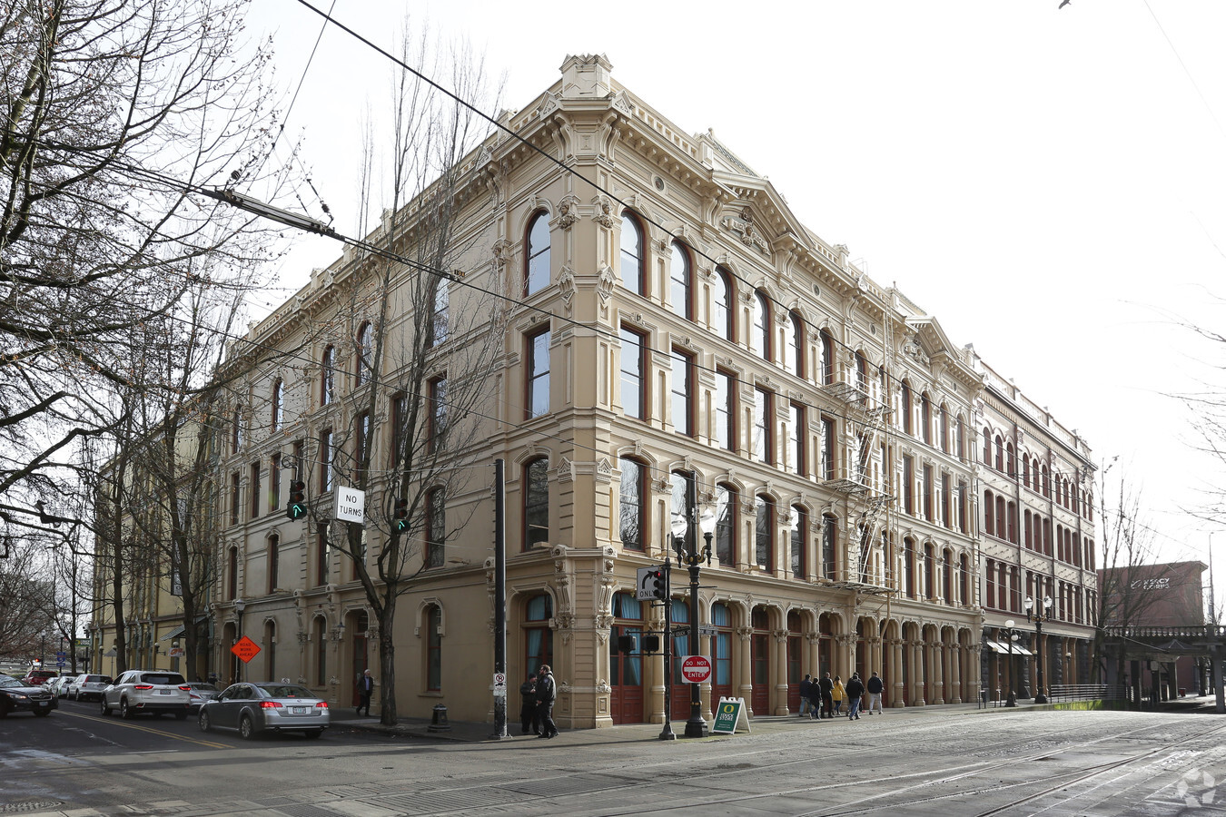
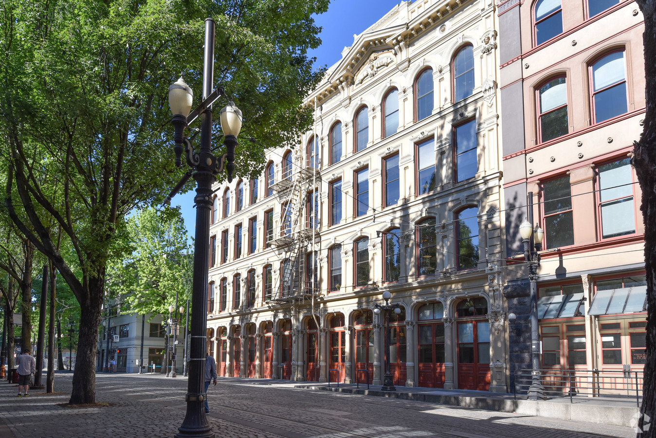
Property Record
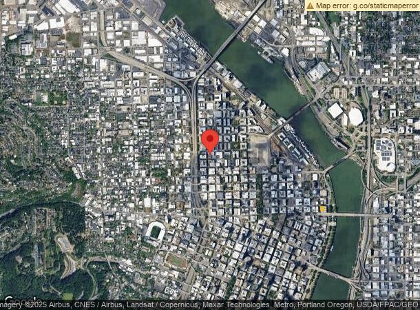
30 Nw 1St Ave, Portland, OR 97209

Current Lease Availabilities
NEARBY LISTINGS FOR SALE OR LEASE
Property Detail
30 Nw 1St Ave
Portland-Vancouver-Hillsboro, OR-WA
Couchs Add
R140327
COUCHS ADD, BLOCK 9, LOT 6&7
Commercialnec
Multnomah
X
Oregon
41067C0400E
6,7
2023
0.22 AC
2023
CBD
005001
Portland
37,000 SF
DEMOGRAPHICS near 30 Nw 1St Ave
1 Mile
3 Mile
5 Mile
2024 Total Population
39,566
211,342
438,039
2029 Population
39,904
209,720
431,634
Pop Growth 2024-2029
+ 0.85%
(0.77%)
(1.46%)
Average Age
42
40
40
2024 Total Households
25,255
109,808
203,082
HH Growth 2024-2029
+ 0.76%
(0.75%)
(1.50%)
Median Household Inc
$60,105
$83,871
$88,846
Avg Household Size
1.40
1.80
2.00
2024 Avg HH Vehicles
1.00
1.00
1.00
Median Home Value
$682,561
$717,189
$651,712
Median Year Built
2001
1968
1959
Nearby Places
- Restaurants
- Banks
- Shops
- Fitness
- Groceries
PUBLIC TRANSPORTATION
TRANSIT/SUBWAY
Nw 13Th & Lovejoy (Portland Streetcar - Tri-County Metropolitan Transportation District of Oregon Rail (TriMet Rail))
DRIVE
WALK
Distance
Nw 13Th & Lovejoy (Portland Streetcar - Tri-County Metropolitan Transportation District of Oregon Rail (TriMet Rail))
0 min
3 min
0.2 mi
Nw 11Th & Johnson (Portland Streetcar - Tri-County Metropolitan Transportation District of Oregon Rail (TriMet Rail))
DRIVE
WALK
Distance
Nw 11Th & Johnson (Portland Streetcar - Tri-County Metropolitan Transportation District of Oregon Rail (TriMet Rail))
1 min
3 min
0.2 mi
Nw 14Th & Northrup (Portland Streetcar - Tri-County Metropolitan Transportation District of Oregon Rail (TriMet Rail))
DRIVE
WALK
Distance
Nw 14Th & Northrup (Portland Streetcar - Tri-County Metropolitan Transportation District of Oregon Rail (TriMet Rail))
1 min
4 min
0.2 mi
Nw 10Th & Johnson (Portland Streetcar - Tri-County Metropolitan Transportation District of Oregon Rail (TriMet Rail))
DRIVE
WALK
Distance
Nw 10Th & Johnson (Portland Streetcar - Tri-County Metropolitan Transportation District of Oregon Rail (TriMet Rail))
2 min
4 min
0.2 mi
Nw 11Th & Glisan (Portland Streetcar - Tri-County Metropolitan Transportation District of Oregon Rail (TriMet Rail))
DRIVE
WALK
Distance
Nw 11Th & Glisan (Portland Streetcar - Tri-County Metropolitan Transportation District of Oregon Rail (TriMet Rail))
1 min
4 min
0.3 mi
COMMUTER RAIL
Portland (Amtrak Cascades - Amtrak, Coast Starlight - Amtrak, Empire Builder - Amtrak)
DRIVE
WALK
Distance
Portland (Amtrak Cascades - Amtrak, Coast Starlight - Amtrak, Empire Builder - Amtrak)
3 min
11 min
0.6 mi
Beaverton Transit Center (West Side Express) (Westside Express Service - Tri-County Metropolitan Transportation District of Oregon Rail (TriMet Rail))
DRIVE
WALK
Distance
Beaverton Transit Center (West Side Express) (Westside Express Service - Tri-County Metropolitan Transportation District of Oregon Rail (TriMet Rail))
15 min
8.3 mi
AIRPORT
Portland International
DRIVE
WALK
Distance
Portland International
23 min
11.5 mi
Freight Ports
Port of Portland
DRIVE
WALK
Distance
Port of Portland
5 min
1.8 mi
Nearby Properties
Address
Land Use
TOTAL SIZE
Lot Size
Zoning
Address
Land Use
TOTAL SIZE
Lot Size
Zoning
395,815 SF
2.66 AC
IRD
Address
Land Use
TOTAL SIZE
Lot Size
Zoning
27.58 AC
EX
Address
Land Use
TOTAL SIZE
Lot Size
Zoning
627,500 SF
16.60 AC
CX
Address
Land Use
TOTAL SIZE
Lot Size
Zoning
334,488 SF
14.19 AC
EX
Address
Land Use
TOTAL SIZE
Lot Size
Zoning
560,000 SF
0.15 AC
CX
Address
Land Use
TOTAL SIZE
Lot Size
Zoning
632,424 SF
12.32 AC
CX
Address
Land Use
TOTAL SIZE
Lot Size
Zoning
326,547 SF
2.42 AC
RH
Address
Land Use
TOTAL SIZE
Lot Size
Zoning
57,314 SF
60.69 AC
OS
Address
Land Use
TOTAL SIZE
Lot Size
Zoning
417,324 SF
0.68 AC
CX
Address
Land Use
TOTAL SIZE
Lot Size
Zoning
409,260 SF
7.41 AC
EX
Address
Land Use
TOTAL SIZE
Lot Size
Zoning
20.71 AC
OS
Address
Land Use
TOTAL SIZE
Lot Size
Zoning
1.09 AC
EX
Address
Land Use
TOTAL SIZE
Lot Size
Zoning
2.24 AC
CX
Address
Land Use
TOTAL SIZE
Lot Size
Zoning
460,000 SF
0.92 AC
CX
Address
Land Use
TOTAL SIZE
Lot Size
Zoning
596,161 SF
0.92 AC
CX
Address
Land Use
TOTAL SIZE
Lot Size
Zoning
559,646 SF
0.92 AC
CXD
Address
Land Use
TOTAL SIZE
Lot Size
Zoning
257,700 SF
2.89 AC
EX
Address
Land Use
TOTAL SIZE
Lot Size
Zoning
0.48 AC
NULL
Address
Land Use
TOTAL SIZE
Lot Size
Zoning
356,314 SF
3.05 AC
CX
Address
Land Use
TOTAL SIZE
Lot Size
Zoning
247,520 SF
7.74 AC
CX
Address
Land Use
TOTAL SIZE
Lot Size
Zoning
128,500 SF
6.95 AC
OS
Address
Land Use
TOTAL SIZE
Lot Size
Zoning
306,000 SF
1.21 AC
NULL
Address
Land Use
TOTAL SIZE
Lot Size
Zoning
178,785 SF
10.20 AC
R5
Address
Land Use
TOTAL SIZE
Lot Size
Zoning
125,217 SF
0.23 AC
CX
Address
Land Use
TOTAL SIZE
Lot Size
Zoning
7.78 AC
EX
Address
Land Use
TOTAL SIZE
Lot Size
Zoning
208,000 SF
6.08 AC
IG1GS
Address
Land Use
TOTAL SIZE
Lot Size
Zoning
689,840 SF
0.92 AC
CX
Address
Land Use
TOTAL SIZE
Lot Size
Zoning
291,451 SF
1.64 AC
RH
Address
Land Use
TOTAL SIZE
Lot Size
Zoning
440,000 SF
1.80 AC
CX
Address
Land Use
TOTAL SIZE
Lot Size
Zoning
584,483 SF
0.90 AC
CX
The World's #1 Commercial Real Estate Marketplace
Connect with us
© 2025 CoStar Group
The information above has been obtained from sources believed reliable. While we do not doubt its accuracy we have not verified it and make no guarantee, warranty or representation about it. It is your responsibility to independently confirm its accuracy and completeness. Any projections, opinions, assumptions, or estimates used are for example only and do not represent the current or future performance of the property. The value of this transaction to you depends on tax and other factors which should be evaluated by your tax, financial, and legal advisors. You and your advisors should conduct a careful, independent investigation of the property to determine to your satisfaction the suitability of the property for your needs.