Property Record
30 Industrial Way, Seekonk, MA 02771
NEARBY LISTINGS FOR SALE OR LEASE
Property Detail
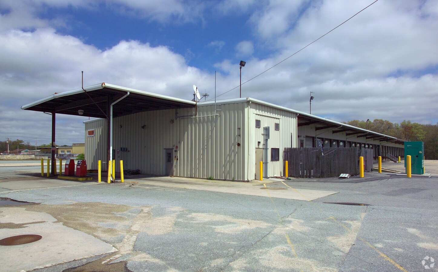
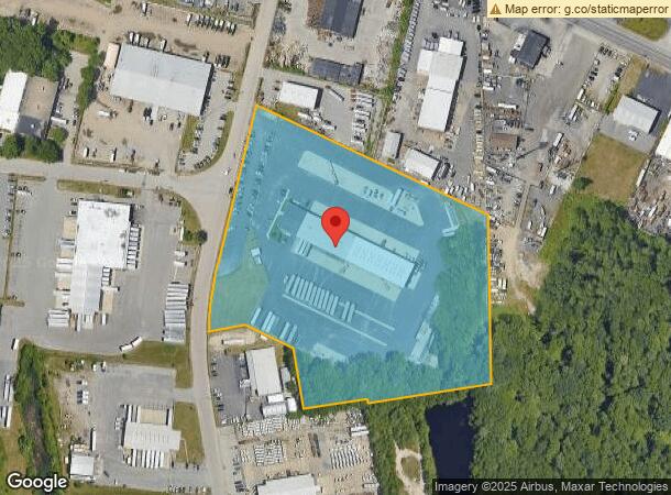
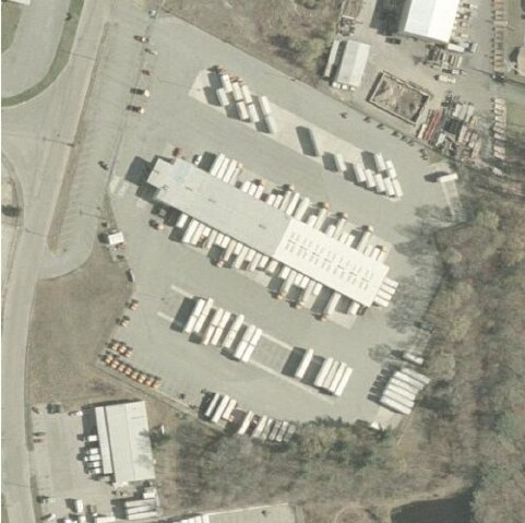
30 Industrial Way
SEEK-000010-000000-001200
Bristol
Autorepair
Massachusetts
X
1200
25005C0218G
9.69 AC
2025
Attleboro/New Bedford
2025
Boston
632200
Providence-Warwick, RI-MA
20,910 SF
DEMOGRAPHICS near 30 Industrial Way
1 Mile
3 Mile
5 Mile
2024 Total Population
1,306
30,383
104,507
2029 Population
1,296
30,367
104,165
Pop Growth 2024-2029
(0.77%)
(0.05%)
(0.33%)
Average Age
44
43
43
2024 Total Households
482
11,855
42,917
HH Growth 2024-2029
(0.62%)
(0.09%)
(0.40%)
Median Household Inc
$119,520
$104,071
$85,225
Avg Household Size
2.60
2.50
2.30
2024 Avg HH Vehicles
2.00
2.00
2.00
Median Home Value
$468,939
$384,011
$370,679
Median Year Built
1970
1964
1958
Nearby Places
- Restaurants
- Banks
- Shops
- Fitness
- Groceries
PUBLIC TRANSPORTATION
COMMUTER RAIL
Providence (Providence/Stoughton Line - Massachusetts Bay Transportation Authority Commuter Rail (Purple Line))
DRIVE
WALK
Distance
Providence (Providence/Stoughton Line - Massachusetts Bay Transportation Authority Commuter Rail (Purple Line))
13 min
7.2 mi
AIRPORT
Rhode Island Tf Green International
DRIVE
WALK
Distance
Rhode Island Tf Green International
26 min
14.1 mi
Freight Ports
Port of Davisville, RI
DRIVE
WALK
Distance
Port of Davisville, RI
43 min
26.4 mi
Nearby Properties
Address
Land Use
TOTAL SIZE
Lot Size
Zoning
Address
Land Use
TOTAL SIZE
Lot Size
Zoning
187,151 SF
29.41 AC
RE
Address
Land Use
TOTAL SIZE
Lot Size
Zoning
455.47 AC
I3
Address
Land Use
TOTAL SIZE
Lot Size
Zoning
225,067 SF
40.70 AC
HB
Address
Land Use
TOTAL SIZE
Lot Size
Zoning
248,000 SF
75.88 AC
I
Address
Land Use
TOTAL SIZE
Lot Size
Zoning
139.58 AC
O1
Address
Land Use
TOTAL SIZE
Lot Size
Zoning
183,710 SF
30.50 AC
RE
Address
Land Use
TOTAL SIZE
Lot Size
Zoning
25.24 AC
R10
Address
Land Use
TOTAL SIZE
Lot Size
Zoning
179,889 SF
17.96 AC
C
Address
Land Use
TOTAL SIZE
Lot Size
Zoning
225,458 SF
24.95 AC
I1
Address
Land Use
TOTAL SIZE
Lot Size
Zoning
2.71 AC
B
Address
Land Use
TOTAL SIZE
Lot Size
Zoning
105,859 SF
16.08 AC
HB
Address
Land Use
TOTAL SIZE
Lot Size
Zoning
105,859 SF
16.08 AC
HB
Address
Land Use
TOTAL SIZE
Lot Size
Zoning
139,692 SF
15.92 AC
HB
Address
Land Use
TOTAL SIZE
Lot Size
Zoning
133,632 SF
17.49 AC
I3
Address
Land Use
TOTAL SIZE
Lot Size
Zoning
7.44 AC
R5
Address
Land Use
TOTAL SIZE
Lot Size
Zoning
126,183 SF
13.02 AC
HB
Address
Land Use
TOTAL SIZE
Lot Size
Zoning
117,041 SF
14.71 AC
HB
Address
Land Use
TOTAL SIZE
Lot Size
Zoning
84,316 SF
8.15 AC
C1
Address
Land Use
TOTAL SIZE
Lot Size
Zoning
91,883 SF
8 AC
HB
Address
Land Use
TOTAL SIZE
Lot Size
Zoning
91,883 SF
8 AC
HB
Address
Land Use
TOTAL SIZE
Lot Size
Zoning
107,352 SF
15.30 AC
HB
Address
Land Use
TOTAL SIZE
Lot Size
Zoning
132,452 SF
17.10 AC
HB
Address
Land Use
TOTAL SIZE
Lot Size
Zoning
9.81 AC
R5
Address
Land Use
TOTAL SIZE
Lot Size
Zoning
4.39 AC
B
Address
Land Use
TOTAL SIZE
Lot Size
Zoning
122,243 SF
23.30 AC
HB
Address
Land Use
TOTAL SIZE
Lot Size
Zoning
4.60 AC
C1
Address
Land Use
TOTAL SIZE
Lot Size
Zoning
95,787 SF
8.27 AC
HB
Address
Land Use
TOTAL SIZE
Lot Size
Zoning
146,320 SF
11.68 AC
HB
Address
Land Use
TOTAL SIZE
Lot Size
Zoning
71,150 SF
4.46 AC
C1
Address
Land Use
TOTAL SIZE
Lot Size
Zoning
113,626 SF
11.31 AC
HB
The World's #1 Commercial Real Estate Marketplace
Connect with us
© 2025 CoStar Group
The information above has been obtained from sources believed reliable. While we do not doubt its accuracy we have not verified it and make no guarantee, warranty or representation about it. It is your responsibility to independently confirm its accuracy and completeness. Any projections, opinions, assumptions, or estimates used are for example only and do not represent the current or future performance of the property. The value of this transaction to you depends on tax and other factors which should be evaluated by your tax, financial, and legal advisors. You and your advisors should conduct a careful, independent investigation of the property to determine to your satisfaction the suitability of the property for your needs.