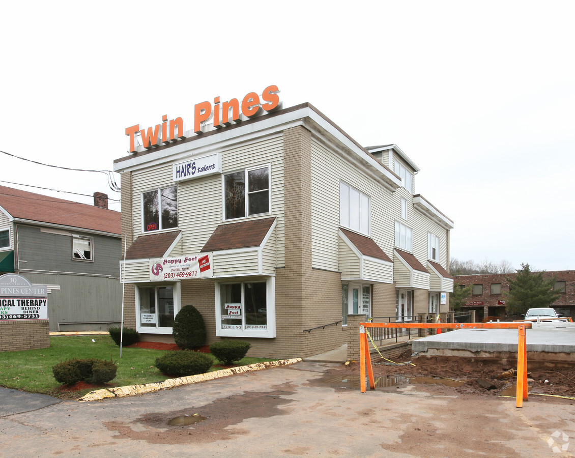
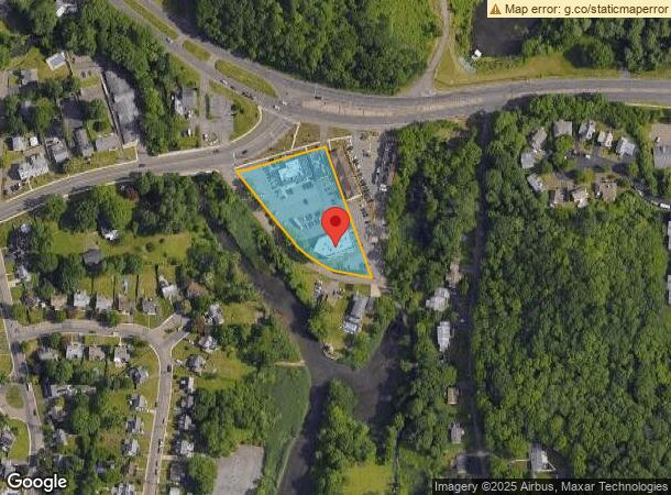
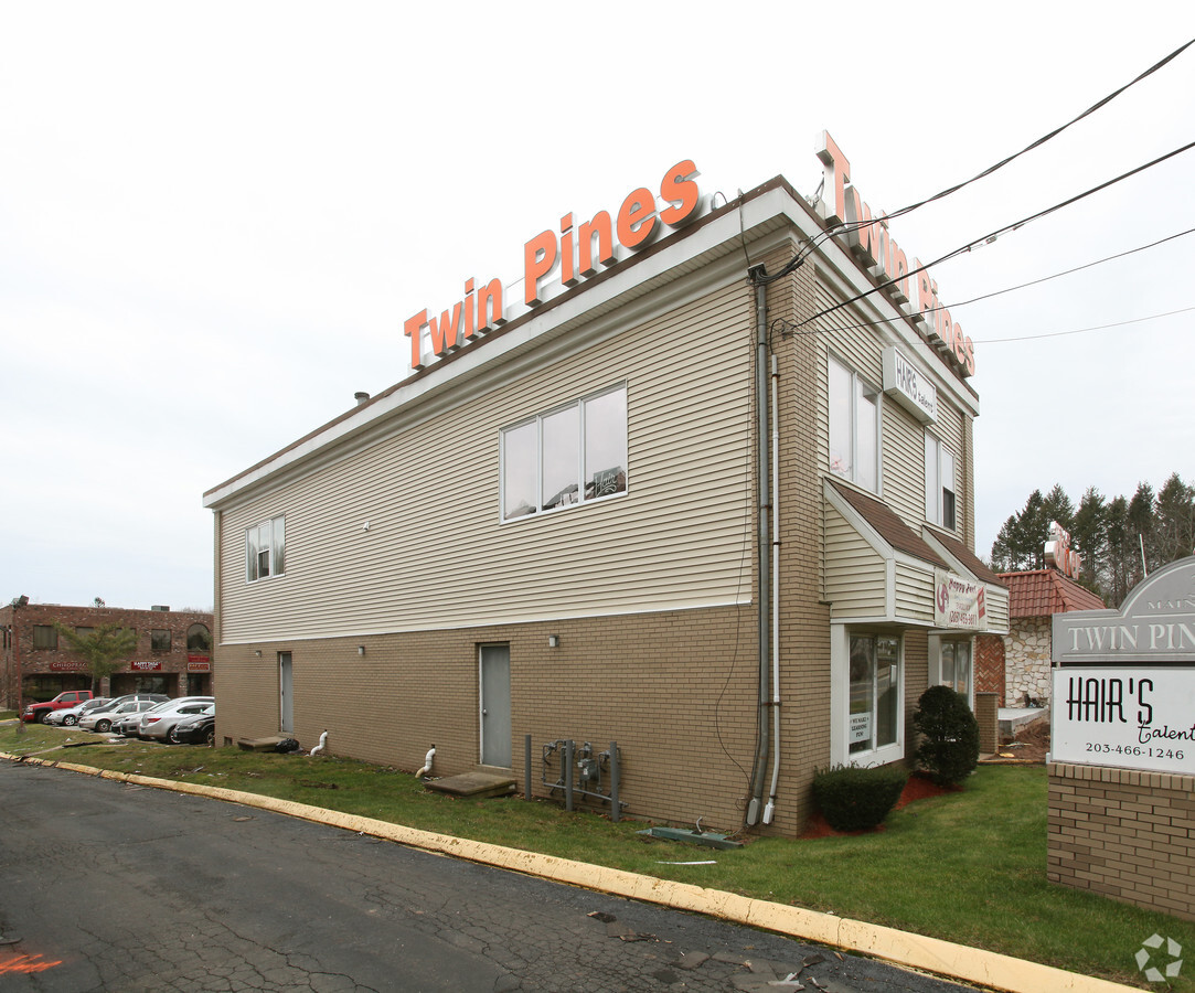
Property Record
34 Main St, East Haven, CT 06512
NEARBY LISTINGS FOR SALE OR LEASE
Property Detail
34 Main St
EHAV-000220-002521-000002
New Haven
Commercialnec
Connecticut
AE
2
09009C0463K
1.28 AC
2024
East Haven
2024
Westchester/So Connecticut
180300
New Haven-Milford, CT
DEMOGRAPHICS near 34 Main St
1 Mile
3 Mile
5 Mile
2024 Total Population
9,042
65,019
173,587
2029 Population
9,108
64,694
172,207
Pop Growth 2024-2029
+ 0.73%
(0.50%)
(0.79%)
Average Age
42
42
39
2024 Total Households
3,793
27,842
71,563
HH Growth 2024-2029
+ 0.63%
(0.42%)
(0.68%)
Median Household Inc
$67,777
$64,649
$60,508
Avg Household Size
2.30
2.30
2.20
2024 Avg HH Vehicles
2.00
2.00
1.00
Median Home Value
$241,630
$255,283
$259,648
Median Year Built
1968
1965
1960
Nearby Places
- Restaurants
- Banks
- Shops
- Fitness
- Groceries
PUBLIC TRANSPORTATION
COMMUTER RAIL
Branford (Shore Line East - Shore Line East)
DRIVE
WALK
Distance
Branford (Shore Line East - Shore Line East)
5 min
2.9 mi
New Haven-Union Station (New Haven Line - Shore Line East, Shore Line East - Shore Line East)
DRIVE
WALK
Distance
New Haven-Union Station (New Haven Line - Shore Line East, Shore Line East - Shore Line East)
8 min
4.4 mi
AIRPORT
Tweed/New Haven
DRIVE
WALK
Distance
Tweed/New Haven
5 min
1.8 mi
Freight Ports
Port of New Haven
DRIVE
WALK
Distance
Port of New Haven
6 min
2.9 mi
SALE & LEASE HISTORY
LISTING DATE
SALE/LEASE

Mar 29, 2022
For Lease
Nearby Properties
Address
Land Use
TOTAL SIZE
Lot Size
Zoning
Address
Land Use
TOTAL SIZE
Lot Size
Zoning
68,706 SF
3.34 AC
BA
Address
Land Use
TOTAL SIZE
Lot Size
Zoning
117,066 SF
71.34 AC
IH
Address
Land Use
TOTAL SIZE
Lot Size
Zoning
8,655 SF
107.61 AC
RS2
Address
Land Use
TOTAL SIZE
Lot Size
Zoning
163,505 SF
3.96 AC
BA
Address
Land Use
TOTAL SIZE
Lot Size
Zoning
17,462 SF
86.34 AC
PARK
Address
Land Use
TOTAL SIZE
Lot Size
Zoning
85,679 SF
14.23 AC
RM2
Address
Land Use
TOTAL SIZE
Lot Size
Zoning
197.78 AC
LI-3
Address
Land Use
TOTAL SIZE
Lot Size
Zoning
132,592 SF
4.61 AC
RM1
Address
Land Use
TOTAL SIZE
Lot Size
Zoning
5,946 SF
0.09 AC
RS2
Address
Land Use
TOTAL SIZE
Lot Size
Zoning
7.72 AC
RA-1
Address
Land Use
TOTAL SIZE
Lot Size
Zoning
98,475 SF
2.83 AC
IH
Address
Land Use
TOTAL SIZE
Lot Size
Zoning
306,943 SF
1.92 AC
RM1
Address
Land Use
TOTAL SIZE
Lot Size
Zoning
1,932 SF
64.06 AC
RS2
Address
Land Use
TOTAL SIZE
Lot Size
Zoning
249,513 SF
6.57 AC
RM1
Address
Land Use
TOTAL SIZE
Lot Size
Zoning
35 AC
RA-1
Address
Land Use
TOTAL SIZE
Lot Size
Zoning
276,776 SF
4.98 AC
RM1
Address
Land Use
TOTAL SIZE
Lot Size
Zoning
2,299 SF
14.94 AC
RA-1
Address
Land Use
TOTAL SIZE
Lot Size
Zoning
96,449 SF
1.67 AC
RS2
Address
Land Use
TOTAL SIZE
Lot Size
Zoning
48,726 SF
9.46 AC
Address
Land Use
TOTAL SIZE
Lot Size
Zoning
19.26 AC
R-2
Address
Land Use
TOTAL SIZE
Lot Size
Zoning
9.34 AC
CA-1
Address
Land Use
TOTAL SIZE
Lot Size
Zoning
105,998 SF
13.68 AC
PDD
Address
Land Use
TOTAL SIZE
Lot Size
Zoning
128,524 SF
2.01 AC
IH
Address
Land Use
TOTAL SIZE
Lot Size
Zoning
16.57 AC
Address
Land Use
TOTAL SIZE
Lot Size
Zoning
2,816 SF
Address
Land Use
TOTAL SIZE
Lot Size
Zoning
5,596 SF
37.74 AC
IH
Address
Land Use
TOTAL SIZE
Lot Size
Zoning
5.50 AC
Address
Land Use
TOTAL SIZE
Lot Size
Zoning
109,119 SF
CA-1
Address
Land Use
TOTAL SIZE
Lot Size
Zoning
20.90 AC
Address
Land Use
TOTAL SIZE
Lot Size
Zoning
19.53 AC
The World's #1 Commercial Real Estate Marketplace
Connect with us
© 2025 CoStar Group
The information above has been obtained from sources believed reliable. While we do not doubt its accuracy we have not verified it and make no guarantee, warranty or representation about it. It is your responsibility to independently confirm its accuracy and completeness. Any projections, opinions, assumptions, or estimates used are for example only and do not represent the current or future performance of the property. The value of this transaction to you depends on tax and other factors which should be evaluated by your tax, financial, and legal advisors. You and your advisors should conduct a careful, independent investigation of the property to determine to your satisfaction the suitability of the property for your needs.