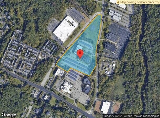
Property Record
30 Vreeland Rd, Florham Park, NJ 07932

NEARBY LISTINGS FOR SALE OR LEASE
Property Detail
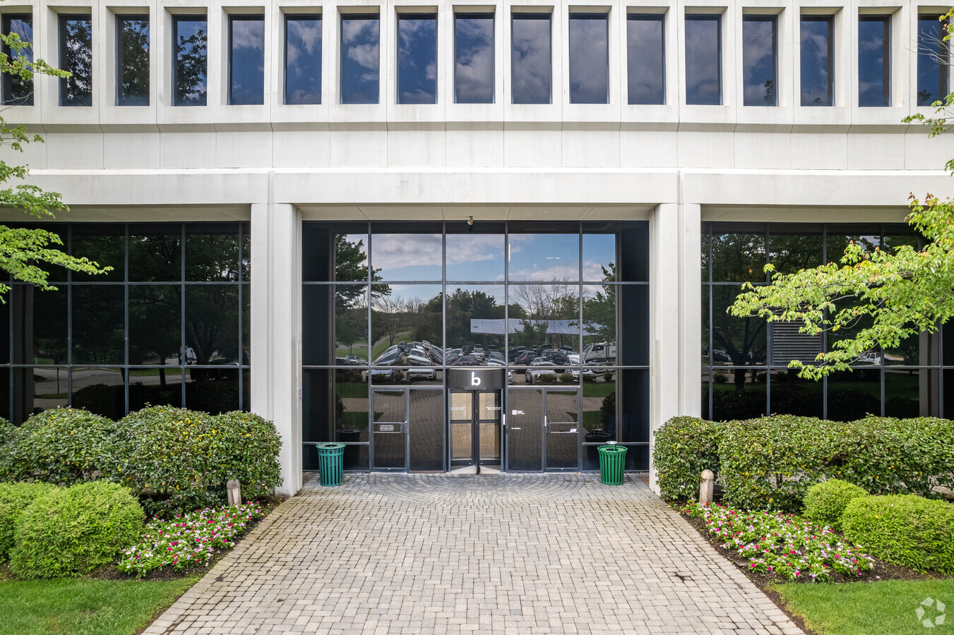
30 Vreeland Rd
11-00302-0000-00001
Morris
Officebuilding
New Jersey
AE
1
34013C0086G
15.35 AC
2023
Morristown Region
2024
Northern New Jersey
042602
Newark, NJ-PA
DEMOGRAPHICS near 30 Vreeland Rd
1 Mile
3 Mile
5 Mile
2024 Total Population
2,947
50,852
158,286
2029 Population
2,940
50,686
157,870
Pop Growth 2024-2029
(0.24%)
(0.33%)
(0.26%)
Average Age
44
42
42
2024 Total Households
1,178
17,882
55,421
HH Growth 2024-2029
(0.42%)
(0.38%)
(0.42%)
Median Household Inc
$144,699
$151,191
$165,763
Avg Household Size
2.50
2.70
2.70
2024 Avg HH Vehicles
2.00
2.00
2.00
Median Home Value
$711,326
$726,019
$767,911
Median Year Built
1980
1966
1964
Nearby Places
- Restaurants
- Banks
- Shops
- Fitness
- Groceries
PUBLIC TRANSPORTATION
COMMUTER RAIL
Madison (Morris & Essex Morristown Line - NJ Transit Commuter Rail (NJ Transit))
DRIVE
WALK
Distance
Madison (Morris & Essex Morristown Line - NJ Transit Commuter Rail (NJ Transit))
9 min
3.9 mi
Chatham (Morris & Essex Morristown Line - NJ Transit Commuter Rail (NJ Transit))
DRIVE
WALK
Distance
Chatham (Morris & Essex Morristown Line - NJ Transit Commuter Rail (NJ Transit))
11 min
4.7 mi
AIRPORT
Newark Liberty International
DRIVE
WALK
Distance
Newark Liberty International
28 min
18.4 mi
Laguardia
DRIVE
WALK
Distance
Laguardia
60 min
41.6 mi
Freight Ports
Maher Terminal
DRIVE
WALK
Distance
Maher Terminal
30 min
18.8 mi
SALE & LEASE HISTORY
LISTING DATE
SALE/LEASE

Sep 24, 2016
For Lease
Oct 14, 2022
For Lease
May 26, 2017
For Lease
Jun 04, 2019
For Lease
Jan 08, 2019
For Lease
Aug 02, 2019
For Lease
Apr 19, 2021
For Lease
Nearby Properties
Address
Land Use
TOTAL SIZE
Lot Size
Zoning
Address
Land Use
TOTAL SIZE
Lot Size
Zoning
701 SF
111.59 AC
SED
Address
Land Use
TOTAL SIZE
Lot Size
Zoning
64.30 AC
MF-4
Address
Land Use
TOTAL SIZE
Lot Size
Zoning
64.80 AC
C-4
Address
Land Use
TOTAL SIZE
Lot Size
Zoning
42.64 AC
D-S
Address
Land Use
TOTAL SIZE
Lot Size
Zoning
9.80 AC
Address
Land Use
TOTAL SIZE
Lot Size
Zoning
31.03 AC
R-L
Address
Land Use
TOTAL SIZE
Lot Size
Zoning
19.05 AC
R-2
Address
Land Use
TOTAL SIZE
Lot Size
Zoning
Address
Land Use
TOTAL SIZE
Lot Size
Zoning
270,000 SF
15.32 AC
OR
Address
Land Use
TOTAL SIZE
Lot Size
Zoning
41.19 AC
MF-C
Address
Land Use
TOTAL SIZE
Lot Size
Zoning
43.60 AC
C-4
Address
Land Use
TOTAL SIZE
Lot Size
Zoning
18.98 AC
R-5B
Address
Land Use
TOTAL SIZE
Lot Size
Zoning
296,578 SF
15 AC
Address
Land Use
TOTAL SIZE
Lot Size
Zoning
Address
Land Use
TOTAL SIZE
Lot Size
Zoning
19.70 AC
R-4
Address
Land Use
TOTAL SIZE
Lot Size
Zoning
27.20 AC
PODS
Address
Land Use
TOTAL SIZE
Lot Size
Zoning
17.26 AC
R-L
Address
Land Use
TOTAL SIZE
Lot Size
Zoning
20.97 AC
R-2
Address
Land Use
TOTAL SIZE
Lot Size
Zoning
304,213 SF
21.73 AC
PODS
Address
Land Use
TOTAL SIZE
Lot Size
Zoning
60 AC
R-L
Address
Land Use
TOTAL SIZE
Lot Size
Zoning
55.22 AC
R-2
Address
Land Use
TOTAL SIZE
Lot Size
Zoning
35.55 AC
P-B2
Address
Land Use
TOTAL SIZE
Lot Size
Zoning
58.64 AC
I
Address
Land Use
TOTAL SIZE
Lot Size
Zoning
15.80 AC
D-S
Address
Land Use
TOTAL SIZE
Lot Size
Zoning
336,832 SF
46.12 AC
R-L
Address
Land Use
TOTAL SIZE
Lot Size
Zoning
6.64 AC
Address
Land Use
TOTAL SIZE
Lot Size
Zoning
27.50 AC
C-4
Address
Land Use
TOTAL SIZE
Lot Size
Zoning
15.50 AC
R-1
Address
Land Use
TOTAL SIZE
Lot Size
Zoning
252,828 SF
44.53 AC
C-1
Address
Land Use
TOTAL SIZE
Lot Size
Zoning
30.70 AC
R-L
The World's #1 Commercial Real Estate Marketplace
Connect with us
© 2025 CoStar Group
The information above has been obtained from sources believed reliable. While we do not doubt its accuracy we have not verified it and make no guarantee, warranty or representation about it. It is your responsibility to independently confirm its accuracy and completeness. Any projections, opinions, assumptions, or estimates used are for example only and do not represent the current or future performance of the property. The value of this transaction to you depends on tax and other factors which should be evaluated by your tax, financial, and legal advisors. You and your advisors should conduct a careful, independent investigation of the property to determine to your satisfaction the suitability of the property for your needs.