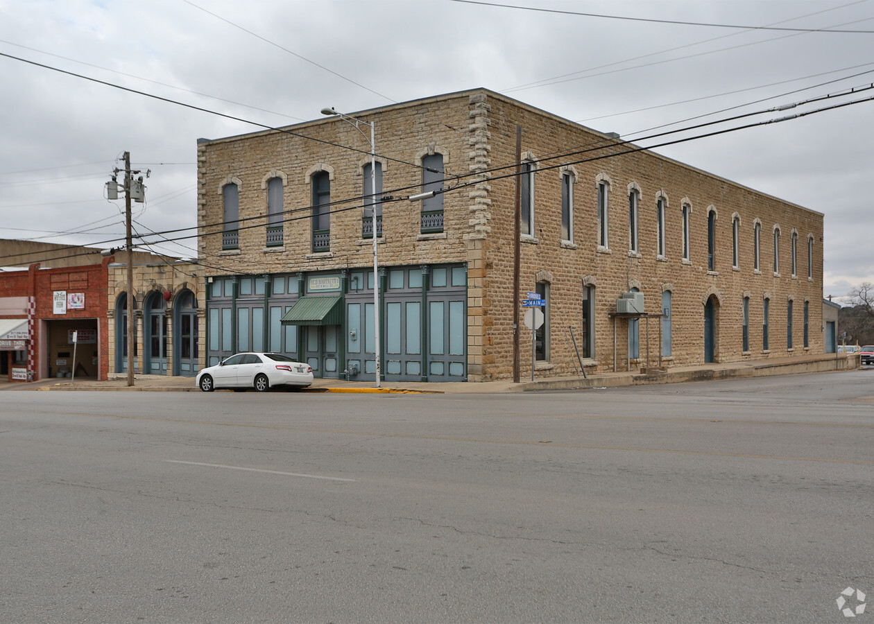
Property Record
300 N Main St, Weatherford, TX 76086

NEARBY LISTINGS FOR SALE OR LEASE
Property Detail
300 N Main St
Dallas-Fort Worth-Arlington, TX
Weatherford Original Town
R000030417
ACRES: 0.283 LOT: 10-12 BLK: 37 SUBD: WEATHERFORD ORIGINAL TOWN (SHANNONS S/D)
Commercialnec
Parker
X
Texas
48367C0270E
10-12
2023
0.28 AC
2023
Parker County
140201
Dallas/Ft Worth
19,712 SF
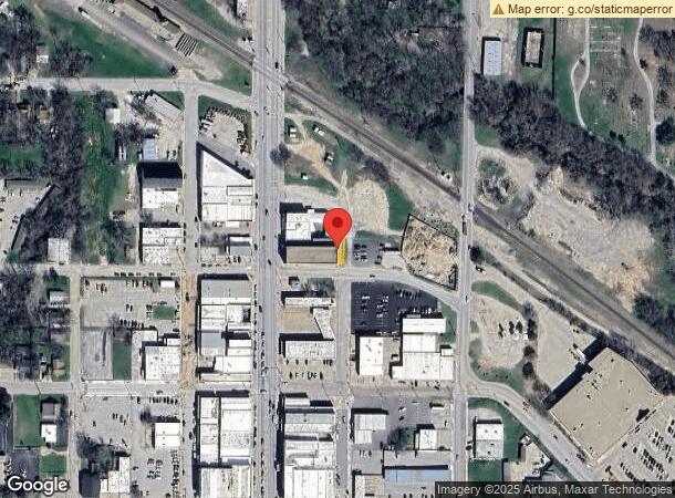
DEMOGRAPHICS near 300 N Main St
1 Mile
3 Mile
5 Mile
2024 Total Population
7,901
32,271
49,444
2029 Population
10,155
41,692
63,926
Pop Growth 2024-2029
+ 28.53%
+ 29.19%
+ 29.29%
Average Age
39
40
40
2024 Total Households
3,185
12,721
19,052
HH Growth 2024-2029
+ 28.54%
+ 29.27%
+ 29.33%
Median Household Inc
$46,794
$62,565
$67,526
Avg Household Size
2.40
2.40
2.50
2024 Avg HH Vehicles
2.00
2.00
2.00
Median Home Value
$209,579
$243,337
$279,008
Median Year Built
1974
1992
1999
Nearby Places
- Restaurants
- Banks
- Shops
- Fitness
- Groceries
Nearby Properties
Address
Land Use
TOTAL SIZE
Lot Size
Zoning
Address
Land Use
TOTAL SIZE
Lot Size
Zoning
399,466 SF
11.50 AC
Address
Land Use
TOTAL SIZE
Lot Size
Zoning
341,996 SF
16.60 AC
Address
Land Use
TOTAL SIZE
Lot Size
Zoning
64.64 AC
Address
Land Use
TOTAL SIZE
Lot Size
Zoning
279,600 SF
14.43 AC
Address
Land Use
TOTAL SIZE
Lot Size
Zoning
171,147 SF
8.77 AC
Address
Land Use
TOTAL SIZE
Lot Size
Zoning
167,850 SF
13.50 AC
Address
Land Use
TOTAL SIZE
Lot Size
Zoning
141,292 SF
13.88 AC
Address
Land Use
TOTAL SIZE
Lot Size
Zoning
103,600 SF
6 AC
Address
Land Use
TOTAL SIZE
Lot Size
Zoning
75,854 SF
8.84 AC
Address
Land Use
TOTAL SIZE
Lot Size
Zoning
210,698 SF
26.61 AC
Address
Land Use
TOTAL SIZE
Lot Size
Zoning
31.61 AC
Address
Land Use
TOTAL SIZE
Lot Size
Zoning
6.95 AC
Address
Land Use
TOTAL SIZE
Lot Size
Zoning
23,886 SF
23.19 AC
Address
Land Use
TOTAL SIZE
Lot Size
Zoning
50,446 SF
2.05 AC
Address
Land Use
TOTAL SIZE
Lot Size
Zoning
104,188 SF
12.73 AC
Address
Land Use
TOTAL SIZE
Lot Size
Zoning
55,112 SF
4.68 AC
Address
Land Use
TOTAL SIZE
Lot Size
Zoning
123,606 SF
10.27 AC
Address
Land Use
TOTAL SIZE
Lot Size
Zoning
134,934 SF
13.23 AC
Address
Land Use
TOTAL SIZE
Lot Size
Zoning
155,253 SF
9.31 AC
Address
Land Use
TOTAL SIZE
Lot Size
Zoning
26,050 SF
5.44 AC
Address
Land Use
TOTAL SIZE
Lot Size
Zoning
81,112 SF
7.34 AC
Address
Land Use
TOTAL SIZE
Lot Size
Zoning
33,650 SF
4 AC
Address
Land Use
TOTAL SIZE
Lot Size
Zoning
65,586 SF
2.98 AC
Address
Land Use
TOTAL SIZE
Lot Size
Zoning
103,125 SF
6.70 AC
Address
Land Use
TOTAL SIZE
Lot Size
Zoning
27,669 SF
3.58 AC
Address
Land Use
TOTAL SIZE
Lot Size
Zoning
29,460 SF
3.67 AC
Address
Land Use
TOTAL SIZE
Lot Size
Zoning
146,651 SF
7.73 AC
Address
Land Use
TOTAL SIZE
Lot Size
Zoning
50,893 SF
10.37 AC
Address
Land Use
TOTAL SIZE
Lot Size
Zoning
7,600 SF
0.85 AC
Address
Land Use
TOTAL SIZE
Lot Size
Zoning
109,420 SF
14.61 AC
The World's #1 Commercial Real Estate Marketplace
Connect with us
© 2025 CoStar Group
The information above has been obtained from sources believed reliable. While we do not doubt its accuracy we have not verified it and make no guarantee, warranty or representation about it. It is your responsibility to independently confirm its accuracy and completeness. Any projections, opinions, assumptions, or estimates used are for example only and do not represent the current or future performance of the property. The value of this transaction to you depends on tax and other factors which should be evaluated by your tax, financial, and legal advisors. You and your advisors should conduct a careful, independent investigation of the property to determine to your satisfaction the suitability of the property for your needs.