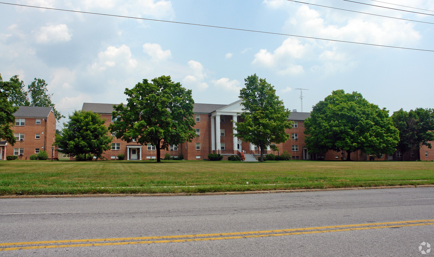
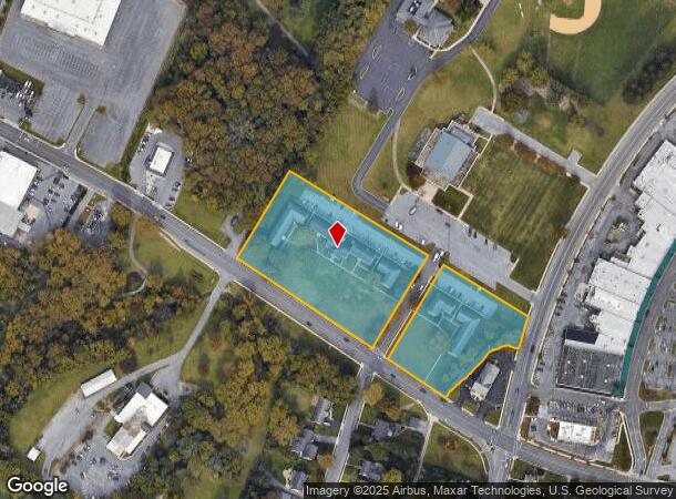
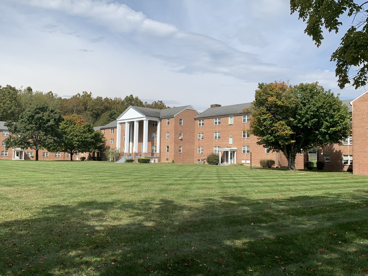
Property Record
300 Northern Ave, Hagerstown, MD 21742

NEARBY LISTINGS FOR SALE OR LEASE
Property Detail
300 Northern Ave
Hagerstown-Martinsburg, MD-WV
Hagerstown Manufacturing Minin
21-010731
4.414 ACRES 300 NORTHERN AVE
Multifamilydwelling
Washington
AE
Maryland
24043C0137D
594
2024
4 AC
2024
Outer Robinwood/Paramnt/Fountain Head
010300
Washington, DC
57,162 SF
DEMOGRAPHICS near 300 Northern Ave
1 Mile
3 Mile
5 Mile
2024 Total Population
9,971
57,523
89,800
2029 Population
10,127
58,345
90,960
Pop Growth 2024-2029
+ 1.56%
+ 1.43%
+ 1.29%
Average Age
41
39
40
2024 Total Households
4,023
23,079
36,084
HH Growth 2024-2029
+ 1.64%
+ 1.47%
+ 1.33%
Median Household Inc
$64,687
$52,254
$56,168
Avg Household Size
2.40
2.40
2.40
2024 Avg HH Vehicles
2.00
2.00
2.00
Median Home Value
$225,737
$199,263
$209,655
Median Year Built
1962
1963
1971
Nearby Places
- Restaurants
- Banks
- Shops
- Fitness
- Groceries
PUBLIC TRANSPORTATION
AIRPORT
Hagerstown Regional/Richard A Henson Field
DRIVE
WALK
Distance
Hagerstown Regional/Richard A Henson Field
9 min
3.8 mi
Freight Ports
Port of Baltimore
DRIVE
WALK
Distance
Port of Baltimore
93 min
76.7 mi
SALE & LEASE HISTORY
LISTING DATE
SALE/LEASE

Jul 21, 2023
For Sale
Nearby Properties
Address
Land Use
TOTAL SIZE
Lot Size
Zoning
Address
Land Use
TOTAL SIZE
Lot Size
Zoning
1,190,700 SF
83.26 AC
HI
Address
Land Use
TOTAL SIZE
Lot Size
Zoning
801,000 SF
86.86 AC
HI
Address
Land Use
TOTAL SIZE
Lot Size
Zoning
36,685 SF
281.72 AC
IG
Address
Land Use
TOTAL SIZE
Lot Size
Zoning
216 SF
52.93 AC
RH
Address
Land Use
TOTAL SIZE
Lot Size
Zoning
12,580 SF
1.46 AC
CCMU
Address
Land Use
TOTAL SIZE
Lot Size
Zoning
277,977 SF
68.60 AC
IG
Address
Land Use
TOTAL SIZE
Lot Size
Zoning
151,660 SF
56.24 AC
RMOD
Address
Land Use
TOTAL SIZE
Lot Size
Zoning
290,600 SF
51.35 AC
IMU
Address
Land Use
TOTAL SIZE
Lot Size
Zoning
117,096 SF
28.13 AC
CR
Address
Land Use
TOTAL SIZE
Lot Size
Zoning
77,934 SF
12.79 AC
RMED
Address
Land Use
TOTAL SIZE
Lot Size
Zoning
267,424 SF
21.44 AC
IMU
Address
Land Use
TOTAL SIZE
Lot Size
Zoning
82,403 SF
1.32 AC
CCMU
Address
Land Use
TOTAL SIZE
Lot Size
Zoning
76,740 SF
16.01 AC
CG
Address
Land Use
TOTAL SIZE
Lot Size
Zoning
127,315 SF
26.65 AC
RMOD
Address
Land Use
TOTAL SIZE
Lot Size
Zoning
91,586 SF
28.49 AC
U
Address
Land Use
TOTAL SIZE
Lot Size
Zoning
6,778 SF
8.24 AC
RH
Address
Land Use
TOTAL SIZE
Lot Size
Zoning
65,433 SF
16.52 AC
PUD
Address
Land Use
TOTAL SIZE
Lot Size
Zoning
88,116 SF
18.44 AC
RMOD
Address
Land Use
TOTAL SIZE
Lot Size
Zoning
5,090 SF
25.27 AC
RMOD
Address
Land Use
TOTAL SIZE
Lot Size
Zoning
3,984 SF
18.32 AC
CR
Address
Land Use
TOTAL SIZE
Lot Size
Zoning
71,928 SF
24.77 AC
RMOD
Address
Land Use
TOTAL SIZE
Lot Size
Zoning
80,816 SF
19.68 AC
ORI
Address
Land Use
TOTAL SIZE
Lot Size
Zoning
123,120 SF
28.54 AC
ORT
Address
Land Use
TOTAL SIZE
Lot Size
Zoning
3,159 SF
14.99 AC
CR
Address
Land Use
TOTAL SIZE
Lot Size
Zoning
23,086 SF
19.36 AC
CR
Address
Land Use
TOTAL SIZE
Lot Size
Zoning
17,574 SF
13.98 AC
RH
Address
Land Use
TOTAL SIZE
Lot Size
Zoning
764,619 SF
31.10 AC
IG
Address
Land Use
TOTAL SIZE
Lot Size
Zoning
35,402 SF
10.18 AC
BG
Address
Land Use
TOTAL SIZE
Lot Size
Zoning
150,000 SF
22.73 AC
HI
Address
Land Use
TOTAL SIZE
Lot Size
Zoning
198 SF
7.04 AC
RH
The World's #1 Commercial Real Estate Marketplace
Connect with us
© 2025 CoStar Group
The information above has been obtained from sources believed reliable. While we do not doubt its accuracy we have not verified it and make no guarantee, warranty or representation about it. It is your responsibility to independently confirm its accuracy and completeness. Any projections, opinions, assumptions, or estimates used are for example only and do not represent the current or future performance of the property. The value of this transaction to you depends on tax and other factors which should be evaluated by your tax, financial, and legal advisors. You and your advisors should conduct a careful, independent investigation of the property to determine to your satisfaction the suitability of the property for your needs.