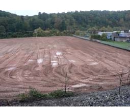
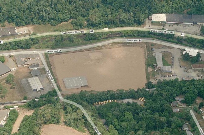
Property Record
300 River Mill Dr, Asheville, NC 28803

NEARBY LISTINGS FOR SALE OR LEASE
Property Detail
300 River Mill Dr
9648-91-0369-00000
A Subdivision Of Lot 1 Pb 67 Pg 165
Apartment
SUBDIV: BLOCK: LOT: TRACT B SECTION: PLAT: 0194-0197
AE
Buncombe
3700964800J
North Carolina
2024
4.44 AC
2025
Central Asheville
002101
Asheville
36,805 SF
Asheville, NC
DEMOGRAPHICS near 300 River Mill Dr
1 Mile
3 Mile
5 Mile
2024 Total Population
5,208
46,272
97,940
2029 Population
5,399
48,069
101,434
Pop Growth 2024-2029
+ 3.67%
+ 3.88%
+ 3.57%
Average Age
41
42
42
2024 Total Households
2,433
21,807
44,432
HH Growth 2024-2029
+ 3.16%
+ 3.48%
+ 3.08%
Median Household Inc
$59,283
$59,128
$63,880
Avg Household Size
2.00
2.00
2.10
2024 Avg HH Vehicles
2.00
2.00
2.00
Median Home Value
$341,560
$362,675
$375,647
Median Year Built
1972
1975
1979
Nearby Places
Map Layers
Map Styles
 Street
 Aerial
- Restaurants
- Banks
- Shops
- Fitness
- Groceries
PUBLIC TRANSPORTATION
AIRPORT
Asheville Regional
DRIVE
WALK
Distance
Asheville Regional
21 min
11.1 mi
Freight Ports
North Charleston Terminal
DRIVE
WALK
Distance
North Charleston Terminal
293 min
254.8 mi
Nearby Properties
Address
Land Use
TOTAL SIZE
Lot Size
Zoning
Address
Land Use
TOTAL SIZE
Lot Size
Zoning
1,663,129 SF
27.85 AC
INST
Address
Land Use
TOTAL SIZE
Lot Size
Zoning
426,749 SF
2,485.30 AC
CS
Address
Land Use
TOTAL SIZE
Lot Size
Zoning
496,200 SF
109.28 AC
INST
Address
Land Use
TOTAL SIZE
Lot Size
Zoning
40,152 SF
2.78 AC
CBD
Address
Land Use
TOTAL SIZE
Lot Size
Zoning
31,034 SF
1.12 AC
CBD
Address
Land Use
TOTAL SIZE
Lot Size
Zoning
94,776 SF
39.70 AC
INST
Address
Land Use
TOTAL SIZE
Lot Size
Zoning
94,004 SF
2.74 AC
CBD
Address
Land Use
TOTAL SIZE
Lot Size
Zoning
109,294 SF
16.28 AC
RAD-IND
Address
Land Use
TOTAL SIZE
Lot Size
Zoning
118,000 SF
0.17 AC
CBD
Address
Land Use
TOTAL SIZE
Lot Size
Zoning
125,122 SF
13.63 AC
UP
Address
Land Use
TOTAL SIZE
Lot Size
Zoning
166,747 SF
2,480.61 AC
CR
Address
Land Use
TOTAL SIZE
Lot Size
Zoning
81,765 SF
23.53 AC
HB
Address
Land Use
TOTAL SIZE
Lot Size
Zoning
47,344 SF
0.71 AC
CBD
Address
Land Use
TOTAL SIZE
Lot Size
Zoning
170,226 SF
29.47 AC
INST
Address
Land Use
TOTAL SIZE
Lot Size
Zoning
51,476 SF
5.82 AC
CBD
Address
Land Use
TOTAL SIZE
Lot Size
Zoning
78,563 SF
2.88 AC
UP
Address
Land Use
TOTAL SIZE
Lot Size
Zoning
46,724 SF
2,480.61 AC
CR
Address
Land Use
TOTAL SIZE
Lot Size
Zoning
20,352 SF
0.67 AC
CBD
Address
Land Use
TOTAL SIZE
Lot Size
Zoning
426,688 SF
40.88 AC
UP
Address
Land Use
TOTAL SIZE
Lot Size
Zoning
112,066 SF
20.92 AC
RM16
Address
Land Use
TOTAL SIZE
Lot Size
Zoning
50,248 SF
12.87 AC
INST
Address
Land Use
TOTAL SIZE
Lot Size
Zoning
47,729 SF
5.50 AC
CBD
Address
Land Use
TOTAL SIZE
Lot Size
Zoning
79,701 SF
15.26 AC
RM16
Address
Land Use
TOTAL SIZE
Lot Size
Zoning
75,342 SF
8.07 AC
HB
Address
Land Use
TOTAL SIZE
Lot Size
Zoning
52,336 SF
2.05 AC
CBD
Address
Land Use
TOTAL SIZE
Lot Size
Zoning
40,900 SF
13.77 AC
R-5
Address
Land Use
TOTAL SIZE
Lot Size
Zoning
59,200 SF
33.49 AC
R-1
Address
Land Use
TOTAL SIZE
Lot Size
Zoning
18,444 SF
0.66 AC
CBD
Address
Land Use
TOTAL SIZE
Lot Size
Zoning
69,472 SF
0.99 AC
CBD
Address
Land Use
TOTAL SIZE
Lot Size
Zoning
30,000 SF
8.25 AC
INST
The World's #1 Commercial Real Estate Marketplace
Connect with us
© 2026 CoStar Group
The information above has been obtained from sources believed reliable. While we do not doubt its accuracy we have not verified it and make no guarantee, warranty or representation about it. It is your responsibility to independently confirm its accuracy and completeness. Any projections, opinions, assumptions, or estimates used are for example only and do not represent the current or future performance of the property. The value of this transaction to you depends on tax and other factors which should be evaluated by your tax, financial, and legal advisors. You and your advisors should conduct a careful, independent investigation of the property to determine to your satisfaction the suitability of the property for your needs.