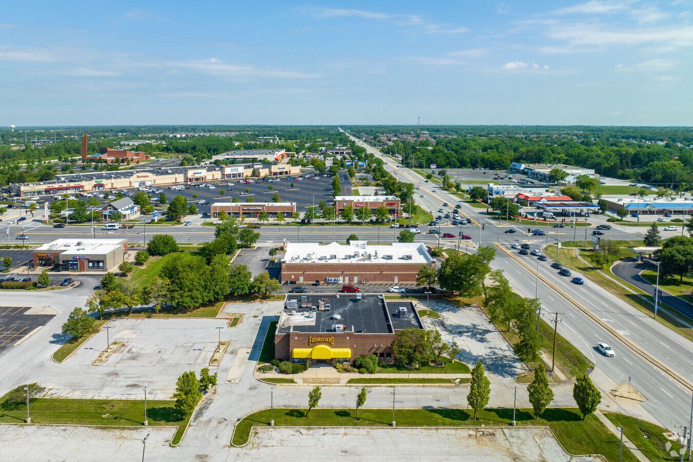
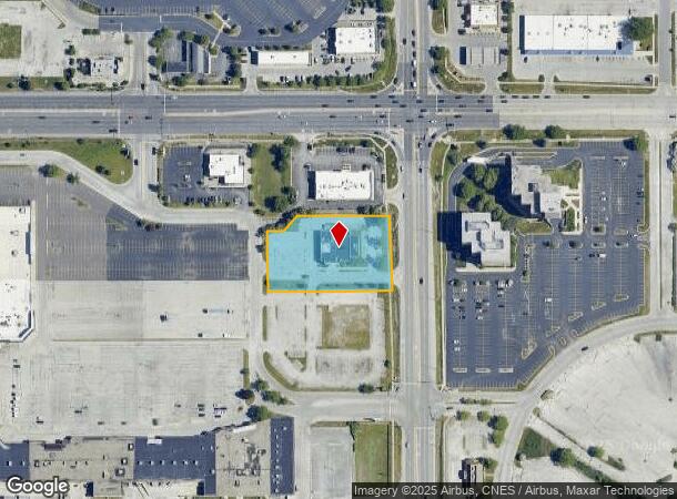
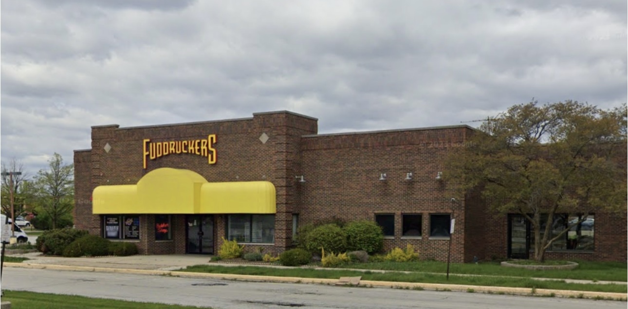
Property Record
300 Lincoln Hwy, Matteson, IL 60443
This Property Is For Sale
NEARBY LISTINGS FOR SALE OR LEASE
Property Detail
300 Lincoln Hwy
Chicago-Naperville-Elgin, IL-IN-WI
Towncenter Sub
31-21-400-016-0000
(TOWNCENTER) SUBDIVISION OF PT OF SE SEC 21-35-13
Commercialbuilding
Cook
X
Illinois
17031C0738J
6
2022
1.43 AC
2024
Far South
830004
Chicago
7,400 SF
DEMOGRAPHICS near 300 Lincoln Hwy
1 Mile
3 Mile
5 Mile
2024 Total Population
4,836
54,268
153,167
2029 Population
4,708
52,950
150,400
Pop Growth 2024-2029
(2.65%)
(2.43%)
(1.81%)
Average Age
43
42
41
2024 Total Households
1,757
20,324
56,533
HH Growth 2024-2029
(2.90%)
(2.71%)
(2.15%)
Median Household Inc
$91,071
$75,028
$74,715
Avg Household Size
2.60
2.60
2.60
2024 Avg HH Vehicles
2.00
2.00
2.00
Median Home Value
$211,523
$177,886
$187,282
Median Year Built
1988
1978
1974
Nearby Places
- Restaurants
- Banks
- Shops
- Fitness
- Groceries
PUBLIC TRANSPORTATION
COMMUTER RAIL
Matteson Station (Metra Electric Line - Northeast Illinois Regional Commuter Railroad (Metra))
DRIVE
WALK
Distance
Matteson Station (Metra Electric Line - Northeast Illinois Regional Commuter Railroad (Metra))
5 min
2.3 mi
211Th Street (Lincoln Highway) Station (Metra Electric Line - Northeast Illinois Regional Commuter Railroad (Metra))
DRIVE
WALK
Distance
211Th Street (Lincoln Highway) Station (Metra Electric Line - Northeast Illinois Regional Commuter Railroad (Metra))
7 min
2.7 mi
AIRPORT
Chicago Midway International
DRIVE
WALK
Distance
Chicago Midway International
34 min
20.8 mi
Freight Ports
Port Milwaukee
DRIVE
WALK
Distance
Port Milwaukee
141 min
114.5 mi
Nearby Properties
Address
Land Use
TOTAL SIZE
Lot Size
Zoning
Address
Land Use
TOTAL SIZE
Lot Size
Zoning
757,504 SF
46.30 AC
Address
Land Use
TOTAL SIZE
Lot Size
Zoning
Address
Land Use
TOTAL SIZE
Lot Size
Zoning
37.62 AC
Address
Land Use
TOTAL SIZE
Lot Size
Zoning
173,415 SF
14.97 AC
Address
Land Use
TOTAL SIZE
Lot Size
Zoning
Address
Land Use
TOTAL SIZE
Lot Size
Zoning
Address
Land Use
TOTAL SIZE
Lot Size
Zoning
72,668 SF
3 AC
Address
Land Use
TOTAL SIZE
Lot Size
Zoning
194,292 SF
21.10 AC
Address
Land Use
TOTAL SIZE
Lot Size
Zoning
300,399 SF
26.50 AC
Address
Land Use
TOTAL SIZE
Lot Size
Zoning
11.84 AC
Address
Land Use
TOTAL SIZE
Lot Size
Zoning
150,289 SF
16.40 AC
Address
Land Use
TOTAL SIZE
Lot Size
Zoning
192,369 SF
22.05 AC
Address
Land Use
TOTAL SIZE
Lot Size
Zoning
1,201 SF
3.65 AC
Address
Land Use
TOTAL SIZE
Lot Size
Zoning
224,611 SF
0.90 AC
Address
Land Use
TOTAL SIZE
Lot Size
Zoning
322,629 SF
53.73 AC
Address
Land Use
TOTAL SIZE
Lot Size
Zoning
2.94 AC
Address
Land Use
TOTAL SIZE
Lot Size
Zoning
4,168 SF
145.94 AC
Address
Land Use
TOTAL SIZE
Lot Size
Zoning
2.04 AC
Address
Land Use
TOTAL SIZE
Lot Size
Zoning
183,041 SF
18.71 AC
Address
Land Use
TOTAL SIZE
Lot Size
Zoning
3.65 AC
Address
Land Use
TOTAL SIZE
Lot Size
Zoning
250,656 SF
Address
Land Use
TOTAL SIZE
Lot Size
Zoning
130,753 SF
8.12 AC
Address
Land Use
TOTAL SIZE
Lot Size
Zoning
3,011 SF
125.12 AC
Address
Land Use
TOTAL SIZE
Lot Size
Zoning
37,522 SF
2.78 AC
Address
Land Use
TOTAL SIZE
Lot Size
Zoning
133,342 SF
11.63 AC
Address
Land Use
TOTAL SIZE
Lot Size
Zoning
96,255 SF
12.01 AC
Address
Land Use
TOTAL SIZE
Lot Size
Zoning
114,992 SF
8.10 AC
Address
Land Use
TOTAL SIZE
Lot Size
Zoning
137,684 SF
6.93 AC
Address
Land Use
TOTAL SIZE
Lot Size
Zoning
6.58 AC
Address
Land Use
TOTAL SIZE
Lot Size
Zoning
251,800 SF
112.19 AC
The World's #1 Commercial Real Estate Marketplace
Connect with us
© 2025 CoStar Group
The information above has been obtained from sources believed reliable. While we do not doubt its accuracy we have not verified it and make no guarantee, warranty or representation about it. It is your responsibility to independently confirm its accuracy and completeness. Any projections, opinions, assumptions, or estimates used are for example only and do not represent the current or future performance of the property. The value of this transaction to you depends on tax and other factors which should be evaluated by your tax, financial, and legal advisors. You and your advisors should conduct a careful, independent investigation of the property to determine to your satisfaction the suitability of the property for your needs.