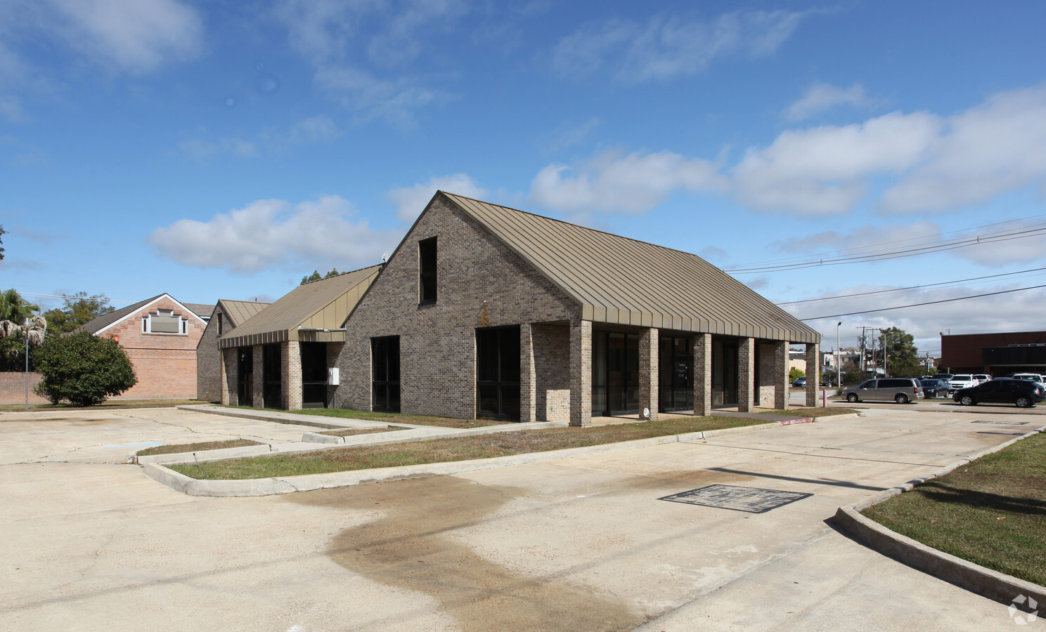
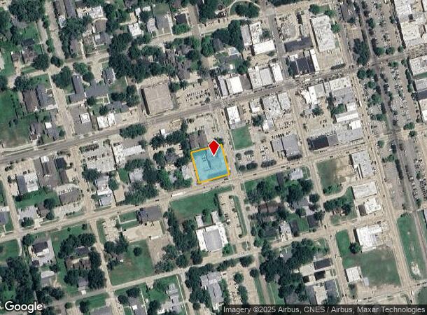
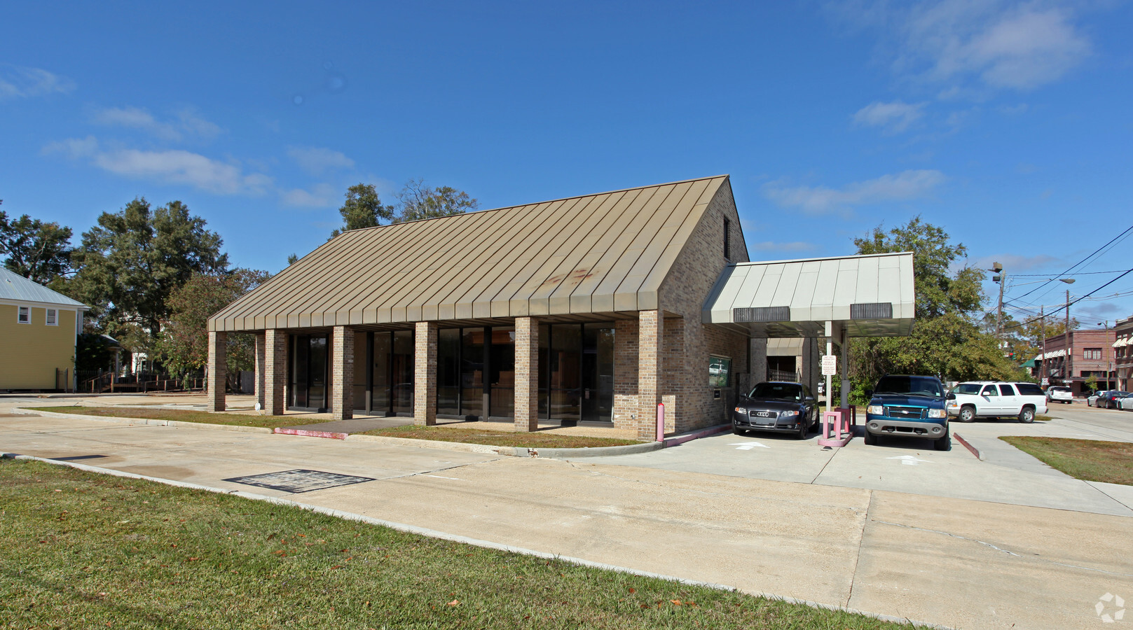
Property Record
300 W Morris Ave, Hammond, LA 70403
NEARBY LISTINGS FOR SALE OR LEASE
Property Detail
300 W Morris Ave
01482807
Hyer Survey
Commercialnec
LOT MEAS 150 X 150 FT BEING SE14 OF SQ 66 HS HAMMOND B450 P480 B995 P687 B1187 P219 B1576 P224 MAP 450480
X
Tangipahoa
22105C0340F
Louisiana
2023
0.52 AC
2023
Louisiana South Area
954300
Other Market Areas
4,452 SF
Hammond, LA
DEMOGRAPHICS near 300 W Morris Ave
1 Mile
3 Mile
5 Mile
2024 Total Population
9,234
33,661
66,210
2029 Population
10,064
36,608
71,732
Pop Growth 2024-2029
+ 8.99%
+ 8.75%
+ 8.34%
Average Age
35
36
37
2024 Total Households
3,331
12,982
25,695
HH Growth 2024-2029
+ 9.31%
+ 8.90%
+ 8.39%
Median Household Inc
$40,969
$42,239
$50,635
Avg Household Size
2.20
2.30
2.40
2024 Avg HH Vehicles
2.00
2.00
2.00
Median Home Value
$181,559
$184,092
$201,416
Median Year Built
1978
1988
1994
Nearby Places
- Restaurants
- Banks
- Shops
- Fitness
- Groceries
PUBLIC TRANSPORTATION
COMMUTER RAIL
Hammond Amtrak Station (City of New Orleans - Amtrak)
DRIVE
WALK
Distance
Hammond Amtrak Station (City of New Orleans - Amtrak)
1 min
7 min
0.4 mi
Freight Ports
Port of Greater Baton Rouge
DRIVE
WALK
Distance
Port of Greater Baton Rouge
60 min
49.4 mi
Nearby Properties
Address
Land Use
TOTAL SIZE
Lot Size
Zoning
Address
Land Use
TOTAL SIZE
Lot Size
Zoning
491,200 SF
67.96 AC
Address
Land Use
TOTAL SIZE
Lot Size
Zoning
666,424 SF
82.56 AC
Address
Land Use
TOTAL SIZE
Lot Size
Zoning
126,240 SF
17.06 AC
Address
Land Use
TOTAL SIZE
Lot Size
Zoning
Address
Land Use
TOTAL SIZE
Lot Size
Zoning
152,841 SF
20.69 AC
Address
Land Use
TOTAL SIZE
Lot Size
Zoning
82,860 SF
11.42 AC
Address
Land Use
TOTAL SIZE
Lot Size
Zoning
Address
Land Use
TOTAL SIZE
Lot Size
Zoning
124,912 SF
12.50 AC
Address
Land Use
TOTAL SIZE
Lot Size
Zoning
24,823 SF
3 AC
Address
Land Use
TOTAL SIZE
Lot Size
Zoning
154,391 SF
12.30 AC
Address
Land Use
TOTAL SIZE
Lot Size
Zoning
1.56 AC
Address
Land Use
TOTAL SIZE
Lot Size
Zoning
432 SF
14.80 AC
Address
Land Use
TOTAL SIZE
Lot Size
Zoning
127,380 SF
9.70 AC
Address
Land Use
TOTAL SIZE
Lot Size
Zoning
199,026 SF
33 AC
Address
Land Use
TOTAL SIZE
Lot Size
Zoning
201,555 SF
11.17 AC
Address
Land Use
TOTAL SIZE
Lot Size
Zoning
36,593 SF
1.54 AC
Address
Land Use
TOTAL SIZE
Lot Size
Zoning
73,922 SF
9.99 AC
Address
Land Use
TOTAL SIZE
Lot Size
Zoning
108,000 SF
9.78 AC
Address
Land Use
TOTAL SIZE
Lot Size
Zoning
47,960 SF
9.16 AC
Address
Land Use
TOTAL SIZE
Lot Size
Zoning
135,524 SF
31.08 AC
Address
Land Use
TOTAL SIZE
Lot Size
Zoning
85,430 SF
6.44 AC
Address
Land Use
TOTAL SIZE
Lot Size
Zoning
96,064 SF
5.03 AC
Address
Land Use
TOTAL SIZE
Lot Size
Zoning
165,402 SF
28.50 AC
Address
Land Use
TOTAL SIZE
Lot Size
Zoning
24,931 SF
2.67 AC
Address
Land Use
TOTAL SIZE
Lot Size
Zoning
60,480 SF
7.28 AC
Address
Land Use
TOTAL SIZE
Lot Size
Zoning
22,000 SF
5.56 AC
Address
Land Use
TOTAL SIZE
Lot Size
Zoning
20,128 SF
20.77 AC
Address
Land Use
TOTAL SIZE
Lot Size
Zoning
43,595 SF
10.17 AC
Address
Land Use
TOTAL SIZE
Lot Size
Zoning
52,074 SF
7.40 AC
Address
Land Use
TOTAL SIZE
Lot Size
Zoning
96,994 SF
4.21 AC
The World's #1 Commercial Real Estate Marketplace
Connect with us
© 2025 CoStar Group
The information above has been obtained from sources believed reliable. While we do not doubt its accuracy we have not verified it and make no guarantee, warranty or representation about it. It is your responsibility to independently confirm its accuracy and completeness. Any projections, opinions, assumptions, or estimates used are for example only and do not represent the current or future performance of the property. The value of this transaction to you depends on tax and other factors which should be evaluated by your tax, financial, and legal advisors. You and your advisors should conduct a careful, independent investigation of the property to determine to your satisfaction the suitability of the property for your needs.