Property Record
3000 N Wooster Ave, Dover, OH 44622

NEARBY LISTINGS FOR SALE OR LEASE
-
-
View all Dover listings for lease on LoopNet.com
Property Detail
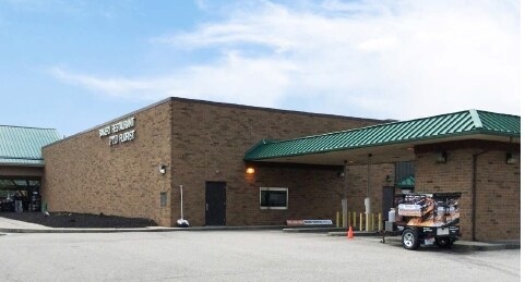
3000 N Wooster Ave
New Philadelphia-Dover, OH
Tuscarawas
1505022010
Ohio
Supermarket
11.85 AC
X
Ohio North Area
39157C0165D
Other Market Areas
87,559 SF
DEMOGRAPHICS near 3000 N Wooster Ave
1 Mile
3 Mile
5 Mile
2024 Total Population
2,804
15,978
34,281
2029 Population
2,779
15,869
34,074
Pop Growth 2024-2029
(0.89%)
(0.68%)
(0.60%)
Average Age
45
43
42
2024 Total Households
1,182
6,365
14,119
HH Growth 2024-2029
(0.93%)
(0.79%)
(0.68%)
Median Household Inc
$88,085
$68,640
$61,336
Avg Household Size
2.30
2.40
2.30
2024 Avg HH Vehicles
2.00
2.00
2.00
Median Home Value
$182,452
$180,158
$170,356
Median Year Built
1975
1969
1965
Nearby Places
Map Layers
Map Styles
 Street
 Aerial
- Restaurants
- Banks
- Shops
- Fitness
- Groceries
PUBLIC TRANSPORTATION
AIRPORT
Akron-Canton Regional
DRIVE
WALK
Distance
Akron-Canton Regional
36 min
30.4 mi
Freight Ports
Port of Toledo
DRIVE
WALK
Distance
Port of Toledo
207 min
177.7 mi
SALE & LEASE HISTORY
LISTING DATE
SALE/LEASE

Aug 26, 2021
For Lease
Nearby Properties
Address
Land Use
TOTAL SIZE
Lot Size
Zoning
Address
Land Use
TOTAL SIZE
Lot Size
Zoning
38,869 SF
2.98 AC
Address
Land Use
TOTAL SIZE
Lot Size
Zoning
4,021,013 SF
12 AC
Address
Land Use
TOTAL SIZE
Lot Size
Zoning
22,049 SF
2.70 AC
Address
Land Use
TOTAL SIZE
Lot Size
Zoning
19,460 SF
57.15 AC
Address
Land Use
TOTAL SIZE
Lot Size
Zoning
1 SF
21.63 AC
Address
Land Use
TOTAL SIZE
Lot Size
Zoning
36,692 SF
3.57 AC
Address
Land Use
TOTAL SIZE
Lot Size
Zoning
14,454 SF
3.52 AC
Address
Land Use
TOTAL SIZE
Lot Size
Zoning
36,354 SF
3.36 AC
Address
Land Use
TOTAL SIZE
Lot Size
Zoning
50,661 SF
28.95 AC
Address
Land Use
TOTAL SIZE
Lot Size
Zoning
28,406 SF
3.24 AC
Address
Land Use
TOTAL SIZE
Lot Size
Zoning
23,580 SF
4 AC
Address
Land Use
TOTAL SIZE
Lot Size
Zoning
1 SF
37.59 AC
Address
Land Use
TOTAL SIZE
Lot Size
Zoning
27,132 SF
10 AC
Address
Land Use
TOTAL SIZE
Lot Size
Zoning
26,782 SF
139.21 AC
Address
Land Use
TOTAL SIZE
Lot Size
Zoning
10,113 SF
1.66 AC
Address
Land Use
TOTAL SIZE
Lot Size
Zoning
16,862 SF
9.80 AC
Address
Land Use
TOTAL SIZE
Lot Size
Zoning
2,376 SF
179 AC
Address
Land Use
TOTAL SIZE
Lot Size
Zoning
32,935 SF
2.06 AC
Address
Land Use
TOTAL SIZE
Lot Size
Zoning
11,680 SF
2.42 AC
Address
Land Use
TOTAL SIZE
Lot Size
Zoning
1,611 SF
200.84 AC
Address
Land Use
TOTAL SIZE
Lot Size
Zoning
33,892 SF
4.98 AC
Address
Land Use
TOTAL SIZE
Lot Size
Zoning
14,378 SF
1.42 AC
Address
Land Use
TOTAL SIZE
Lot Size
Zoning
13,904 SF
13.73 AC
Address
Land Use
TOTAL SIZE
Lot Size
Zoning
4,316 SF
140.58 AC
Address
Land Use
TOTAL SIZE
Lot Size
Zoning
61,200 SF
10.42 AC
Address
Land Use
TOTAL SIZE
Lot Size
Zoning
15,332 SF
1.83 AC
Address
Land Use
TOTAL SIZE
Lot Size
Zoning
5,288 SF
1.52 AC
Address
Land Use
TOTAL SIZE
Lot Size
Zoning
8,680 SF
104.80 AC
Address
Land Use
TOTAL SIZE
Lot Size
Zoning
2.11 AC
Address
Land Use
TOTAL SIZE
Lot Size
Zoning
13,728 SF
1.72 AC
The World's #1 Commercial Real Estate Marketplace
Connect with us
© 2025 CoStar Group
The information above has been obtained from sources believed reliable. While we do not doubt its accuracy we have not verified it and make no guarantee, warranty or representation about it. It is your responsibility to independently confirm its accuracy and completeness. Any projections, opinions, assumptions, or estimates used are for example only and do not represent the current or future performance of the property. The value of this transaction to you depends on tax and other factors which should be evaluated by your tax, financial, and legal advisors. You and your advisors should conduct a careful, independent investigation of the property to determine to your satisfaction the suitability of the property for your needs.