Property Record
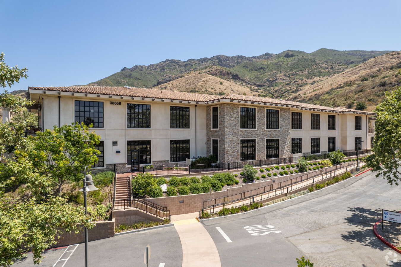
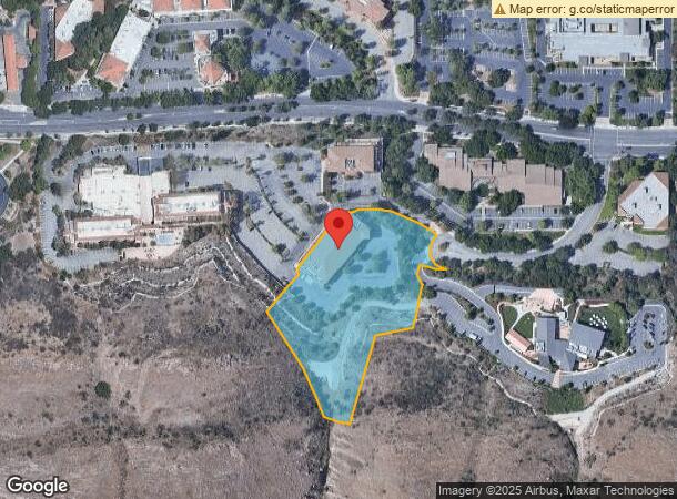
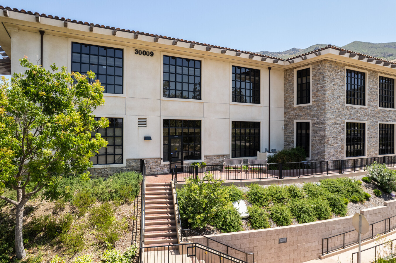
30009 Ladyface Ct, Agoura Hills, CA 91301
NEARBY LISTINGS FOR SALE OR LEASE
Property Detail
30009 Ladyface Ct
Los Angeles-Long Beach-Glendale, CA
City Of Agoura Hills
2061-005-063
TR=40477 LAND DESC IN DOC 864754,050414 AS PAR 1 POR VAC ST,POR LOTS 1 AND 4
Officebuilding
Los Angeles
X
California
06111C0995E
1,4
2024
3.90 AC
2024
Calabasas/Westlake Vill
800335
Los Angeles
35,252 SF
DEMOGRAPHICS near 30009 Ladyface Ct
1 Mile
3 Mile
5 Mile
2024 Total Population
5,947
41,092
76,069
2029 Population
5,717
40,006
74,313
Pop Growth 2024-2029
(3.87%)
(2.64%)
(2.31%)
Average Age
43
44
44
2024 Total Households
2,066
15,887
29,814
HH Growth 2024-2029
(4.16%)
(2.79%)
(2.45%)
Median Household Inc
$151,630
$142,457
$135,718
Avg Household Size
2.90
2.60
2.50
2024 Avg HH Vehicles
2.00
2.00
2.00
Median Home Value
$838,397
$938,889
$981,702
Median Year Built
1982
1981
1981
Nearby Places
- Restaurants
- Banks
- Shops
- Fitness
- Groceries
PUBLIC TRANSPORTATION
AIRPORT
Bob Hope
DRIVE
WALK
Distance
Bob Hope
39 min
28.5 mi
Los Angeles International
DRIVE
WALK
Distance
Los Angeles International
48 min
36.6 mi
Freight Ports
The Port of Hueneme
DRIVE
WALK
Distance
The Port of Hueneme
41 min
28.8 mi
Nearby Properties
Address
Land Use
TOTAL SIZE
Lot Size
Zoning
Address
Land Use
TOTAL SIZE
Lot Size
Zoning
38,851 SF
40.49 AC
M-1
Address
Land Use
TOTAL SIZE
Lot Size
Zoning
676,545 SF
19.76 AC
WVM1*
Address
Land Use
TOTAL SIZE
Lot Size
Zoning
142,150 SF
15.35 AC
AH SP*
Address
Land Use
TOTAL SIZE
Lot Size
Zoning
736,464 SF
19.64 AC
WVM1*
Address
Land Use
TOTAL SIZE
Lot Size
Zoning
Address
Land Use
TOTAL SIZE
Lot Size
Zoning
10.63 AC
C4
Address
Land Use
TOTAL SIZE
Lot Size
Zoning
163,773 SF
5.80 AC
Address
Land Use
TOTAL SIZE
Lot Size
Zoning
142,738 SF
5.56 AC
AH BP-M-FC
Address
Land Use
TOTAL SIZE
Lot Size
Zoning
168,729 SF
10.21 AC
WVM1*
Address
Land Use
TOTAL SIZE
Lot Size
Zoning
142,578 SF
6.12 AC
Address
Land Use
TOTAL SIZE
Lot Size
Zoning
2,398 SF
11.59 AC
C2
Address
Land Use
TOTAL SIZE
Lot Size
Zoning
169,597 SF
7.19 AC
AH SP*
Address
Land Use
TOTAL SIZE
Lot Size
Zoning
117,172 SF
14.47 AC
C1
Address
Land Use
TOTAL SIZE
Lot Size
Zoning
116,906 SF
6.35 AC
LCA21*
Address
Land Use
TOTAL SIZE
Lot Size
Zoning
201,223 SF
6.94 AC
LCA21*
Address
Land Use
TOTAL SIZE
Lot Size
Zoning
365,098 SF
18.18 AC
WVM1*
Address
Land Use
TOTAL SIZE
Lot Size
Zoning
42,203 SF
16.37 AC
CHEVRON TE
Address
Land Use
TOTAL SIZE
Lot Size
Zoning
94,268 SF
0.81 AC
Address
Land Use
TOTAL SIZE
Lot Size
Zoning
138,762 SF
8.69 AC
LCA21*
Address
Land Use
TOTAL SIZE
Lot Size
Zoning
98,127 SF
2.56 AC
AHRA20000*
Address
Land Use
TOTAL SIZE
Lot Size
Zoning
230,960 SF
6.99 AC
WVM1*
Address
Land Use
TOTAL SIZE
Lot Size
Zoning
10,201 SF
0.81 AC
Address
Land Use
TOTAL SIZE
Lot Size
Zoning
115,790 SF
5.41 AC
WVM1*
Address
Land Use
TOTAL SIZE
Lot Size
Zoning
86,558 SF
8.83 AC
AHC3*
Address
Land Use
TOTAL SIZE
Lot Size
Zoning
117,968 SF
6.19 AC
AH BP-M-FC
Address
Land Use
TOTAL SIZE
Lot Size
Zoning
71,159 SF
5.74 AC
AH BP-OR-F
Address
Land Use
TOTAL SIZE
Lot Size
Zoning
59,772 SF
9.76 AC
M-1
Address
Land Use
TOTAL SIZE
Lot Size
Zoning
65,546 SF
4.08 AC
LCA21*
Address
Land Use
TOTAL SIZE
Lot Size
Zoning
183,251 SF
11.60 AC
RPD-19-
Address
Land Use
TOTAL SIZE
Lot Size
Zoning
191,936 SF
11.59 AC
RPD-19-
The World's #1 Commercial Real Estate Marketplace
Connect with us
© 2025 CoStar Group
The information above has been obtained from sources believed reliable. While we do not doubt its accuracy we have not verified it and make no guarantee, warranty or representation about it. It is your responsibility to independently confirm its accuracy and completeness. Any projections, opinions, assumptions, or estimates used are for example only and do not represent the current or future performance of the property. The value of this transaction to you depends on tax and other factors which should be evaluated by your tax, financial, and legal advisors. You and your advisors should conduct a careful, independent investigation of the property to determine to your satisfaction the suitability of the property for your needs.