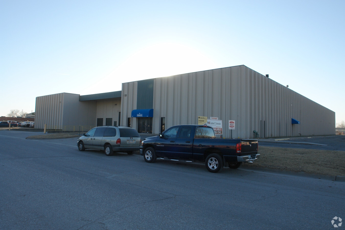
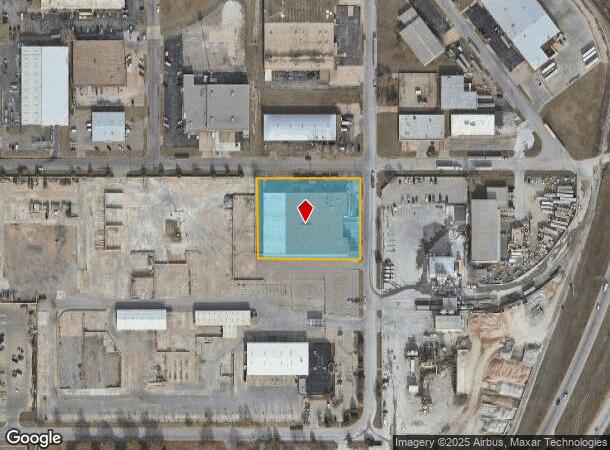
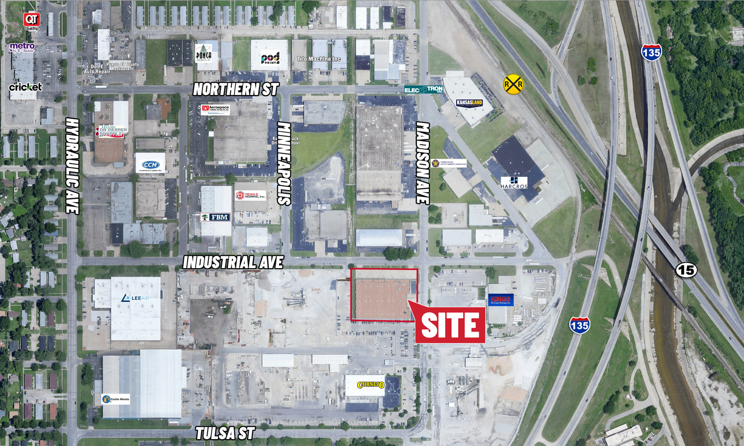
Property Record
3001 S Madison Ave, Wichita, KS 67216
Current Lease Availabilities
NEARBY LISTINGS FOR SALE OR LEASE
Property Detail
3001 S Madison Ave
Wichita, KS
Greenbergs Add
212-03-0-33-01-001.00
LOT 1 GREENBERGS ADDITION
Warehouse
Sedgwick
X
Kansas
20173C0368G
1
2023
1.83 AC
2023
Southeast
005900
Wichita
47,975 SF
DEMOGRAPHICS near 3001 S Madison Ave
1 Mile
3 Mile
5 Mile
2024 Total Population
10,056
84,792
193,002
2029 Population
10,368
87,644
198,436
Pop Growth 2024-2029
+ 3.10%
+ 3.36%
+ 2.82%
Average Age
36
37
37
2024 Total Households
3,590
34,105
78,651
HH Growth 2024-2029
+ 3.09%
+ 3.31%
+ 2.84%
Median Household Inc
$43,159
$40,847
$45,533
Avg Household Size
2.60
2.40
2.30
2024 Avg HH Vehicles
2.00
2.00
2.00
Median Home Value
$72,024
$75,719
$100,346
Median Year Built
1956
1957
1959
Nearby Places
- Restaurants
- Banks
- Shops
- Fitness
- Groceries
PUBLIC TRANSPORTATION
AIRPORT
Wichita Dwight D Eisenhower Ntl
DRIVE
WALK
Distance
Wichita Dwight D Eisenhower Ntl
17 min
10.4 mi
Freight Ports
Tulsa Port Of Catoosa
DRIVE
WALK
Distance
Tulsa Port Of Catoosa
202 min
189.0 mi
Nearby Properties
Address
Land Use
TOTAL SIZE
Lot Size
Zoning
Address
Land Use
TOTAL SIZE
Lot Size
Zoning
430,593 SF
11.89 AC
GO,LC
Address
Land Use
TOTAL SIZE
Lot Size
Zoning
379,016 SF
35.45 AC
SF-5
Address
Land Use
TOTAL SIZE
Lot Size
Zoning
237,087 SF
48.33 AC
B
Address
Land Use
TOTAL SIZE
Lot Size
Zoning
418.47 AC
AFB
Address
Land Use
TOTAL SIZE
Lot Size
Zoning
167,304 SF
6.19 AC
MF-29
Address
Land Use
TOTAL SIZE
Lot Size
Zoning
152,978 SF
7.86 AC
LI
Address
Land Use
TOTAL SIZE
Lot Size
Zoning
3,063,858 SF
57.81 AC
LI
Address
Land Use
TOTAL SIZE
Lot Size
Zoning
167,315 SF
2 AC
LC,SF-5
Address
Land Use
TOTAL SIZE
Lot Size
Zoning
211,379 SF
23.34 AC
SF-5
Address
Land Use
TOTAL SIZE
Lot Size
Zoning
62,580 SF
7.83 AC
SF20
Address
Land Use
TOTAL SIZE
Lot Size
Zoning
107,370 SF
3.72 AC
PUD
Address
Land Use
TOTAL SIZE
Lot Size
Zoning
233,436 SF
20.38 AC
LI
Address
Land Use
TOTAL SIZE
Lot Size
Zoning
67,145 SF
11.49 AC
LI
Address
Land Use
TOTAL SIZE
Lot Size
Zoning
84,788 SF
5.98 AC
PUD
Address
Land Use
TOTAL SIZE
Lot Size
Zoning
79,955 SF
7.04 AC
SF-5
Address
Land Use
TOTAL SIZE
Lot Size
Zoning
87,108 SF
3.95 AC
LC,SF-5
Address
Land Use
TOTAL SIZE
Lot Size
Zoning
106,159 SF
16.16 AC
SF-5
Address
Land Use
TOTAL SIZE
Lot Size
Zoning
63,908 SF
25.58 AC
SF-5
Address
Land Use
TOTAL SIZE
Lot Size
Zoning
71,568 SF
4.83 AC
TF-3
Address
Land Use
TOTAL SIZE
Lot Size
Zoning
134,475 SF
19.87 AC
LI
Address
Land Use
TOTAL SIZE
Lot Size
Zoning
98,077 SF
10.92 AC
SF-5
Address
Land Use
TOTAL SIZE
Lot Size
Zoning
119,245 SF
10.77 AC
MF29
Address
Land Use
TOTAL SIZE
Lot Size
Zoning
64,218 SF
5.76 AC
TF-3
Address
Land Use
TOTAL SIZE
Lot Size
Zoning
71,651 SF
5.82 AC
SF-5
Address
Land Use
TOTAL SIZE
Lot Size
Zoning
64,650 SF
3.57 AC
CBD
Address
Land Use
TOTAL SIZE
Lot Size
Zoning
62,775 SF
4.73 AC
SF-5
Address
Land Use
TOTAL SIZE
Lot Size
Zoning
91,734 SF
16.30 AC
SF-5
Address
Land Use
TOTAL SIZE
Lot Size
Zoning
75,932 SF
5.46 AC
SF-5
Address
Land Use
TOTAL SIZE
Lot Size
Zoning
35,528 SF
7.14 AC
LC
The World's #1 Commercial Real Estate Marketplace
Connect with us
© 2025 CoStar Group
The information above has been obtained from sources believed reliable. While we do not doubt its accuracy we have not verified it and make no guarantee, warranty or representation about it. It is your responsibility to independently confirm its accuracy and completeness. Any projections, opinions, assumptions, or estimates used are for example only and do not represent the current or future performance of the property. The value of this transaction to you depends on tax and other factors which should be evaluated by your tax, financial, and legal advisors. You and your advisors should conduct a careful, independent investigation of the property to determine to your satisfaction the suitability of the property for your needs.