Property Record
3005 W Horizon Ridge Pky, Henderson, NV 89052


NEARBY LISTINGS FOR SALE OR LEASE
Property Detail
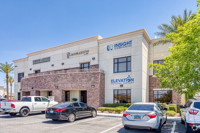
3005 W Horizon Ridge Pky
Las Vegas-Henderson-Paradise, NV
Seven Hills Business Park
177-35-510-027
SEVEN HILLS BUSINESS PARK PLAT BOOK 96 PAGE 61 PT LOT B
Commercialnec
Clark
X
Nevada
32003C2930F
b
2025
1.48 AC
2025
South Las Vegas
005346
Las Vegas
22,224 SF
DEMOGRAPHICS near 3005 W Horizon Ridge Pky
1 Mile
3 Mile
5 Mile
2024 Total Population
24,241
140,470
311,079
2029 Population
25,814
150,858
336,235
Pop Growth 2024-2029
+ 6.49%
+ 7.40%
+ 8.09%
Average Age
38
42
42
2024 Total Households
9,896
56,182
125,670
HH Growth 2024-2029
+ 6.45%
+ 7.34%
+ 7.99%
Median Household Inc
$64,828
$79,077
$82,936
Avg Household Size
2.40
2.50
2.40
2024 Avg HH Vehicles
2.00
2.00
2.00
Median Home Value
$416,903
$415,052
$427,632
Median Year Built
2003
2000
2000
Nearby Places
Map Layers
Map Styles
 Street
 Aerial
- Restaurants
- Banks
- Shops
- Fitness
- Groceries
PUBLIC TRANSPORTATION
AIRPORT
Harry Reid International
DRIVE
WALK
Distance
Harry Reid International
13 min
7.5 mi
Boulder City Municipal
DRIVE
WALK
Distance
Boulder City Municipal
28 min
19.4 mi
SALE & LEASE HISTORY
LISTING DATE
SALE/LEASE

Sep 25, 2016
For Lease
Nov 19, 2019
For Lease
Dec 01, 2020
For Lease
Aug 05, 2019
For Lease
Nearby Properties
Address
Land Use
TOTAL SIZE
Lot Size
Zoning
Address
Land Use
TOTAL SIZE
Lot Size
Zoning
630,906 SF
39.87 AC
CT
Address
Land Use
TOTAL SIZE
Lot Size
Zoning
9,314 SF
23.10 AC
PS
Address
Land Use
TOTAL SIZE
Lot Size
Zoning
882 SF
39.43 AC
Address
Land Use
TOTAL SIZE
Lot Size
Zoning
197,134 SF
24.59 AC
Address
Land Use
TOTAL SIZE
Lot Size
Zoning
614,616 SF
55.59 AC
Address
Land Use
TOTAL SIZE
Lot Size
Zoning
1,365 SF
22.68 AC
Address
Land Use
TOTAL SIZE
Lot Size
Zoning
7,177 SF
15.88 AC
Address
Land Use
TOTAL SIZE
Lot Size
Zoning
1,184,001 SF
57.02 AC
IP
Address
Land Use
TOTAL SIZE
Lot Size
Zoning
5,975 SF
18.81 AC
Address
Land Use
TOTAL SIZE
Lot Size
Zoning
4,312 SF
19.42 AC
C:R-4
Address
Land Use
TOTAL SIZE
Lot Size
Zoning
614,520 SF
28.81 AC
Address
Land Use
TOTAL SIZE
Lot Size
Zoning
438,778 SF
19.30 AC
C:R-4
Address
Land Use
TOTAL SIZE
Lot Size
Zoning
3,528 SF
18.15 AC
RH36
Address
Land Use
TOTAL SIZE
Lot Size
Zoning
161,090 SF
355.75 AC
Address
Land Use
TOTAL SIZE
Lot Size
Zoning
36.85 AC
PS
Address
Land Use
TOTAL SIZE
Lot Size
Zoning
Address
Land Use
TOTAL SIZE
Lot Size
Zoning
3,990 SF
24.88 AC
RM16
Address
Land Use
TOTAL SIZE
Lot Size
Zoning
Address
Land Use
TOTAL SIZE
Lot Size
Zoning
18.08 AC
RE
Address
Land Use
TOTAL SIZE
Lot Size
Zoning
4,405 SF
19.79 AC
Address
Land Use
TOTAL SIZE
Lot Size
Zoning
4,444 SF
18.11 AC
Address
Land Use
TOTAL SIZE
Lot Size
Zoning
402,610 SF
15.51 AC
R3
Address
Land Use
TOTAL SIZE
Lot Size
Zoning
220,694 SF
44.74 AC
Address
Land Use
TOTAL SIZE
Lot Size
Zoning
22,009 SF
11.53 AC
Address
Land Use
TOTAL SIZE
Lot Size
Zoning
481,860 SF
27.18 AC
Address
Land Use
TOTAL SIZE
Lot Size
Zoning
371,958 SF
22.85 AC
RM16
Address
Land Use
TOTAL SIZE
Lot Size
Zoning
Address
Land Use
TOTAL SIZE
Lot Size
Zoning
213,957 SF
19.68 AC
Address
Land Use
TOTAL SIZE
Lot Size
Zoning
3,850 SF
6.09 AC
R3
The World's #1 Commercial Real Estate Marketplace
Connect with us
© 2026 CoStar Group
The information above has been obtained from sources believed reliable. While we do not doubt its accuracy we have not verified it and make no guarantee, warranty or representation about it. It is your responsibility to independently confirm its accuracy and completeness. Any projections, opinions, assumptions, or estimates used are for example only and do not represent the current or future performance of the property. The value of this transaction to you depends on tax and other factors which should be evaluated by your tax, financial, and legal advisors. You and your advisors should conduct a careful, independent investigation of the property to determine to your satisfaction the suitability of the property for your needs.